Bombay, Minnesota
| Bombay, Minnesota | |
|---|---|
| Unincorporated community | |
 Bombay, Minnesota  Bombay, Minnesota Location of the community of Bombay | |
| Coordinates: 44°17′01″N 92°53′30″W / 44.28361°N 92.89167°WCoordinates: 44°17′01″N 92°53′30″W / 44.28361°N 92.89167°W | |
| Country | United States |
| State | Minnesota |
| County | Goodhue County |
| Township | Wanamingo Township and Cherry Grove Township |
| Elevation | 1,171 ft (357 m) |
| Time zone | Central (CST) (UTC-6) |
| • Summer (DST) | CDT (UTC-5) |
| ZIP code | 55983 |
| Area code(s) | 507 |
| GNIS feature ID | 640356[1] |
Bombay is an unincorporated community in Goodhue County, Minnesota, United States.
The community is located near the junction of State Highway 60 (MN 60) and 70th Avenue.
County 1 Boulevard and County 12 Boulevard are also in the immediate area. Bombay is located within Wanamingo Township and Cherry Grove Township.
ZIP codes 55983 (Wanamingo) and 55946 (Kenyon) meet near Bombay.
References
Municipalities and communities of Goodhue County, Minnesota, United States | ||
|---|---|---|
| Cities | 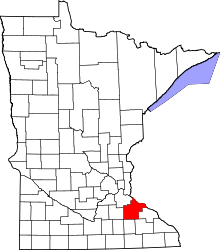 | |
| Townships | ||
| CDP | ||
| Unincorporated communities | ||
| Indian reservation | ||
| Footnotes | ‡This populated place also has portions in an adjacent county or counties | |
This article is issued from Wikipedia - version of the 7/28/2016. The text is available under the Creative Commons Attribution/Share Alike but additional terms may apply for the media files.