Bloomingburg, Ohio
| Bloomingburg, Ohio | |
|---|---|
| Village | |
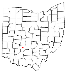 Location of Bloomingburg, Ohio | |
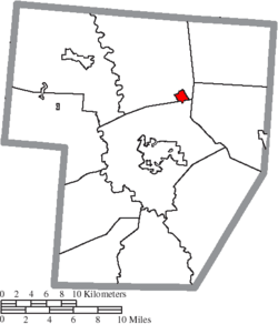 Location of Bloomingburg in Fayette County | |
| Coordinates: 39°36′25″N 83°23′41″W / 39.60694°N 83.39472°WCoordinates: 39°36′25″N 83°23′41″W / 39.60694°N 83.39472°W | |
| Country | United States |
| State | Ohio |
| County | Fayette |
| Area[1] | |
| • Total | 0.70 sq mi (1.81 km2) |
| • Land | 0.70 sq mi (1.81 km2) |
| • Water | 0 sq mi (0 km2) |
| Elevation[2] | 994 ft (303 m) |
| Population (2010)[3] | |
| • Total | 938 |
| • Estimate (2012[4]) | 930 |
| • Density | 1,340.0/sq mi (517.4/km2) |
| Time zone | Eastern (EST) (UTC-5) |
| • Summer (DST) | EDT (UTC-4) |
| ZIP code | 43106 |
| Area code(s) | 740 |
| FIPS code | 39-07188[5] |
| GNIS feature ID | 1064455[2] |
Bloomingburg is a village in Fayette County, Ohio, United States. The population was 938 at the 2010 census.
History
Bloomingburg was laid out in 1815.[6] According to tradition, the village was named for the many flowers kept in the yards of the townswomen.[7] A post office has been in operation at Bloomingburg since 1819.[8] Bloomingburg was noted as a "stop" on the Underground Railroad.[9]
Geography
Bloomingburg is located at 39°36′25″N 83°23′41″W / 39.60694°N 83.39472°W (39.607052, -83.394692).[10]
According to the United States Census Bureau, the village has a total area of 0.70 square miles (1.81 km2), all land.[1]
Gallery
-
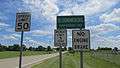
Bloomingburg corporation limit sign.
-
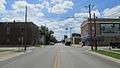
Looking south on Main Street in Bloomingburg.
-
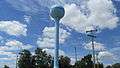
Water tower in Bloomingburg.
Demographics
| Historical population | |||
|---|---|---|---|
| Census | Pop. | %± | |
| 1870 | 312 | — | |
| 1880 | 526 | 68.6% | |
| 1890 | 638 | 21.3% | |
| 1900 | 636 | −0.3% | |
| 1910 | 610 | −4.1% | |
| 1920 | 552 | −9.5% | |
| 1930 | 543 | −1.6% | |
| 1940 | 567 | 4.4% | |
| 1950 | 623 | 9.9% | |
| 1960 | 719 | 15.4% | |
| 1970 | 895 | 24.5% | |
| 1980 | 869 | −2.9% | |
| 1990 | 769 | −11.5% | |
| 2000 | 874 | 13.7% | |
| 2010 | 938 | 7.3% | |
| Est. 2015 | 921 | [11] | −1.8% |
2010 census
As of the census[3] of 2010, there were 938 people, 321 households, and 239 families residing in the village. The population density was 1,340.0 inhabitants per square mile (517.4/km2). There were 368 housing units at an average density of 525.7 per square mile (203.0/km2). The racial makeup of the village was 88.6% White, 3.1% African American, 0.6% Native American, 6.2% from other races, and 1.5% from two or more races. Hispanic or Latino of any race were 6.9% of the population.
There were 321 households of which 46.4% had children under the age of 18 living with them, 49.5% were married couples living together, 17.1% had a female householder with no husband present, 7.8% had a male householder with no wife present, and 25.5% were non-families. 19.3% of all households were made up of individuals and 5.9% had someone living alone who was 65 years of age or older. The average household size was 2.92 and the average family size was 3.31.
The median age in the village was 30.8 years. 32.1% of residents were under the age of 18; 8.4% were between the ages of 18 and 24; 29% were from 25 to 44; 20.7% were from 45 to 64; and 9.7% were 65 years of age or older. The gender makeup of the village was 51.7% male and 48.3% female.
2000 census
As of the census[5] of 2000, there were 874 people, 309 households, and 221 families residing in the village. The population density was 1,253.6 people per square mile (482.1/km²). There were 332 housing units at an average density of 476.2 per square mile (183.1/km²). The racial makeup of the village was 92.33% White, 4.81% African American, 0.23% Native American, 1.95% from other races, and 0.69% from two or more races. Hispanic or Latino of any race were 3.78% of the population.
There were 309 households out of which 41.4% had children under the age of 18 living with them, 52.1% were married couples living together, 12.6% had a female householder with no husband present, and 28.2% were non-families. 22.7% of all households were made up of individuals and 8.1% had someone living alone who was 65 years of age or older. The average household size was 2.78 and the average family size was 3.18.
In the village the population was spread out with 30.9% under the age of 18, 10.6% from 18 to 24, 30.2% from 25 to 44, 19.6% from 45 to 64, and 8.7% who were 65 years of age or older. The median age was 30 years. For every 100 females there were 100.5 males. For every 100 females age 18 and over, there were 104.1 males.
The median income for a household in the village was $31,346, and the median income for a family was $31,979. Males had a median income of $25,595 versus $20,855 for females. The per capita income for the village was $12,281. About 11.1% of families and 16.0% of the population were below the poverty line, including 20.6% of those under age 18 and 9.6% of those age 65 or over.
Notable person
- B. C. Edwards, third head football coach for the Illinois State Redbirds.
References
- 1 2 "US Gazetteer files 2010". United States Census Bureau. Archived from the original on 2012-01-24. Retrieved 2013-01-06.
- 1 2 "US Board on Geographic Names". United States Geological Survey. 2007-10-25. Retrieved 2008-01-31.
- 1 2 "American FactFinder". United States Census Bureau. Retrieved 2013-01-06.
- ↑ "Population Estimates". United States Census Bureau. Archived from the original on 2013-06-17. Retrieved 2013-06-17.
- 1 2 "American FactFinder". United States Census Bureau. Archived from the original on 2013-09-11. Retrieved 2008-01-31.
- ↑ Allen, Frank M. (1914). History of Fayette County, Ohio: Her People, Industries and Institutions. B. F. Bowen, Incorporated. p. 332. Retrieved 28 November 2013.
- ↑ Overman, William Daniel (1958). Ohio Town Names. Akron, OH: Atlantic Press. p. 15.
- ↑ "Fayette County". Jim Forte Postal History. Retrieved 13 December 2015.
- ↑ Dills, R. S. (1881). History of Fayette County: Together with Historic Notes on the Northwest, and the State of Ohio. Gleaned from Early Authors, Old Maps and Manuscripts, Private and Official Correspondence, and All Other Authentic Sources. Odell & Mayer. p. 989.
- ↑ "US Gazetteer files: 2010, 2000, and 1990". United States Census Bureau. 2011-02-12. Retrieved 2011-04-23.
- ↑ "Annual Estimates of the Resident Population for Incorporated Places: April 1, 2010 to July 1, 2015". Retrieved July 2, 2016.
- ↑ "Census of Population and Housing". Census.gov. Archived from the original on May 11, 2015. Retrieved June 4, 2015.
Municipalities and communities of Fayette County, Ohio, United States | ||
|---|---|---|
| City | 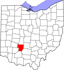 | |
| Villages | ||
| Townships | ||
| CDPs | ||
| Unincorporated communities | ||
| Footnotes | ‡This populated place also has portions in an adjacent county or counties | |