Black River (Arizona)
| Black River | |
 | |
| Country | United States |
|---|---|
| State | Arizona |
| County | Apache, Graham, Navajo, Gila, Greenlee |
| Source | near Alpine |
| - location | Apache-Sitgreaves National Forest, Greenlee County |
| - elevation | 7,482 ft (2,281 m) [1] |
| - coordinates | 33°45′03″N 109°21′46″W / 33.75083°N 109.36278°W [2] |
| Mouth | Salt River |
| - location | Confluence with White River, Gila County |
| - elevation | 4,222 ft (1,287 m) [2] |
| - coordinates | 33°44′20″N 110°13′32″W / 33.73889°N 110.22556°WCoordinates: 33°44′20″N 110°13′32″W / 33.73889°N 110.22556°W [2] |
| Length | 114 mi (183 km) [3] |
| Basin | 1,314 sq mi (3,403 km2) [4] |
| Discharge | for mouth (average) and a gauge 5 miles (8 km) upstream for maximum and minimum |
| - average | 420 cu ft/s (12 m3/s) [4][5] |
| - max | 54,700 cu ft/s (1,549 m3/s) |
| - min | 11 cu ft/s (0 m3/s) |
 Location of the mouth of the Black River in Arizona
| |
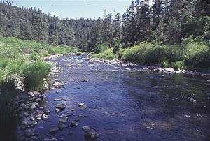
The Black River is a 114-mile-long (183 km)[3] river in the White Mountains of the U.S. state of Arizona. It forms southwest of Alpine and flows southwest then northwest to meet the White River west of Fort Apache. The merged streams form the Salt River, a major tributary of the Gila River.[6]
James Ohio Pattie named the river in 1826 as he explored the area.[7]
Course
From source to mouth, the river flows through Apache, Greenlee, Graham, Navajo and Gila counties.[2] It forms a boundary between Apache and Greenlee counties, then between Apache and Graham counties, and further downstream, between Graham and Navajo counties.[6]
Along its lower reaches, the Black River is the boundary between the Fort Apache Indian Reservation on the north and the San Carlos Indian Reservation on the south.[6] The river also passes near the Bear Wallow Wilderness, through which flows one of the river's tributaries, Bear Wallow Creek.[6]
Some of the places along the lower river are difficult to reach. Many of the roads in the area are unpaved and unmarked on major maps. The "Black River AZ Map" and "Lower Black River guide book" show more details. Bear encounters are possible along this river.
Flora and fauna
Rainbow and brown trout and smallmouth bass are among the 13 species of fish found in the Black River.[4] Major fishes in this river system also include channel catfish, desert suckers, and fathead minnows, among others.[4]
The East Fork Black River and West Fork Black River, which merge to form the mainstem, have populations of brown trout and Apache trout.[8] The headwaters tributaries support many aquatic insects, including more than 30 species of caddisflies. Some of the state's best sports fisheries are found in the Black River watershed.[9] Special permits are required to fish on either reservation.
Plants in the riparian zones include several kinds of willows and cottonwoods, as well as alders and saltcedar.[4] Beaver, muskrats, great blue herons, mallards, and osprey are among the vertebrates found in or near the river.[4]
See also
References
- ↑ Source elevation derived from Google Earth search using GNIS source coordinates.
- 1 2 3 4 "Black River". Geographic Names Information System. United States Geological Survey. February 8, 1980. Retrieved May 17, 2013.
- 1 2 "The National Map". U.S. Geological Survey. Archived from the original on April 5, 2012. Retrieved March 8, 2011.
- 1 2 3 4 5 6 Benke and Cushing, p. 536
- ↑ "Water-Data Report 2012, 9490500 Black River Near Fort Apache, AZ" (PDF). United States Geological Survey. Retrieved July 13, 2013.
- 1 2 3 4 Arizona Road & Recreation Atlas (7th ed.). Medford, Oregon: Benchmark Maps. 2012. pp. 75–77 and 80–81. ISBN 978-0-929591-97-1.
- ↑ Byrd H. Granger (1960). Arizona Place Names. University of Arizona Press. p. 5. Retrieved November 20, 2011.
- ↑ "Where to Fish: White Mountains". Arizona Fish and Game Department. Retrieved May 17, 2013.
- ↑ Benke and Cushing, p. 519
- Information and Education Division (2007, HookedAZ Fishing Community). "Arizona Fishin' Holes". Phoenix, AZ: Arizona Game and Fish Department. Check date values in:
|date=(help)
Works cited
- Benke, Arthur C., ed., and Cushing, Colbert E., ed.; Blinn, Dean W. and Poff, N. Leroy (2005). "Chapter 11: Colorado River Basin" in Rivers of North America. Burlington, Massachusetts: Elsevier Academic Press. ISBN 0-12-088253-1. OCLC 59003378.
External links
- HookedAZ Fishing Community | The Black River
- Arizona Boating Locations Facilities Map
- White Mountain Apache Tribe Wildlife and Outdoor Recreation Division
- San Carlos Apache Tribe Recreation and Wildlife
- Angler Guide Arizona Fishing Report