Black Butte, Oregon
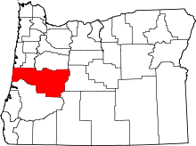
Black Butte was an unincorporated community in Lane County, Oregon, United States.[1] It was located near Black Butte, a dark-colored mountain at the headwaters of the Coast Fork Willamette River, about 20 miles south of Cottage Grove, at the confluence of Garoutte Creek and the Little River.[2][3] The Black Butte Mine, which operated from the 1890s to the 1960s, was one of the largest mercury mines in the state.[4][5] Mercury contamination from abandoned mine tailings continues to be a health concern in the area, including mercury-contaminated runoff from Furnace Creek that has made its way to Cottage Grove Lake.[5]
The post office at Black Butte was originally named Harris, after William Harris, the first postmaster.[3] Harris post office was established in 1898, and the name changed to Blackbutte in 1901.[3][6] The office ran until 1957.[3] At one time there was a Black Butte School; in 1932 the Black Butte School District was consolidated with the London School District.[7]
See also
References
- ↑ "Black Butte". Geographic Names Information System. United States Geological Survey. April 1, 1993. Retrieved December 28, 2015.
- ↑ Oregon Atlas & Gazetteer (7th ed.). Yarmouth, Maine: DeLorme. 2008. p. 47. ISBN 0-89933-347-8.
- 1 2 3 4 McArthur, Lewis A.; McArthur, Lewis L. (2003) [1928]. Oregon Geographic Names (7th ed.). Portland, Oregon: Oregon Historical Society Press. pp. 86, 393. ISBN 978-0875952772.
- ↑ "Black Butte Mine". U.S. Environmental Protection Agency. Retrieved December 28, 2015.
- 1 2 "Environmental Health Assessment: Black Butte Mine - Lane County". Oregon Health Authority. Retrieved December 28, 2015.
- ↑ "Blackbutte Post Office (historical)". Geographic Names Information System. United States Geological Survey. August 1, 1994. Retrieved December 28, 2015.
- ↑ "2 Grade Schools Approve Merger". The Register-Guard. January 15, 1932. Retrieved December 28, 2015.
External links
- Historic images of Black Butte from Lane County Historical Museum
- Historic images of Black Butte from Salem Public Library
- Historic images of Lane County schools, including Black Butte School, from Oregon Genealogy Trails
- Historic image of Black Butte School from the University of Oregon Libraries
- Black Butte Mine Superfund Site Education Partnership collaboration between Oregon State University, the EPA, and London School
- The Black Butte Mine in Cottage Grove, OR (video) from The Superfund Research Program at Oregon State University
Coordinates: 43°34′09″N 123°04′39″W / 43.5692872°N 123.0775721°W