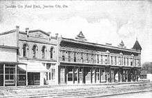
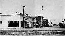
Junction City, Oregon
| Junction City, Oregon | |
|---|---|
| City | |
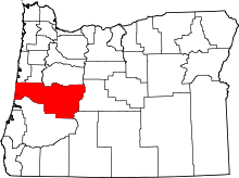
 Location in Oregon | |
| Coordinates: 44°13′14″N 123°12′15″W / 44.22056°N 123.20417°WCoordinates: 44°13′14″N 123°12′15″W / 44.22056°N 123.20417°W | |
| Country | United States |
| State | Oregon |
| County | Lane |
| Incorporated | 1872 |
| Government | |
| • Mayor | Mike Cahill |
| Area[1] | |
| • Total | 2.36 sq mi (6.11 km2) |
| • Land | 2.36 sq mi (6.11 km2) |
| • Water | 0 sq mi (0 km2) |
| Elevation | 325 ft (99.1 m) |
| Population (2010)[2] | |
| • Total | 5,392 |
| • Estimate (2012[3]) | 5,552 |
| • Density | 2,284.7/sq mi (882.1/km2) |
| Time zone | Pacific (UTC-8) |
| • Summer (DST) | Pacific (UTC-7) |
| ZIP code | 97448 |
| Area code(s) | 541 |
| FIPS code | 41-38000[4] |
| GNIS feature ID | 1166668[5] |
| Website | www.junctioncityoregon.gov |
Junction City is a city in Lane County, Oregon, United States. Its population was 5,392 at the 2010 census.[6]
History
In the 1870s, Junction City was named by railroad magnate Ben Holladay, who decided this would be where the rail line on the east side of the Willamette Valley would meet the rail line on the west side. The westside line, however, was not built according to plan, although Junction City later was where the two main branches of U.S. Route 99 (which divided in Portland) would rejoin. The city was incorporated in 1872.[7]
Junction City gained media attention from major outlets such as CNN, Fox News, and The Today Show in 2003,[8][9] when a number of local men posed in the nude for "The Men of the Long Tom Grange Calendar"[10] to raise money for the local school district. The project raised over $265,000 for local schools and brought national attention to the issue of school funding.[11]
Geography
According to the United States Census Bureau, the city has a total area of 2.36 square miles (6.11 km2), all of it land.[1]
Climate
This region experiences warm (but not hot) and dry summers, with no average monthly temperatures above 71.6 °F. According to the Köppen Climate Classification system, Junction City has a warm-summer Mediterranean climate, abbreviated "Csb" on climate maps.[12]
Demographics
| Historical population | |||
|---|---|---|---|
| Census | Pop. | %± | |
| 1880 | 428 | — | |
| 1900 | 506 | — | |
| 1910 | 759 | 50.0% | |
| 1920 | 687 | −9.5% | |
| 1930 | 922 | 34.2% | |
| 1940 | 1,187 | 28.7% | |
| 1950 | 1,475 | 24.3% | |
| 1960 | 1,614 | 9.4% | |
| 1970 | 2,373 | 47.0% | |
| 1980 | 3,320 | 39.9% | |
| 1990 | 3,670 | 10.5% | |
| 2000 | 5,132 | 39.8% | |
| 2010 | 5,392 | 5.1% | |
| Est. 2015 | 5,842 | [13] | 8.3% |
2010 census
As of the census[2] of 2010, there were 5,392 people, 2,184 households, and 1,394 families residing in the city. The population density was 2,284.7 inhabitants per square mile (882.1/km2). There were 2,323 housing units at an average density of 984.3 per square mile (380.0/km2). The racial makeup of the city was 90.4% White, 0.7% African American, 1.3% Native American, 0.6% Asian, 0.1% Pacific Islander, 3.7% from other races, and 3.2% from two or more races. Hispanic or Latino of any race were 9.0% of the population.
There were 2,184 households of which 33.3% had children under the age of 18 living with them, 45.0% were married couples living together, 13.0% had a female householder with no husband present, 5.8% had a male householder with no wife present, and 36.2% were non-families. 28.4% of all households were made up of individuals and 13.8% had someone living alone who was 65 years of age or older. The average household size was 2.43 and the average family size was 2.93.
The median age in the city was 36 years. 25% of residents were under the age of 18; 9.1% were between the ages of 18 and 24; 26.4% were from 25 to 44; 24.4% were from 45 to 64; and 15.1% were 65 years of age or older. The gender makeup of the city was 47.8% male and 52.2% female.
2000 census
As of the census[4] of 2000, there were 4,721 people, 1,823 households, and 1,170 families residing in the city. The population density was 3,405.1 people per square mile (1,311.4/km²). There were 1,921 housing units at an average density of 1,385.5 per square mile (533.6/km²). The racial makeup of the city was 91.21% White, 0.30% African American, 1.23% Native American, 0.59% Asian, 0.04% Pacific Islander, 3.66% from other races, and 2.97% from two or more races. Hispanic or Latino of any race were 8.28% of the population. There were 1,823 households out of which 34.4% had children under the age of 18 living with them, 50.5% were married couples living together, 10.1% had a female householder with no husband present, and 35.8% were non-families. 30.5% of all households were made up of individuals and 16.5% had someone living alone who was 65 years of age or older. The average household size was 2.51 and the average family size was 3.15.
In the city the population was 27.1% under the age of 18, 10.5% from 18 to 24, 27.9% from 25 to 44, 19.6% from 45 to 64, and 14.9% who were 65 years of age or older. The median age was 34 years. For every 100 females there were 92.1 males. For every 100 females age 18 and over, there were 88.5 males.
The median income for a household in the city was $35,347, and the median income for a family was $43,875. Males had a median income of $31,044 versus $21,757 for females. The per capita income for the city was $16,155. About 6.3% of families and 8.8% of the population were below the poverty line, including 11.7% of those under age 18 and 14.5% of those age 65 or over.
Economy
Junction City is home to a large and eclectic farming community, the bulk of which is made up of several large family-owned farms. Lochmead Farms, one of the largest privately owned dairy farms in the Pacific Northwest, is owned and operated by the Gibson family. Stroda Farms, a high-volume Christmas tree and general crop farm, is privately owned and operated by the Stroda family. The city was the home of Country Coach, a large luxury motorcoach manufacturer, which went bankrupt in November 2009. It was also the home of Monaco Coach Corporation prior to their move to nearby Coburg.
Annual events
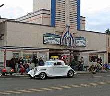
- Junction City is home to the Scandinavian Festival, an annual four-day event which pays homage to the cultures of Denmark, Finland, Norway, Sweden, and Iceland; held mid-August.[15]
- The Daffodil Drive Festival is a two-day event held each year in mid-March. It features a 6-mile drive along Ferguson Road, which leads to the Long Tom Grange, where visitors can purchase daffodil bulbs and other goods.[16][17]
Education
The city is served by the Junction City School District, which includes Junction City High School.
Public safety
The Junction City Police Department serves the city.
Notable people
- Bobby Doerr, Major League Baseball player, member of National Baseball Hall of Fame and Museum
- Kate Elliott, fantasy and science fiction writer
- Ty Harden, Major League Soccer player
- Eric Hays, basketball player and coach
- Buster B. Jones, American fingerpicking style guitar player
- Derek Humphry, founder of the Hemlock Society
- Walter McClure, track and field athlete
- Dmae Roberts, public radio producer, writer, actress, and playwright
- Dave Wilcox, American football player, member of Pro Football Hall of Fame
- Justin Wilcox, American football coach
- John N. Williamson, politician
References
- 1 2 "US Gazetteer files 2010". United States Census Bureau. Retrieved 2012-12-21.
- 1 2 "American FactFinder". United States Census Bureau. Retrieved 2012-12-21.
- ↑ "Population Estimates". United States Census Bureau. Retrieved 2013-06-02.
- 1 2 "American FactFinder". United States Census Bureau. Retrieved 2008-01-31.
- ↑ "US Board on Geographic Names". United States Geological Survey. 2007-10-25. Retrieved 2008-01-31.
- ↑ "Race, Hispanic or Latino, Age, and Housing Occupancy: 2010 Census Redistricting Data (Public Law 94-171) Summary File (QT-PL), Junction City city, Oregon". U.S. Census Bureau, American FactFinder 2. Retrieved October 31, 2011.
- ↑ "Names of Lane County Communities Reveal Interesting Histories, Anecdotes". Eugene Register-Guard. January 4, 1942. p. 4. Retrieved April 23, 2015.
- ↑ "Men Drop Their Drawers for Local Schools". Retrieved 2016-01-15.
- ↑ "Calendar Exposes School Financing Problems". www.educationworld.com. Retrieved 2016-01-15.
- ↑
- ↑ McGowan, Karen (August 4, 2006). "The naked truth: Calendar is back". Eugene Register-Guard. Retrieved January 15, 2016 – via https://news.google.com/newspapers?nid=1310&dat=20060804&id=l19WAAAAIBAJ&sjid=avADAAAAIBAJ&pg=3221,569403&hl=en.
- ↑ Climate Summary for Junction City, Oregon
- ↑ "Annual Estimates of the Resident Population for Incorporated Places: April 1, 2010 to July 1, 2015". Retrieved July 2, 2016.
- ↑ "Census of Population and Housing". Census.gov. Retrieved June 4, 2015.
- ↑ "Junction City, Oregon's Scandinavian Festival Homepage". Retrieved 2012-03-16.
- ↑ "Daffodil Festival in Junction City Oregon sponsored by the Long Tom Grange". Retrieved 2012-03-16.
- ↑ Adeline Bash (March 16, 2012). "Festival blooms anew after disastrous year". Register-Guard. Retrieved 2012-03-16.
External links
| Wikimedia Commons has media related to Junction City, Oregon. |