Bethel, Vermont
| Bethel, Vermont | |
|---|---|
| Town | |
|
Old mill buildings in Bethel, Vermont | |
 Location in Windsor County and the state of Vermont. | |
 Bethel, Vermont Location in the United States | |
| Coordinates: 43°50′40″N 72°38′46″W / 43.84444°N 72.64611°WCoordinates: 43°50′40″N 72°38′46″W / 43.84444°N 72.64611°W | |
| Country | United States |
| State | Vermont |
| County | Windsor |
| Chartered | 1779 (Vermont) |
| Area | |
| • Total | 45.4 sq mi (117.7 km2) |
| • Land | 45.2 sq mi (117.0 km2) |
| • Water | 0.3 sq mi (0.7 km2) |
| Elevation | 573 ft (256 m) |
| Population (2010) | |
| • Total | 2,030 |
| • Density | 45/sq mi (17/km2) |
| • Households | 817 |
| • Families | 548 |
| Time zone | EST (UTC-5) |
| • Summer (DST) | EDT (UTC-4) |
| ZIP code | 05032 |
| Area code(s) | 802 |
| FIPS code | 50-05800[1] |
| GNIS feature ID | 1462043[2] |
| Website |
bethelvt |

Bethel is a town in Windsor County, Vermont, United States. The population was 2,030 at the 2010 census.[3] The town includes the locations of Bethel village, Bethel-Gilead, East Bethel, Lilliesville, Lympus (formerly Olympus), and West Bethel. Bethel is best known for being the source of Bethel White granite which was used to build Union Station (Washington, D.C.) and the National Museum of Natural History. Bethel was the first town created by the independent Republic of Vermont in 1779 and was named after the Biblical village of Bethel.
Geography
According to the United States Census Bureau, the town has a total area of 45.4 square miles (117.7 km2), of which 45.2 square miles (117.0 km2) is land and 0.27 square miles (0.7 km2), or 0.58%, is water.[4]
Bethel is crossed by Interstate 89 (Exit 3 serves the town), Vermont Route 12 and Vermont Route 107. Amtrak's Vermonter train, operating daily between St. Albans and Washington, DC also passes through, but does not stop in town as it traverses the New England Central Railroad. The closest stations are Randolph to the north and White River Junction to the southeast.
Etymology
Dudley Chase, a grantee, was on a surveying expedition with a group of men. The men made camp in an area near the (now)entrance to Gilead Brook road where there is a group of large moss covered rocks. The men slept on the rocks and upon waking, Dudley Chase declared that it was the best night sleeping he had just like the Biblical experience of Jacob when sleeping in a field with a stone for a pillow.[5] In the Biblical story, Jacob named the place Beth-el (House of God). Chase's associates were so impressed that they named the town the same.[6]
Demographics

| Historical population | |||
|---|---|---|---|
| Census | Pop. | %± | |
| 1790 | 473 | — | |
| 1800 | 913 | 93.0% | |
| 1810 | 1,041 | 14.0% | |
| 1820 | 1,318 | 26.6% | |
| 1830 | 1,667 | 26.5% | |
| 1840 | 1,886 | 13.1% | |
| 1850 | 1,730 | −8.3% | |
| 1860 | 1,834 | 6.0% | |
| 1870 | 1,817 | −0.9% | |
| 1880 | 1,693 | −6.8% | |
| 1890 | 1,448 | −14.5% | |
| 1900 | 1,611 | 11.3% | |
| 1910 | 1,943 | 20.6% | |
| 1920 | 1,782 | −8.3% | |
| 1930 | 1,650 | −7.4% | |
| 1940 | 1,477 | −10.5% | |
| 1950 | 1,534 | 3.9% | |
| 1960 | 1,356 | −11.6% | |
| 1970 | 1,347 | −0.7% | |
| 1980 | 1,715 | 27.3% | |
| 1990 | 1,866 | 8.8% | |
| 2000 | 1,968 | 5.5% | |
| 2010 | 2,030 | 3.2% | |
| Est. 2014 | 2,016 | [7] | −0.7% |
| U.S. Decennial Census[8] | |||
As of the census[1] of 2000, there were 1,968 people, 817 households, and 548 families residing in the town. The population density was 43.4 people per square mile (16.8/km2). There were 956 housing units at an average density of 21.1 per square mile (8.1/km2). The racial makeup of the town was 97.82% White, 0.25% African American, 0.10% Native American, 0.36% Asian, 0.05% Pacific Islander, 0.05% from other races, and 1.37% from two or more races. Hispanic or Latino of any race were 1.47% of the population.
There were 817 households out of which 30.8% had children under the age of 18 living with them, 53.2% were married couples living together, 9.9% had a female householder with no husband present, and 32.9% were non-families. 25.9% of all households were made up of individuals and 10.0% had someone living alone who was 65 years of age or older. The average household size was 2.41 and the average family size was 2.87.
In the town the population was spread out with 24.7% under the age of 18, 6.3% from 18 to 24, 28.8% from 25 to 44, 27.3% from 45 to 64, and 13.0% who were 65 years of age or older. The median age was 39 years. For every 100 females there were 96.2 males. For every 100 females age 18 and over, there were 94.0 males.
The median income for a household in the town was $34,141, and the median income for a family was $41,250. Males had a median income of $30,109 versus $21,829 for females. The per capita income for the town was $17,577. About 7.9% of families and 10.6% of the population were below the poverty line, including 9.7% of those under age 18 and 15.7% of those age 65 or over.
Education
Residents of Bethel in grades K-6 attend Bethel Elementary School and those in Grades 7-12 attend the adjoining Whitcomb Junior/Senior High School, which is part of the Windsor Northwest Supervisory Union (#50) and serves the towns of Bethel, Granville, Hancock, Pittsfield, Rochester, and Stockbridge.[9]
Notable people
- Harry Burrell, Major League Baseball pitcher and right fielder; born in Bethel.[10]
- Pat Putnam, MLB first baseman, born in Bethel.
- Stephen Thomas, awarded a Medal of Honor for his actions in the Civil War.
- Larry Townsend, Vermont legislator.
- Kirk White, pagan lecturer, author, and teacher.
In popular culture
- Bethel is featured in the 2007 film I Am Legend, where it serves a fortified colony of uninfected survivors from a "cancer cure" that mutates into a virus and becomes a pandemic, killing over 90% the human populace of the world in the film's then-future of December 2009. However, the Bethel scenes at the close of the film were actually filmed in the New Jersey town of Mt. Airy.
Climate
This climatic region is typified by large seasonal temperature differences, with warm to hot (and often humid) summers and cold (sometimes severely cold) winters. According to the Köppen Climate Classification system, Bethel has a humid continental climate, abbreviated "Dfb" on climate maps.[11]
References
- 1 2 "American FactFinder". United States Census Bureau. Archived from the original on 2013-09-11. Retrieved 2008-01-31.
- ↑ "US Board on Geographic Names". United States Geological Survey. 2007-10-25. Retrieved 2008-01-31.
- ↑ "Profile of General Population and Housing Characteristics: 2010 Demographic Profile Data (DP-1): Bethel town, Windsor County, Vermont". U.S. Census Bureau, American Factfinder. Archived from the original on September 11, 2013. Retrieved July 30, 2012.
- ↑ "Geographic Identifiers: 2010 Demographic Profile Data (G001): Bethel town, Windsor County, Vermont". U.S. Census Bureau, American Factfinder. Archived from the original on September 11, 2013. Retrieved July 30, 2012.
- ↑ Genesis 28:11-22
- ↑
- ↑ "Annual Estimates of the Resident Population for Incorporated Places: April 1, 2010 to July 1, 2014". Retrieved June 4, 2015.
- ↑ "U.S. Decennial Census". United States Census Bureau. Archived from the original on May 11, 2015. Retrieved May 16, 2015.
- ↑ Directories : Supervisory Unions/Districts (S-W)
- ↑ "Harry Burrell". Baseball Almanac. Retrieved September 22, 2012.
- ↑ Climate Summary for Bethel, Vermont
External links
Municipalities and communities of Windsor County, Vermont, United States | ||
|---|---|---|
| Towns | 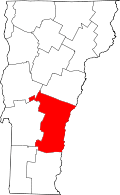 | |
| Villages | ||
| CDPs | ||
| Other communities | ||