Quechee, Vermont
| Quechee, Vermont | |
|---|---|
| Census-designated place | |
|
Quechee Gorge, Quechee State Park, fall 2009 | |
 Location in Windsor County and the state of Vermont. | |
| Coordinates: 43°38′44″N 72°25′6″W / 43.64556°N 72.41833°WCoordinates: 43°38′44″N 72°25′6″W / 43.64556°N 72.41833°W | |
| Country | United States |
| State | Vermont |
| County | Windsor |
| Area | |
| • Total | 1.9 sq mi (5.0 km2) |
| • Land | 1.9 sq mi (4.8 km2) |
| • Water | 0.08 sq mi (0.2 km2) |
| Elevation | 580 ft (180 m) |
| Population (2010) | |
| • Total | 656 |
| • Density | 340/sq mi (130/km2) |
| Time zone | Eastern (EST) (UTC-5) |
| • Summer (DST) | EDT (UTC-4) |
| ZIP code | 05059 |
| Area code(s) | 802 |
| FIPS code | 50-57775[1] |
| GNIS feature ID | 1459125[2] |

Quechee is a census-designated place and one of five unincorporated villages in the town of Hartford, Windsor County, Vermont, United States. As of the 2010 census, the population of the CDP was 656.[3] It is the site of Quechee Gorge on the Ottauquechee River and is also the home to the Quechee Lakes planned community initiated in the late 1960s, which also brought to the community the small Quechee Lakes Ski Area in the 1970s.
Quechee was known for a picturesque covered bridge at the site of the old Quechee mill, which now houses the Simon Pearce glass-blowing facility and restaurant. The bridge was severely damaged by flooding caused by Hurricane Irene in 2011.[4] The bridge has since been rebuilt.
Quechee has a small branch post office with zip code 05059.
Geography
Quechee is located along the Ottauquechee River in the western part of the town of Hartford. U.S. Route 4 passes through the CDP, just south of the village center, connecting with Woodstock and Rutland to the west and with White River Junction to the east. Quechee Gorge forms the southeastern edge of the CDP.
References
- ↑ "American FactFinder". United States Census Bureau. Archived from the original on September 11, 2013. Retrieved 2008-01-31.
- ↑ "US Board on Geographic Names". United States Geological Survey. 2007-10-25. Retrieved 2008-01-31.
- ↑ "Profile of General Population and Housing Characteristics: 2010 Demographic Profile Data (DP-1): Quechee CDP, Vermont". U.S. Census Bureau, American Factfinder. Archived from the original on September 11, 2013. Retrieved August 3, 2012.
- ↑ A rampage of rivers - The Boston Globe
External links
- Town of Hartford official website
- Quechee State Park
- Quechee Public Library
- Quechee Lakes Landowners' Association, Inc. - The Quechee Club
Municipalities and communities of Windsor County, Vermont, United States | ||
|---|---|---|
| Towns | 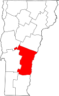 | |
| Villages | ||
| CDPs | ||
| Other communities | ||