Ballinderry
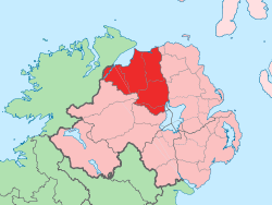
Ballinderry (from Irish Baile an Doire, meaning "town of the oak wood") is a small civil and ecclesiastical parish on both sides of the County Londonderry / County Tyrone border in Northern Ireland. It is a rural parish of about 350 houses and lies on the western shores of Lough Neagh.
The parish contains two small villages: Ballylifford and Derrychrin, which are of relatively close proximity to Cookstown, Coalisland, Magherafelt and Dungannon. They are also very close to the settlements of Ardboe, Moortown, The Loup and Ballyronan.
Places of interest
Ballinderry River flows into Lough Neagh at Ballinderry. The river has formed the border between the two counties of Derry and Tyrone since the creation of the former. It is regarded by anglers as one of the best trout rivers in Ulster, and is also good for salmon. One variety of trout, known as dollaghan, is native to the Lough Neagh area. Canoeing is also popular along the river and canoe steps have been built at several points to aid the sport's participants.
Due to its location on the shores of Lough Neagh, fishing was historically the primary source of income for many local people.
People of interest
- Seán Larkin was a militant Irish republican from the townland of Belagherty. He was a member of the Irish Volunteers in the early 1910s, and was later a member of the Irish Republican Army (3rd Western Division) during the Irish War of Independence. He did not support the Anglo-Irish Treaty and fought for the "anti-treaty" side in the Irish Civil War which followed. He was executed by the Irish Free State on 14 March 1923. Republicans hold commemorations at his graveside every year.
- Declan Bateson - Member of Derry GAA's 1993 All-Ireland winning team.
- Enda Muldoon - All Star winning Derry GAA footballer.
- Kevin McGuckin - Current Derry GAA player and vice-captain.
- Conleith Gilligan - Current Derry GAA player
- James Conway - Current Derry GAA player
- Finbarr O'Neill - Former head of the Mitsubishi Motors
- Suspected serial killer John Bodkin Adams, lived in Ballinderry from 1903 to 1911. He became a general practitioner and worked in Eastbourne, England, from 1922. He was charged in 1957 with the murder of two patients but was acquitted. He was however, suspected of causing the death of 163 other patients.[1]
Sport
- Gaelic games are the most popular sports in the area, with Ballinderry Shamrocks GAC being the local club. Páirc na Seamróg is the team's grounds. Ballinderry GAC is best known for winning the All-Ireland Senior Club Football Championship in 2002. They field Gaelic football teams at U8, U10 U12, U14, U16, Minor, Reserve, Thirds and Senior levels. Ballinderry also fields Camogie teams from u8s right up to Seniors.[2]
- Angling is also popular in the area, judging by the growing membership of "Ballinderry Bridge Angling Club".
Education
- Ballylifford Primary School - Catholic primary school
- Derrychrin Primary School - Catholic primary school
Politics
Ballinderry gives its name to one of the three electoral areas that make up Cookstown District Council. Two councillors live in Ballinderry: Michael McIvor (Sinn Féin) and Patsy McGlone (Social Democratic and Labour Party). Sinn Féin has a branch in the area, known as the Volunteers Heron/Wilkinson/McNally Cumann.
Townlands
Ballinderry consists of 12 townlands.[3] Below is a list of these townlands along with their Irish origin and meaning.[4]
- Ardagh (from Irish: Ard achadh, meaning "high field")
- Ballinderry (from Irish: Baile an Doire, meaning "town of the oakwood")
- Ballydonnell (from Irish: Baile Uí Domhnaill, meaning "townland of the O'Donnells")
- Ballylifford
- Ballymultrea (from Irish: Baile Uí Maoiltrea, meaning "O'Multrea's townland")
- Ballyronan Beg (from Irish: Baile Uí Ronáin Beag, meaning "O'Ronans town (little)")
- Belagherty
- Killymuck (from Irish: Coill a Muc, meaning "the wood of the pigs")
- Lanaglug (from Irish: Lann na gClog, meaning "church of the bells")
- The Gort alias Eglish (from Irish: Eaglais, meaning "church")
- Mullan Upper (from Irish: Mullán, meaning "small summit")
- Mullan Lower (from Irish: Mullán, meaning "small summit")
See also
References
- ↑ Cullen, Pamela V., "A Stranger in Blood: The Case Files on Dr John Bodkin Adams", London, Elliott & Thompson, 2006, ISBN 1-904027-19-9
- ↑ The Birth Of Gaelic Football In Ballinderry
- ↑ Public Records Office Northern Ireland - Parish of Ballinderry
- ↑ Place Names NI
- NI Neighbourhood Information System
- Discover Northern Ireland article on Ballinderry River
- Ballinderry GAC Website
External links
Coordinates: 54°39′12″N 6°33′39″W / 54.65333°N 6.56083°W