Arta, Greece
| Arta Άρτα | |
|---|---|
|
The historic Bridge of Arta. | |
 Arta | |
|
Location within the region  | |
| Coordinates: 39°9′N 20°59′E / 39.150°N 20.983°ECoordinates: 39°9′N 20°59′E / 39.150°N 20.983°E | |
| Country | Greece |
| Administrative region | Epirus |
| Regional unit | Arta |
| Government | |
| • Mayor | Ioannis Papalexis |
| Area | |
| • Municipality | 457.2 km2 (176.5 sq mi) |
| • Municipal unit | 47.973 km2 (18.522 sq mi) |
| Elevation | 30 m (100 ft) |
| Population (2011)[1] | |
| • Municipality | 43,166 |
| • Municipality density | 94/km2 (240/sq mi) |
| • Municipal unit | 27,330 |
| • Municipal unit density | 570/km2 (1,500/sq mi) |
| Community[1] | |
| • Population | 24,427 (2011) |
| Time zone | EET (UTC+2) |
| • Summer (DST) | EEST (UTC+3) |
| Postal code | 471 00 |
| Area code(s) | 26810 |
| Vehicle registration | ΑΤ |
| Website | www.arta.gr |

Arta (Greek: Άρτα) is a city in northwestern Greece, capital of the regional unit of Arta, which is part of Epirus region. The city was known in ancient times as Ambracia (Ancient Greek: Ἀμβρακία). Arta is known for the medieval bridge over the Arachthos River. Arta is also known for its ancient sites from the era of Pyrrhus of Epirus and its well-preserved 13th-century castle. Arta's Byzantine history is reflected in its many Byzantine churches; perhaps the best known is the Panagia Paregoretissa (Mother of God the Consoling), built about 1290 by Despot Nikephoros I Komnenos Doukas. The city is the seat of the Technological Educational Institute of Epirus.
History
Antiquity
The first settlement in the area of the modern city dates to the 9th century B.C. Ambracia was founded as a Corinthian colony in the 7th century B.C.
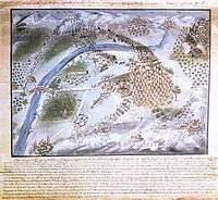
In 295 BC Pyrrhus of Epirus, king of the Molossians, transferred the capital of his kingdom to Ambracia, which he used as a base from which he attacked the Romans. Pyrrhus managed to achieve great but costly victories against the Romans, hence the phrase "Pyrrhic victory" which refers to an exchange at the Battle of Asculum. In 146 BC, Ambracia became part of the Roman Republic.
Byzantine period


Despite the existence several churches from the 9th and 10th centuries, Arta is first attested only in the late 11th century. In the Komnenian period, the city flourished as a commercial centre, with links to Venice, and quickly rose to become an archbishopric (by 1157). By the end of the 12th century, Arta probably formed a distinct fiscal district (episkepsis) within the wider theme of Nicopolis.[2]
In 1205, after the fall of Constantinople to the Fourth Crusade, Arta became the capital of the Despotate of Epirus. It continued to prosper under its new rulers, despite repeated attempts by another Greek successor state, the Empire of Nicaea (and after 1261, the restored Byzantine Empire), to subdue Epirus. As late as the 15th century, the Chronicle of the Tocco attests to the prosperity of Arta and its fertile region, "with many water buffaloes, cows, and horses", and a lively commercial activity in dried meat, lard, ham, furs, and indigo drawing merchants from Venice and Dubrovnik. Archaeological finds also attest to a local ceramic industry.[2] Fortified in 1227, Arta was briefly occupied in 1259, following the Battle of Pelagonia, by the Nicaeans. The restored Byzantine emperors continued their assaults, but it was not until 1338 that Andronikos III Palaiologos finally secured control of the city, only for it to be wrested from the Byzantines a few years later by Serbian emperor Stefan Dušan.[2] Serbian rule was followed by Albanian rule (1358–1416), until it was taken by Carlo I Tocco, Count of Cephalonia and Zakynthos. The city remained in Tocco hands until 1449, when the Ottoman Empire captured it.[2]
Ottoman period
Under Ottoman rule, the town was called in Turkish Narda. It was occupied by Venetians in 1717 and the French in 1797, but the Ottomans retook it in 1799. The city was eventually taken from the Ottomans and finally was annexed to the Greek Kingdom in 1881 by the Treaty of Berlin.
Climate
| Climate data for Arta (1976-1997) | |||||||||||||
|---|---|---|---|---|---|---|---|---|---|---|---|---|---|
| Month | Jan | Feb | Mar | Apr | May | Jun | Jul | Aug | Sep | Oct | Nov | Dec | Year |
| Average high °C (°F) | 13.3 (55.9) |
14.0 (57.2) |
16.7 (62.1) |
20.1 (68.2) |
25.0 (77) |
29.1 (84.4) |
31.8 (89.2) |
32.0 (89.6) |
29.0 (84.2) |
24.1 (75.4) |
19.0 (66.2) |
14.9 (58.8) |
22.42 (72.35) |
| Daily mean °C (°F) | 8.7 (47.7) |
9.4 (48.9) |
11.9 (53.4) |
15.2 (59.4) |
19.9 (67.8) |
24.0 (75.2) |
26.5 (79.7) |
26.5 (79.7) |
23.1 (73.6) |
18.3 (64.9) |
13.5 (56.3) |
9.9 (49.8) |
17.24 (63.03) |
| Average low °C (°F) | 4.7 (40.5) |
5.2 (41.4) |
7.0 (44.6) |
9.9 (49.8) |
13.9 (57) |
17.3 (63.1) |
19.5 (67.1) |
19.9 (67.8) |
17.1 (62.8) |
13.4 (56.1) |
9.4 (48.9) |
6.0 (42.8) |
11.94 (53.49) |
| Average rainfall mm (inches) | 131.8 (5.189) |
135.0 (5.315) |
93.8 (3.693) |
81.5 (3.209) |
58.5 (2.303) |
21.8 (0.858) |
12.6 (0.496) |
17.2 (0.677) |
43.5 (1.713) |
115.4 (4.543) |
186.0 (7.323) |
187.5 (7.382) |
1,084.6 (42.701) |
| Average rainy days | 12.1 | 11.1 | 10.6 | 9.6 | 7.4 | 4.2 | 2.5 | 2.5 | 4.9 | 8.1 | 11.9 | 13.0 | 97.9 |
| Average relative humidity (%) | 71.7 | 70.6 | 68.9 | 68.8 | 66.0 | 61.4 | 59.2 | 59.4 | 63.6 | 67.7 | 74.1 | 73.2 | 67.05 |
| Source: Hellenic National Meteorological Service [3] | |||||||||||||
Landmarks
Classical

The modern city is on the site of ancient Ambracia. Remains of the classic era include the ancient walls, the ruins of an ancient temple of Apollo, a small theatre, and remnants of the southwest cemetery.
Byzantine


The town's fortifications were built by Michael I Komnenos Doukas in the early 13th century, but their present form is largely post-Byzantine. Secular architecture from the Byzantine period, including the palace of the Despots of Epirus, has vanished completely, but the city preserves numerous churches.[2]
The most important Byzantine church is the cathedral Church of the Paregoretissa, built ca. 1290 by Nikephoros I Komnenos Doukas and his wife Anna Palaiologina Kantakouzene. Other important churches of the late Byzantine period are the Church of the Kato Panagia, built by Nikephoros I's father Michael II Komnenos Doukas, and the Monastery of Saint Theodora, housing the tomb of the city's patron, Theodora of Arta.[2] Several other churches dating to the 9th and 10th centuries also survive in and around the city: Saint Basil of the Bridge, Saint Demetrios of Katsoures in Plisioi, the Panagia Blacherna monastery, the Panagia Vryoni in Neochoraki, the Red Church in Vourgareli, the Panagia of Koronisia in Koronisia and the Church of the Pantanassa in Filippiada.
Museums
- Archaeological Museum of Arta
- Church of the Paregoretissa
- Folk museum 'Skoufas'
- Historical museum 'Skoufas'
- Private folk museum in Kypseli.
- Archaeological museum of Koronisia
Technological Educational Institute of Epirus
The Technological Educational Institute of Epirus (T.E.I.) has a main campus and its administration seat in Arta and has branch campuses in the three other main cities of Epirus, Ioannina, Igoumenitsa and Preveza. It has four (4) Faculties and thirteen (13) Departments.
Transportation
Arta is located NNW of Antirrio, Messolongi and Agrinio, NE of Preveza, SSE of Ioannina and nearly SW of Trikala.
Regular bus lines connect Arta with all bigger Greek cities. (bus to Athens departs several times a day and trip takes about 5 hours)
The city is linked with the GR-5 (Antirrio - Ioannina) and the GR-30 which links with Peta and Trikala. The Arachthos River flows to the west with its reservoir lying directly to the north.
Municipality
The present municipality Arta was formed at the 2011 local government reform by the merger of the following 5 former municipalities, that became municipal units (constituent communities in brackets):[4]
- Amvrakikos (Aneza, Vigla, Gavria, Kalogeriko, Koronisia, Polydroso, Rachi, Strongyli, Psathotopi)
- Arta (Arta, Keramates, Kostakioi, Limini)
- Filothei (Agios Spyridon, Kalamia, Kalovatos, Kirkizates, Rokka, Chalkiades)
- Vlacherna (Vlacherna, Grammenitsa, Grimpovo, Korfovouni)
- Xirovouni (Ammotopos, Dafnoti, Kampi, Pantanassa, Pistiana, Rodavgi, Skoupa, Faneromeni)
The municipality has an area of 457.248 km2, the municipal unit 47.493 km2.[5]
Quarters of Arta
- Agia Triada
- Agioi Anargyroi
- Agios Georgios Glykorrizou
- Eleousa
- Glykorrizo
- Kato Panagia Artas
- Marathovouni
Historical population
| Year | Municipal unit | Municipality |
|---|---|---|
| 1981 | 20,004 | - |
| 1991 | 23,710 | - |
| 2001 | 23,863 | - |
| 2011 | 27,330 | 43,166 |
Notable people
Ancient
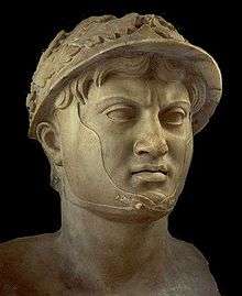
- Pyrrhus (318 BC-272 BC), general and king of Epirus
- Epicrates of Ambracia (4th century BC), comic poet
- Silanus of Ambracia (5th century BC), soothsayer in Xenophon's Anabasis
- Epigonus of Ambracia (6th-5th BC), musician
Byzantine
- Michael I Komnenos Doukas, founder and first ruler of the principality of Epirus from 1205 until his death in 1215.
- Theodore Komnenos Doukas, (died c. 1253), ruler of Epirus from 1215 to 1230 and of Thessalonica from 1224 to 1230.
- Theodora Petraliphaina, canonized as Saint Theodora of Arta; (ca. 1225 – after 1270), consort of Epirus and Orthodox Christian saint.
- Michael II Komnenos Doukas, ruler of Epirus from 1230 until his death in 1266/68.
- Nikephoros I Komnenos Doukas, (c. 1240 – c. 1297) ruler of Epirus from 1267/8 to c. 1297.
- Thomas I Komnenos Doukas,(c. 1285–1318) ruler of Epirus from c. 1297 until his death in 1318.
Modern
- Maximus the Greek (1475–1556), monk, publicist, writer, scholar, humanist and translator
- Nikolaos Skoufas (1779–1818), member of the Filiki Eteria
- Georgios Karaiskakis (1780–1827),hero of the Greek War of Independence
- Theodoros Tzinis (1798–1869), fighter of the Greek War of Independence
- Azmi Ömer Akalın, Wāli of Bursa.[6]
- Hoca Ishak Efendi (1774–1835), Ottoman engineer and translator
- Napoleon Zervas (1891–1957), WWII general and resistance leader
- Konstantinos Karapanos (1840–1911),political and archaeologist
- Alexandros Karapanos (1873–1946), politician and diplomat
- Yiannis Moralis (1916), painter
- Antonios Nikopolidis (1971), footballer
Professional sports
Handball
Basketball
- Pyrros Artas
Football
Volleyball
See also
References
- 1 2 "Απογραφή Πληθυσμού - Κατοικιών 2011. ΜΟΝΙΜΟΣ Πληθυσμός" (in Greek). Hellenic Statistical Authority.
- 1 2 3 4 5 6 Gregory, Timothy E.; Ševčenko, Nancy Patterson (1991). "Arta". In Kazhdan, Alexander. The Oxford Dictionary of Byzantium. Oxford and New York: Oxford University Press. pp. 191–192. ISBN 978-0-19-504652-6.
- ↑ "Mean Arta Climatic Averages". Hellenic National Meteorological Service. Retrieved 30 April 2015.
- ↑ Kallikratis law Greece Ministry of Interior (Greek)
- ↑ "Population & housing census 2001 (incl. area and average elevation)" (PDF) (in Greek). National Statistical Service of Greece.
- ↑ Özdalga, Elisabeth (2005). Late Ottoman society: the intellectual legacy. Psychology Press. p. 332. ISBN 978-0-415-34164-6. Retrieved 19 November 2010.
External links
- Arta Prefecture
- Municipality of Arta on GTP Travel Pages (in English and Greek)
- Arta (community) on GTP Travel Pages (in English and Greek)
- Archaeological Museum of Arta (Greek)
| Regional unit of Arta | 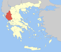 | |
|---|---|---|
| Regional unit of Ioannina | ||
| Regional unit of Preveza | ||
| Regional unit of Thesprotia | ||
| ||