Arizona State Route 88
| ||||
|---|---|---|---|---|
|
A map of Central Arizona delineating SR 88 in red. | ||||
| Route information | ||||
| Maintained by ADOT | ||||
| Length: | 45.67 mi[1] (73.50 km) | |||
| Existed: | 1936 – present | |||
| Major junctions | ||||
| West end: |
| |||
| East end: |
| |||
| Highway system | ||||
| ||||


State Route 88 (SR 88) is a 45.67 mi (73.50 km) long state highway in the U.S. state of Arizona. It runs from U.S. Route 60 (US 60) in Apache Junction through desert terrain to SR 188 near Roosevelt Dam. Following the Salt River for much of its length, the section east of Tortilla Flat is known as the Apache Trail and is part of the National Forest Scenic Byway system. The Apache Trail was built in the mid-1920s and the number 88 was assigned in 1927. An eastern extension of SR 88 to Globe was redesignated as SR 188 in the late 1990s.
Route description
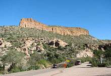
SR 88 begins at a diamond interchange with US 60, the Superstition Freeway, in southern Apache Junction. The route follows Idaho Road northward through a residential area with four lanes. Following a junction with Old West Highway, SR 88 turns northeast onto Apache Trail and narrows to two lanes. The route exits the city limits of Apache Junction, entering desert terrain. Passing a ghost town known as Goldfield, Apache Trail enters Tonto National Forest just northwest of Lost Dutchman State Park. SR 88 nears Canyon Lake south of the Mormon Flat Dam and follows a part of the southern coast of Canyon Lake. Apache Trail heads away from the Salt River. It passes through the town of Tortilla Flat, becoming an unpaved dirt trail winding eastward through the Superstition Mountains. SR 88 again turns northeast and nears Apache Lake. The route follows the Salt River northeast to the Theodore Roosevelt Dam, near which the route is again paved. SR 88 intersects with SR 188 along the coast of Theodore Roosevelt Lake.[2]
The highway is maintained by the Arizona Department of Transportation (ADOT), which is responsible for maintaining highways in the state, including SR 88. As part of this role, ADOT periodically surveys traffic along its routes. These surveys are presented in the form of average annual daily traffic, which is the number of vehicles who use the route on any average day during the year. In 2009, ADOT calculated that around as few as 400 vehicles used the route daily near the Roosevelt Dam and as many as 16,000 daily at the US 60 interchange in Apache Junction.[3] The section east of Canyon Lake is part of the Apache Trail National Forest Scenic Byway system.[4] No part of the highway has been listed in the National Highway System,[5] a system of roads in the United States important to the nation's economy, defense, and mobility.[6]
History


The Apache Trail connected the Old Spanish Trail where Apache Junction is today and Roosevelt Lake with an unpaved road as early as 1925, following much of the modern route.[7][8] By the next year, SR 66 followed the Apache Trail and the Old Spanish Trail was numbered as US 80.[9] The number 88 was given to the route by 1927, but continued past its current terminus east to US 180 west of Globe.[10] US 60 and US 89 became concurrent with US 80 at the western terminus by 1935,[11] and the US 70 designation was added to the road by 1939.[12] The section of the route from Apache Junction to Canyon Lake was paved in the late 1940s.[13][14] By 1958, the section east of Roosevelt Dam was paved.[15] The extra designations at SR 88's western terminus were removed by 1971, leaving only the US 60 designation.[16] In 1999, the section east of Roosevelt Dam was renumbered as SR 188, cutting SR 88 back to its current terminus.[17]
Junction list
| County | Location | mi[1] | km | Destinations | Notes |
|---|---|---|---|---|---|
| Pinal | Apache Junction | 0.00 | 0.00 | Interchange; western terminus; exit 197 on US 60; continues south as Idaho Road | |
| Maricopa | | 45.67 | 73.50 | Eastern terminus; former southern terminus of SR 188; Apache Trail continues east as SR 188 south | |
| 1.000 mi = 1.609 km; 1.000 km = 0.621 mi | |||||
See also
References
- 1 2 Multimodal Planning Division (September 5, 2003). "2008 ADOT Highway Log" (PDF). Arizona Department of Transportation. p. 228–229. Retrieved April 9, 2008.
- ↑ Google (March 25, 2012). "SR 88" (Map). Google Maps. Google. Retrieved March 25, 2012.
- ↑ Arizona Department of Transportation. "State Highway Traffic Log" (PDF). Arizona Department of Transportation. p. 25. Retrieved March 25, 2012.
- ↑ Federal Highway Administration. "Apache Trail Historic Road". Retrieved March 26, 2012.
- ↑ Multimodal Planning Division (September 2009). National Highway System (PDF) (Map). Arizona Department of Transportation. Retrieved March 25, 2012.
- ↑ "The National Highway System". Federal Highway Administration. August 26, 2010. Retrieved March 25, 2012.
- ↑ Arizona and New Mexico (Map). Rand McNally. 1924. § K13. Retrieved March 26, 2012.
- ↑ Auto Trails Map of Arizona and New Mexico (Map). Rand McNally. 1925. § H5. Retrieved March 26, 2012.
- ↑ Map of Arizona (Map). Arizona Highway Department. 1926. Retrieved March 26, 2012.
- ↑ Official State Routes and State Highways of the State of Arizona (Map). Arizona Highway Department. 1927. Retrieved March 26, 2012.
- ↑ Road Map of Arizona (Map). Arizona State Highway Department. 1935. Retrieved April 3, 2012.
- ↑ Road Map of Arizona (Map). Arizona State Highway Department. 1939. Retrieved April 3, 2012.
- ↑ Road Map of Arizona (Map). Arizona State Highway Department. 1946. § H5. Retrieved March 26, 2012.
- ↑ Highway Map of Arizona and New Mexico (Map). H.M. Gousha. 1951. § E5. Retrieved March 26, 2012.
- ↑ Road Map of Arizona (Map). Cartography by Rand McNally. Arizona State Highway Department. 1958. § G6. Retrieved March 26, 2012.
- ↑ Arizona (Map). Cartography by Photogrammetry and Mapping Division. Arizona Highway Department. 1971. Retrieved April 3, 2012.
- ↑ Intermodal Transportation Division (August 20, 1999). "Right-of-Way Resolution 1999-08-A-034" (PDF). Arizona Department of Transportation. Retrieved March 26, 2012.
External links