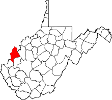
Apple Grove, Mason County, West Virginia
| Apple Grove, West Virginia | |
|---|---|
| Census-designated place | |
 Apple Grove, West Virginia | |
| Coordinates: 38°39′54″N 82°10′09″W / 38.66500°N 82.16917°WCoordinates: 38°39′54″N 82°10′09″W / 38.66500°N 82.16917°W | |
| Country | United States |
| State | West Virginia |
| County | Mason |
| Area[1] | |
| • Total | 2.458 sq mi (6.37 km2) |
| • Land | 2.303 sq mi (5.96 km2) |
| • Water | 0.155 sq mi (0.40 km2) |
| Elevation | 591 ft (180 m) |
| Population (2010)[2] | |
| • Total | 204 |
| • Density | 83/sq mi (32/km2) |
| Time zone | Eastern (EST) (UTC-5) |
| • Summer (DST) | EDT (UTC-4) |
| ZIP code | 25502 |
| Area code(s) | 304 & 681 |
| GNIS feature ID | 1553735[3] |
Apple Grove is a census-designated place (CDP) in Mason County, West Virginia, USA, on the Ohio River located along West Virginia Route 2. Apple Grove lies just south of Gallipolis Ferry. As of the 2010 census, its population was 204.[2] It is part of the Point Pleasant, WV–OH Micropolitan Statistical Area.
Climate
The climate in this area is characterized by relatively high temperatures and evenly distributed precipitation throughout the year. According to the Köppen Climate Classification system, Apple Grove has a Humid subtropical climate, abbreviated "Cfa" on climate maps.[4]
| Climate data for Apple Grove, Mason County, West Virginia | |||||||||||||
|---|---|---|---|---|---|---|---|---|---|---|---|---|---|
| Month | Jan | Feb | Mar | Apr | May | Jun | Jul | Aug | Sep | Oct | Nov | Dec | Year |
| Average high °C (°F) | 5 (41) |
7 (45) |
13 (55) |
19 (66) |
24 (75) |
28 (83) |
30 (86) |
29 (85) |
26 (79) |
20 (68) |
13 (56) |
7 (45) |
18 (65) |
| Average low °C (°F) | −6 (21) |
−5 (23) |
−1 (31) |
4 (40) |
9 (49) |
14 (58) |
17 (63) |
17 (62) |
12 (54) |
6 (43) |
1 (33) |
−4 (25) |
6 (42) |
| Average precipitation mm (inches) | 81 (3.2) |
74 (2.9) |
99 (3.9) |
86 (3.4) |
99 (3.9) |
91 (3.6) |
100 (4) |
89 (3.5) |
80 (3) |
64 (2.5) |
71 (2.8) |
79 (3.1) |
1,011 (39.8) |
| Source: Weatherbase [5] | |||||||||||||
References
- ↑ "US Gazetteer files: 2010, 2000, and 1990". United States Census Bureau. 2011-02-12. Retrieved 2011-04-23.
- 1 2 "American FactFinder". United States Census Bureau. Archived from the original on 2013-09-11. Retrieved 2011-05-14.
- ↑ U.S. Geological Survey Geographic Names Information System: Apple Grove, Mason County, West Virginia
- ↑ Climate Summary for Apple Grove, West Virginia
- ↑ "Weatherbase.com". Weatherbase. 2013. Retrieved on September 13, 2013.
This article is issued from Wikipedia - version of the 10/16/2016. The text is available under the Creative Commons Attribution/Share Alike but additional terms may apply for the media files.