West Virginia Route 2
| ||||
|---|---|---|---|---|
| Route information | ||||
| Maintained by WVDOH | ||||
| Length: | 230.6 mi[1] (371.1 km) | |||
| Existed: | 1920s – present | |||
| Major junctions | ||||
| South end: |
| |||
|
| ||||
| North end: |
| |||
| Location | ||||
| Counties: | Hancock, Brooke, Ohio, Marshall, Wetzel, Tyler, Pleasants, Wood, Jackson, Mason, Cabell | |||
| Highway system | ||||
| ||||

West Virginia Route 2 is a state highway in the US state of West Virginia. It generally parallels the Ohio River along the western border of the state, from U.S. Route 60 in Huntington (just west of the East End Bridge) northeasterly to U.S. Route 30 in Chester (just south of the Jennings Randolph Memorial Bridge).
WV 2 leaves the shores of the Ohio River in two places: between Point Pleasant and Mount Alto (where West Virginia Route 62 follows the river) and between Ravenswood and Waverly (where West Virginia Route 68 mostly follows the river).
History
Huntington to Parkersburg
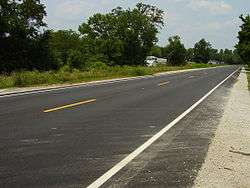
WV 2 was reconstructed from Lesage to Glenwood as an improved two-lane highway with shoulders on a four-lane right-of-way in the mid-1980s. Currently, there are long-range plans to widen WV 2 from WV 193 near Barboursville northeast to Point Pleasant to four lanes at a cost of $237,300,000.[2] Even further down the road is WV 2 widening from Point Pleasant to Interstate 77 at a cost of $207,300,000. The projects are ranked 86th and 98th,respectively.
Parkersburg to Wheeling
Within the six-year plan produced by the West Virginia Department of Transportation is a four-lane upgrade for WV 2 between McKeefrey and Parkersburg. Ranked 55th, this project has an estimated price tag of $432,000,000.[2]
Wheeling to Chester
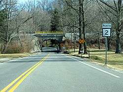
WV 2 is a variable two-lane and four-lane highway from Wheeling to its northern terminus at Chester.
For a time, Route 2 deviated from its current alignment to follow a more northeasterly route from New Cumberland to US 30 via the unincorporated area of New Manchester. The current alignment of WV 2 passing the Mountaineer Race Track and Gaming Resort to US 30 was formerly numbered WV 66 and is reflected as such in many of the county highways in the area. The former routing of WV 2 is now WV 8.
On June 23, 2000, work began on a project that widened WV 2 from two to four lanes from Weirton at US 22 (Robert C. Byrd Expressway) south to CR 8 near Follansbee. The project length was just 0.9 miles. Work was supposed to be complete by June 31, 2001, however, construction wrapped up on October 31 at a cost of $21,444,875.[3] The project entailed stabilizing the hillside by reshaping the highwall, widening the roadway with four 12-foot (3.7 m) lanes, creating 10-foot (3.0 m) outside shoulders, and 8-foot (2.4 m) interior shoulders. 3.9 million cubic yards of earth were removed during the excavation process.

One year later, the highway widening project progressed further south for 2.5 miles (4.0 km).[4]
There are currently plans to widen WV 2 from two to four lanes from US 22 north to Chester at a cost of $463,900,000; this would include a bypass of New Cumberland and would also correct rockfall hazards along the entire length.[2] Likewise, a project to widen WV 2 from two to four lanes from Follansbee south to Wheeling is projected to cost $489,500,000. This would connect to an incomplete interchange at Interstate 70 and U.S. Route 250 and include a northern bypass of Wheeling. The projects are ranked 45th and 48th, respectively.
Notes
- The state route is the subject of Driving Up the Ohio River on Route 2 in Late Fall, a poem by Larry Smith. The poem was featured on the October 26, 2006 edition of The Writer's Almanac radio program.[5]
Major intersections
| County | Location | mi | km | Destinations | Notes | ||
|---|---|---|---|---|---|---|---|
| Cabell | Huntington | Southern terminus of WV 2 | |||||
| | Northern terminus of WV 193 | ||||||
| Mason | Henderson | Interchange | |||||
| Henderson–Point Pleasant line | Bartow Jones Bridge over Kanawha River | ||||||
| Point Pleasant | |||||||
| Southern terminus of first WV 62 concurrency | |||||||
| | Northern terminus of first WV 62 concurrency | ||||||
| | Western terminus of WV 87 | ||||||
| Jackson | Mount Alto | Southern terminus of second WV 62 concurrency | |||||
| | Northern terminus of second WV 62 concurrency | ||||||
| Ravenswood | Southern terminus of US 33 concurrency | ||||||
| Silverton | Northern terminus of US 33 concurrency; southern terminus of I-77 concurrency; WV 2 south follows exit 146 | ||||||
| see I-77 | |||||||
| Wood | | Northern terminus of I-77 concurrency; WV 2 north follows exit 179 | |||||
| | Southern terminus of WV 31 concurrency | ||||||
| | Northern terminus of WV 31 concurrency | ||||||
| Pleasants | | ||||||
| St. Marys | Northern terminus of WV 16 | ||||||
| Tyler | Sistersville | Northern terminus of WV 18 | |||||
| Charles Street - Sistersville Ferry | |||||||
| Wetzel | | Northern terminus of WV 180 | |||||
| New Martinsville | Southern terminus of WV 7 concurrency | ||||||
| Interchange; northern terminus of WV 7 concurrency | |||||||
| Proctor | Western terminus of CR 89; formerly WV 89 | ||||||
| Marshall | | Southern terminus of Alternate WV 2 | |||||
| | Northern terminus of Alternate WV 2 | ||||||
| Moundsville | |||||||
| Southern terminus of US 250 concurrency; southbound exit and northbound entrance | |||||||
| Glen Dale | Southern terminus of WV 86 | ||||||
| McMechen | East Baltimore Street - McMechen | Northbound exit only | |||||
| 12th Street - McMechen | |||||||
| 3rd Street - McMechen | Northbound access only; Southern terminus of freeway | ||||||
| Benwood | South Marshall Street - Benwood, McMechen | ||||||
| Bellaire Bridge | Former interchange | ||||||
| 4th Street - Benwood | |||||||
| Ohio | Wheeling | I-470 exit 1 | |||||
| Interchange; northbound exit and southbound entrance; northern terminus of US 250 concurrency; northern terminus of freeway | |||||||
| 10th Street (Wheeling Suspension Bridge) | |||||||
| Southern terminus of US 40 concurrency; I-70 exit 1A | |||||||
| Northern terminus of US 40 concurrency | |||||||
| Brooke | Wellsburg | Western terminus of WV 67 | |||||
| Western terminus of WV 27 | |||||||
| Follansbee | Western terminus of Alternate WV 27 | ||||||
| | Market Street Bridge - Steubenville | ||||||
| | Interchange; southern terminus of US 22 concurrency; WV 2 south follows exit 1 | ||||||
| Weirton Junction | Interchange; northern terminus of US 22 concurrency; WV 2 north follows exit 2 | ||||||
| Hancock | Weirton | Western terminus of CR 507 concurrency | |||||
| Eastern terminus of CR 507 concurrency | |||||||
| Western terminus of WV 105 | |||||||
| New Cumberland | Southern terminus of WV 8 | ||||||
| Newell | Newell Toll Bridge | ||||||
| Chester | Interchange; northern terminus of WV 2 | ||||||
| 1.000 mi = 1.609 km; 1.000 km = 0.621 mi | |||||||
References
- ↑ Distance calculated using Microsoft MapPoint mapping software.
- 1 2 3 "Sheet1." West Virginia Department of Transportation. Nov. 1, 2006
- ↑ "WV 2 Project Follansbee-Weirton Road II." West Virginia Department of Transportation. Nov. 1, 2006
- ↑ "Panhandle Archaic." West Virginia Department of Culture. Nov. 1, 2006
- ↑ THURSDAY, 26 OCTOBER 2006 The Writer's Almanac from American Public Media.