Ancud
| Ancud | ||||||
|---|---|---|---|---|---|---|
| City and Commune | ||||||
|
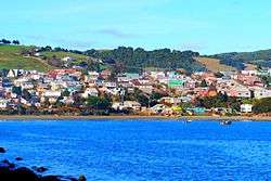
Partial view of Ancud | ||||||
| ||||||
| Coordinates (city): 41°52′S 73°50′W / 41.867°S 73.833°WCoordinates: 41°52′S 73°50′W / 41.867°S 73.833°W | ||||||
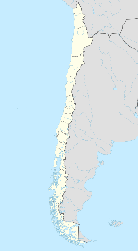
| Country | Chile | |||||
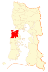
| Region | Los Lagos | |||||
| Province | Chiloé | |||||
| Founded as | San Carlos de Chiloé | |||||
| Founded | 20 August 1768 | |||||
| Government[1] | ||||||
| • Type | Municipality | |||||
| • Alcalde | Soledad Moreno Nuñez (Ind) | |||||
| Area[2] | ||||||
| • Total | 1,252.4 km2 (483.6 sq mi) | |||||
| Elevation | 0 m (0 ft) | |||||
| Population (2012 Census) | ||||||
| • Total | 40,819 | |||||
| • Density | 33/km2 (84/sq mi) | |||||
| • Urban | 27,292 | |||||
| • Rural | 12,654 | |||||
| Demonym(s) | Ancuditian | |||||
| Sex[2] | ||||||
| • Men | 19,793 | |||||
| • Women | 20,153 | |||||
| Time zone | CLT (UTC−4) | |||||
| • Summer (DST) | CLST (UTC−3) | |||||
| Area code(s) | 56 + 65 | |||||
| Website |
www | |||||


Ancud (Spanish pronunciation: [aŋˈkuð]) is a city in southern Chile located in the northernmost part of the island and province of Chiloé, in Los Lagos Region. It is the second largest city of Chiloé Archipelago after Castro. The city was established in 1768 to function as the capital of the archipelago and held that position until 1982.
Geography
Numerous glaciations have dredged the Chacao Channel to the north, separating Chiloé Island from mainland Chile to the north, marking the border between two natural regions of Chile, Zona Sur to the north and Zona Austral to the south. The Pacific Ocean lies on the west as the Chilean Coastal Range continues as a chain of islands. To the southeast of the commune is Quemchi and Dalcahue to the south. The commune has a surface area of 1,752.4 km2 (677 sq mi).[2]
History
As consequence of the Seven Years' War the Spanish authorities had the coastal fortification system of Chile updated and expanded.[3][4] Inspired in the recommendations of former governor Antonio Narciso de Santa María the Spanish founded the "city-fort" of Ancud in 1767–1768 and separated Chiloé from the Captaincy General of Chile into a direct dependency of the Viceroyalty of Peru.[5] As with other 18th century forts in Chile the establishment of Ancud led through the new Ancud-Castro road to an expansion on local trade and agriculture.[6]
Climate
Ancud has an oceanic climate (Köppen climate classification Cfb) with significant precipitation in each month.[7] Winters are cool and wet with a July average of 7.5 °C (45.5 °F). Precipitation during this time of the year is very high, averaging around 350 millimetres (14 in) and humidity is high, averaging around 87-88%.[8] Summers are mild with a January average of 15.0 °C (59.0 °F) and during this time, precipitation is lower though still significant, averaging 125 millimetres (5 in) in January.[8] Temperatures rarely exceed 30 °C (86.0 °F). The average annual precipitation is 2,540 millimetres (100 in) and there are 200 days with measureable precipitation. However, precipitation is highly variable from year to year with 1993 being the driest, recording only 759 millimetres (30 in) and 1977 being the wettest at 3,712 millimetres (146 in).[8] The record high was 32.7 °C (90.9 °F) in January 27, 1975 and the record low was −3.0 °C (26.6 °F) in June 30, 1970.[8]
| Climate data for Ancud | |||||||||||||
|---|---|---|---|---|---|---|---|---|---|---|---|---|---|
| Month | Jan | Feb | Mar | Apr | May | Jun | Jul | Aug | Sep | Oct | Nov | Dec | Year |
| Record high °C (°F) | 32.7 (90.9) |
28.2 (82.8) |
31.0 (87.8) |
24.7 (76.5) |
17.8 (64) |
29.0 (84.2) |
20.0 (68) |
17.2 (63) |
22.1 (71.8) |
23.6 (74.5) |
25.2 (77.4) |
30.0 (86) |
32.7 (90.9) |
| Average high °C (°F) | 17.8 (64) |
17.8 (64) |
16.5 (61.7) |
13.8 (56.8) |
11.6 (52.9) |
9.8 (49.6) |
9.4 (48.9) |
10.0 (50) |
11.3 (52.3) |
13.0 (55.4) |
14.8 (58.6) |
16.5 (61.7) |
13.5 (56.3) |
| Daily mean °C (°F) | 15.0 (59) |
14.8 (58.6) |
13.6 (56.5) |
11.4 (52.5) |
9.7 (49.5) |
7.9 (46.2) |
7.5 (45.5) |
8.0 (46.4) |
9.1 (48.4) |
10.6 (51.1) |
12.3 (54.1) |
13.9 (57) |
11.1 (52) |
| Average low °C (°F) | 10.9 (51.6) |
10.3 (50.5) |
9.6 (49.3) |
8.2 (46.8) |
7.2 (45) |
5.6 (42.1) |
5.2 (41.4) |
5.4 (41.7) |
6.1 (43) |
7.0 (44.6) |
8.6 (47.5) |
10.0 (50) |
7.8 (46) |
| Record low °C (°F) | 1.6 (34.9) |
0.9 (33.6) |
0.9 (33.6) |
0.0 (32) |
0.0 (32) |
−3.0 (26.6) |
−2.8 (27) |
−2.2 (28) |
−2.0 (28.4) |
0.2 (32.4) |
1.8 (35.2) |
0.0 (32) |
−3.0 (26.6) |
| Average precipitation mm (inches) | 124.6 (4.906) |
107.4 (4.228) |
129.6 (5.102) |
195.4 (7.693) |
354.2 (13.945) |
361.4 (14.228) |
326.6 (12.858) |
271.4 (10.685) |
221.3 (8.713) |
172.3 (6.783) |
146.9 (5.783) |
128.5 (5.059) |
2,539.6 (99.983) |
| Average precipitation days | 14 | 11 | 13 | 16 | 20 | 21 | 20 | 20 | 19 | 16 | 16 | 14 | 200 |
| Average relative humidity (%) | 74 | 76 | 79 | 84 | 88 | 88 | 87 | 85 | 82 | 78 | 76 | 75 | 81 |
| Source: Dirección Meteorológica de Chile[8] | |||||||||||||
Demographics
According to the 2002 census of the National Statistics Institute, Ancud spans an area of 1,252.4 km2 (484 sq mi) and has 39,946 inhabitants (19,793 men and 20,153 women). Of these, 27,292 (68.3%) lived in urban areas and 12,654 (31.7%) in rural areas. The population grew by 6.5% (2,430 persons) between the 1992 and 2002 censuses.[2] The demonym of a person from Ancud is Ancuditano for a man and Ancuditana for a woman.
Administration
As a commune, Ancud is a third-level administrative division of Chile administered by a municipal council, headed by an alcalde who is directly elected every four years. The 2008-2012 alcalde is Federico Krüger Finterbüch.[1]
Within the electoral divisions of Chile, Ancud is represented in the Chamber of Deputies by Mr. Gabriel Ascencio (PDC) and Mr. Alejandro Santana (RN) as part of the 58th electoral district, (together with Castro, Quemchi, Dalcahue, Curaco de Vélez, Quinchao, Puqueldón, Chonchi, Queilén, Quellón, Chaitén, Hualaihué, Futaleufú and Palena). The commune is represented in the Senate by Camilo Escalona Medina (PS) and Carlos Kuschel Silva (RN) as part of the 17th senatorial constituency (Los Lagos Region).
Education
Previously the area had a German school, Deutsche Schule Ancud-Chiloe.[9]
Landmarks
Colonial fort system

The fort system of Ancud together with nearby the forts of Agüi one of the four fort systems that existed in colonial Chiloé.[6][10] The fort system of Ancud is made up of two forts and four batteries. Fuerte Real de San Carlos was built as late as 1824 by orders of Antonio de Quintanilla, the last Spanish governor of Chiloé. The arsenal (polvorín) of this can still be seen at the centre of a small plaza. The battery of San Antonio is the best preserved part of the fort system.[10]
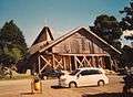
Gallery
-

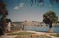
Fuerte San Antonio
-

Avenida Salvador Allende
-
Avenida Salvador Allende
-
Cathedral
-

Plaza de Armas and Town Hall
-
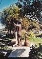
Firebrigade Monument
See also
- Ancud Volcanic Complex
- Churches of Chiloé
- Islotes de Puñihuil Natural Monument
- Mahlon Williamson (barque)
References
- 1 2 "Municipality of Ancud" (in Spanish). Retrieved 10 November 2010.
- 1 2 3 4 "National Statistics Institute" (in Spanish). Archived from the original on 20 December 2010. Retrieved 3 December 2010.
- ↑ "Lugares estratégicos", Memoria chilena (in Spanish), Biblioteca Nacional de Chile, retrieved 30 December 2015
- ↑ "Ingeniería Militar durante la Colonia", Memoria chilena (in Spanish), Biblioteca Nacional de Chile, retrieved 30 December 2015
- ↑ Urbina Carrasco, María Ximena (2014). "El frustrado fuerte de Tenquehuen en el archipiélago de los Chonos, 1750: Dimensión chilota de un conflicto hispano-británico". Historia. 47 (I). Retrieved 28 January 2016.
- 1 2 Sahady Villanueva, Antonio; Bravo Sánchez, José; Quilodrán Rubio, Carolina (2010). "Flandes Indiano Chiloense: un patrimonio invencible en el tiempo". Revista de Urbanismo (in Spanish). 23: 1–27. Retrieved 30 January 2016.
- ↑ Kottek, M.; J. Grieser; C. Beck; B. Rudolf; F. Rubel (2006). "World Map of the Köppen-Geiger climate classification updated" (PDF). Meteorol. Z. 15 (3): 259–263. doi:10.1127/0941-2948/2006/0130. Retrieved December 27, 2012.
- 1 2 3 4 5 "Estadisca Climatologica Tomo II" (PDF) (in Spanish). Dirección General de Aeronáutica Civil. March 2001. Retrieved December 27, 2012.
- ↑ "Deutscher Bundestag 4. Wahlperiode Drucksache IV/3672" (Archive). Bundestag (West Germany). 23 June 1965. Retrieved on 12 March 2016. p. 21/51.
- 1 2 Sahady Villanueva, Antonio; Bravo Sánchez, José; Quilodrán Rubio, Carolina (2011). "Fuertes españoles en Chiloé: las huellas de la historia en medio del paisaje insular". Revista INVI. 73 (26): 133–165. Retrieved 30 January 2016.
External links
| Wikimedia Commons has media related to Ancud. |
-
 Ancud travel guide from Wikivoyage
 - (Spanish) Municipality of Ancud
- Satellite view of the Chiloé archipielago (Google maps)
- Satellite view of Ancud (Google maps)

| Main islands | |||||||||||||||
|---|---|---|---|---|---|---|---|---|---|---|---|---|---|---|---|
| Water bodies | |||||||||||||||
| Cities and towns | |||||||||||||||
| History | |||||||||||||||
| Culture |
| ||||||||||||||
1: These islands are not part of Chiloé Province | |||||||||||||||