Alcala, Cagayan
| Alcala | ||
|---|---|---|
| Municipality | ||
| ||
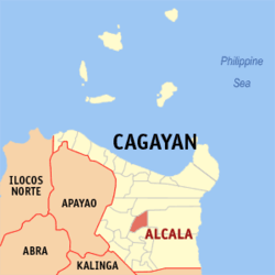 Map of Cagayan showing the location of Alcala | ||
.svg.png) Alcala Location within the Philippines | ||
| Coordinates: 17°54′N 121°40′E / 17.9°N 121.67°ECoordinates: 17°54′N 121°40′E / 17.9°N 121.67°E | ||
| Country | Philippines | |
| Region | Cagayan Valley (Region II) | |
| Province | Cagayan | |
| District | 1st District | |
| Barangays | 25 | |
| Government[1] | ||
| • Mayor | Criselda "Dadang" I. Antonio | |
| Area[2] | ||
| • Total | 187.2 km2 (72.3 sq mi) | |
| Population (2015 census)[3] | ||
| • Total | 38,883 | |
| • Density | 210/km2 (540/sq mi) | |
| Time zone | PST (UTC+8) | |
| ZIP code | 3507 | |
| IDD : area code | +63 (0)78 | |
| Income class | 3rd class | |

Alcala is a third class municipality in the province of Cagayan, Philippines. According to the 2015 census, it has a population of 38,883 people.[3]
Alcala is home to the Saint Philomene Church, regarded as the widest church in the Cagayan Valley.
Alcala Milk Candy is a famous product of this municipality.
Barangays
Alcala is politically subdivided into 25 barangays.[2]
- Abbeg
- Afusing Bato
- Afusing Daga
- Agani
- Baculod
- Baybayog
- Cabuluan
- Calantac
- Carallangan
- Centro Norte (Pob.)
- Centro Sur (Pob.)
- Dalaoig
- Damurog
- Jurisdiction
- Malalatan
- Maraburab
- Masin
- Pagbangkeruan
- Pared
- Piggatan
- Pinopoc
- Pussian
- San Esteban
- Tamban
- Tupang
Demographics
| Population census of Alcala | ||
|---|---|---|
| Year | Pop. | ±% p.a. |
| 1990 | 29,161 | — |
| 1995 | 32,035 | +1.78% |
| 2000 | 33,997 | +1.28% |
| 2007 | 35,694 | +0.67% |
| 2010 | 37,773 | +2.08% |
| 2015 | 38,883 | +0.55% |
| Source: Philippine Statistics Authority[3][4] | ||
In the 2015 census, the population of Alcala, Cagayan, was 38,883 people,[3] with a density of 210 inhabitants per square kilometre or 540 inhabitants per square mile.
References
- ↑ "Official City/Municipal 2013 Election Results". Intramuros, Manila, Philippines: Commission on Elections (COMELEC). 11 September 2013. Retrieved 24 January 2014.
- 1 2 "Province: CAGAYAN". PSGC Interactive. Makati City, Philippines: National Statistical Coordination Board. Retrieved 24 January 2014.
- 1 2 3 4 "Region II (CAGAYAN VALLEY)". Census of Population (2015): Total Population by Province, City, Municipality and Barangay (Report). PSA. Retrieved 20 June 2016.
- ↑ "Region II (CAGAYAN VALLEY)". Census of Population and Housing (2010): Total Population by Province, City, Municipality and Barangay (Report). NSO. Retrieved 29 June 2016.
External links
 |
Gattaran | | ||
| Santo Niño / Cagayan River | |
Baggao | ||
| ||||
| | ||||
| Amulung |
Tuguegarao (capital) | |
| Municipalities | |
| Component city | |
| Barangays | |
This article is issued from Wikipedia - version of the 11/15/2016. The text is available under the Creative Commons Attribution/Share Alike but additional terms may apply for the media files.