Albrightsville, Pennsylvania
| Albrightsville, Pennsylvania | |
|---|---|
| Census-designated place | |
 Albrightsville Location in Pennsylvania | |
| Coordinates: 41°0′52″N 75°36′3″W / 41.01444°N 75.60083°WCoordinates: 41°0′52″N 75°36′3″W / 41.01444°N 75.60083°W | |
| Country | United States |
| State | Pennsylvania |
| County | Carbon |
| Townships | Kidder, Penn Forest |
| Area | |
| • Total | 1.01 sq mi (2.61 km2) |
| • Land | 1.01 sq mi (2.61 km2) |
| • Water | 0.0 sq mi (0.0 km2) |
| Elevation | 1,510 ft (460 m) |
| Population (2010) | |
| • Total | 202 |
| • Density | 200/sq mi (77.3/km2) |
| Time zone | Eastern (EST) (UTC-5) |
| • Summer (DST) | EDT (UTC-4) |
| ZIP code | 18210 |
| Area code(s) | 570 Exchange: 722 |
| FIPS code | 42-00652 |
| GNIS feature ID | 1168122 |
Albrightsville is an unincorporated community and census-designated place[1] in Kidder and Penn Forest townships, Carbon County, Pennsylvania, United States. As of the 2010 census, the population was 202.[2] It is drained by Mud Run (which forms the township boundary) westward into the Lehigh River. Pennsylvania Routes 534 and 903 intersect at the eastern corner of the village. Although it has its own post office with the ZIP code of 18210, areas just to the north and west use the Lake Harmony ZIP code of 18624.[3] The Holiday Pocono community is directly to the north, across PA 534, and Towamensing Trails is directly across PA 903 to the southeast. The community is just east of Hickory Run State Park.
References
- ↑ http://www.census.gov/2010census/
- ↑ "Geographic Identifiers: 2010 Census Summary File 1 (G001): Albrightsville CDP, Pennsylvania". U.S. Census Bureau, American Factfinder. Retrieved April 7, 2015.
- ↑ http://www.hipcodes.com/18210/
 |
Leonardsville/Pocono Mountain Lake Estates | Holiday Pocono, Lake Harmony, Split Rock | Tunkhannock Township, Monroe County | |
| Hickory Run State Park | |
Meckesville, Indian Mountain Lake | ||
| ||||
| | ||||
| Christmans | Penn Forest Township | Towamensing Trails |
Municipalities and communities of Carbon County, Pennsylvania, United States | ||
|---|---|---|
| Boroughs | 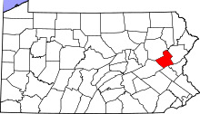 | |
| Townships | ||
| CDPs | ||
| Unincorporated communities | ||
| Footnotes | ‡This populated place also has portions in an adjacent county or counties | |
This article is issued from Wikipedia - version of the 8/27/2015. The text is available under the Creative Commons Attribution/Share Alike but additional terms may apply for the media files.