15th Street–Prospect Park (IND Culver Line)
| 15th Street–Prospect Park | |||||||
|---|---|---|---|---|---|---|---|
| New York City Subway rapid transit station | |||||||
 | |||||||
| Station statistics | |||||||
| Address |
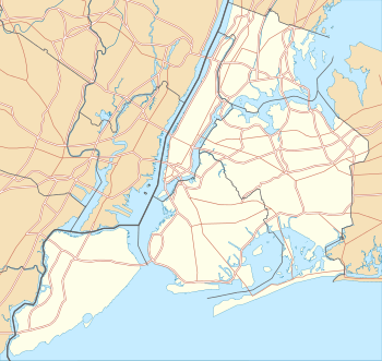
15th Street & Prospect Park West Brooklyn, NY 11215 | ||||||
| Borough | Brooklyn | ||||||
| Locale | Windsor Terrace, Park Slope | ||||||
| Coordinates | 40°39′37.96″N 73°58′47.94″W / 40.6605444°N 73.9799833°WCoordinates: 40°39′37.96″N 73°58′47.94″W / 40.6605444°N 73.9799833°W | ||||||
| Division | B (IND) | ||||||
| Line | IND Culver Line | ||||||
| Services |
F G | ||||||
| Transit connections |
| ||||||
| Structure | Underground | ||||||
| Platforms | 1 island platform | ||||||
| Tracks | 2 | ||||||
| Other information | |||||||
| Opened | October 7, 1933 | ||||||
| Traffic | |||||||
| Passengers (2015) |
2,011,237[1] | ||||||
| Rank | 247 out of 422 | ||||||
| Station succession | |||||||
| Next north |
Seventh Avenue: F | ||||||
| Next south |
Fort Hamilton Parkway: F | ||||||
| |||||||
| |||||||
|
| |||||||
|
15th Street–Prospect Park Subway Station (IND) | |||||||
| MPS | New York City Subway System MPS | ||||||
| NRHP Reference # | 05000748[2] | ||||||
| Added to NRHP | July 27, 2005 | ||||||


15th Street–Prospect Park is a local station on the IND Culver Line of the New York City Subway. Located at 15th Street and Prospect Park West in Windsor Terrace/Park Slope, Brooklyn, it is served by the F and G trains at all times.
Station layout
| G | Street Level | Exit/Entrance |
| M | Mezzanine | Fare control, station agent |
| P Platform level |
Northbound local | ← ← |
| Island platform, doors will open on the left | ||
| Southbound local | → → | |
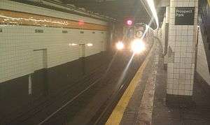
This underground station, opened on October 7, 1933, as part of an extension of the Culver Line from Bergen Street to Church Avenue.[3] It was added to the U.S. National Register of Historic Places on July 27, 2005,[2] It has two tracks and an island platform. The two express tracks of the line run under Prospect Park, and are neither visible from this station nor used in revenue service.
The station and tunnel were constructed about 100 feet (30 m) east of Prospect Park West. Therefore, the station is not located underneath a street, and some portions of the tunnel are directly underneath Prospect Park, while others are between the west side of the park and 10th Avenue.
Both trackside walls have an orange-yellow trim line with a medium brown border with small black and white "15TH ST." signs below it at regular intervals. This tile band is set in a three-high course, a pattern usually reserved for express stations. Large, white brick columns run along both sides of the platform and the mezzanine above at regular intervals with alternating ones having the standard black and white station name plate.
Entrances and exits
The narrow mezzanine is full length and allows out-of-system walking from one end to the other while the area inside fare control does not, having two sections, one considerably smaller than the other. The northern end has four exit stairs, the latter two of which have stone banisters:[4]
- one to the north side of the Bartel-Pritchard Square between 15th Street and Prospect Park[4]
- one on the corner of Prospect Park West and Prospect Park Southwest[4]
- one inside Prospect Park at Prospect Park West[4]
- one inside Prospect Park at Prospect Park Southwest[4]
The center of the mezzanine has one staircase going up to the north side of 16th Street while the south end has one staircase going up to the north side of Windsor Place near the intersection of Howard Place.[4] Full height turnstiles provide access to/from fare control near these three entrances/exits. The station's only token booth and bank of regular turnstiles is located between the south and center fare control areas. Evidence of at least two former booths exist.
-

Northeastern stair
-

Eastern stair
-

Southern stair, Windsor Place
In popular culture
Several dream sequences in the film Pi, which take place in an empty generic-looking New York City Subway station, were shot at 15th Street–Prospect Park. In some of the shots, the sign indicating the exit to Bartel-Pritchard Square is visible in the background.
References
- ↑ "Facts and Figures: Annual Subway Ridership". Metropolitan Transportation Authority. Retrieved 2016-04-19.
- 1 2 "NPS Focus". National Register of Historic Places. National Park Service. Retrieved November 6, 2011.
- ↑ New York Times, City Subway Extended, October 7, 1933, page 16
- 1 2 3 4 5 6 "MTA Neighborhood Maps: Park Slope/Prospect Park" (PDF). mta.info. Metropolitan Transportation Authority. 2015. Retrieved 2 August 2015.
External links
- nycsubway.org – IND Crosstown: 15th Street/Prospect Park
- Station Reporter — F Train
- The Subway Nut — 15th Street–Prospect Park Pictures
- Bartel Prichard Square entrance from Google Maps Street View
- 16th Street entrance from Google Maps Street View
- Windsor Place entrance from Google Maps Street View