14th Street (Manhattan)
|
14th Street looking west from Fifth Avenue | |
| Maintained by | NYCDOT |
|---|---|
| Length | 2.0 mi[1] (3.2 km) |
| Location | Manhattan, New York City |
| Postal code | 10014, 10011, 10003, 10009 |
| Coordinates | 40°44′09″N 73°59′34″W / 40.7357°N 73.9929°WCoordinates: 40°44′09″N 73°59′34″W / 40.7357°N 73.9929°W |
| West end |
|
| East end | Avenue C in East Village / Stuyvesant Town |
| North | 15th Street |
| South | 13th Street |
| Construction | |
| Commissioned | March 1811 |

14th Street is a major crosstown street in the New York City borough of Manhattan. Presently primarily a shopping street, in the earlier history of New York City 14th Street was an upscale location, but it lost its glamor and status as the city grew northward.
At Broadway, 14th Street forms the southern border of Union Square. It is also considered the northern boundary of Greenwich Village, Alphabet City, and the East Village, and the southern boundary of Chelsea, Flatiron/Lower Midtown, and Gramercy.
14th Street marks the southern terminus of Manhattan's grid system. North of 14th Street, the streets make up a near-perfect grid that runs in numerical order. South of 14th, the grid continues in the East Village almost perfectly, but not so in Greenwich Village, where an older and less uniform grid plan applies.
History
The street was designated by the Commissioners' Plan of 1811 as the southernmost of 15 east-west streets that would be 100 feet (30 m) in width (while other streets were designated as 60 feet (18 m) wide).[2]
Description
West 14th Street begins at an interchange with New York State Route 9A northeast of Greenwich Village.[3] At the end of the interchange, it intersects with 10th Avenue. The street continues east, intersecting with Washington Street, Ninth Avenue/Hudson Street, Eighth Avenue,[3] Seventh Avenue, Sixth Avenue, and Fifth Avenue. After Fifth Avenue, West 14th Street becomes East 14th Street and goes on to form the southern border of Union Square between University Place and Fourth Avenue. East of Fourth Avenue, 14th Street forms the southern end of Irving Place, a north-south road that terminates at Gramercy Park. 14th Street then intersects with Third Avenue, which forms the border between the neighborhoods of the East Village to the south and Gramercy to the north. The street goes on to intersect with Second Avenue, the location of the future 14th Street station in the unfunded Phase 3 of the Second Avenue Subway.[4] At First Avenue, 14th Street widens from a four-lane road to a six-lane divided boulevard with a westbound service road. It then intersects with the main thoroughfares of Alphabet City: Avenue A, Avenue B, and Avenue C, where the street terminates.
Public transportation
14th Street is well served by the New York City Subway. The BMT Canarsie Line runs underneath 14th Street from Eighth Avenue to the East River, stopping at First Avenue, Third Avenue, Union Square, Sixth Avenue, and Eighth Avenue. The line is served at all times by the L train. Additionally, every line that crosses 14th Street has a stop there:
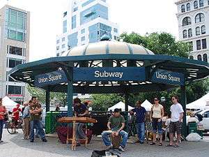
- 14th Street – Union Square on the BMT Canarsie Line, BMT Broadway Line, and IRT Lexington Avenue Line serving the 4 5 6 <6> L N Q R W trains
- 14th Street / Sixth Avenue on the IRT Broadway – Seventh Avenue Line, BMT Canarsie Line, and IND Sixth Avenue Line serving the 1 2 3 F L M trains
- 14th Street – Eighth Avenue on the BMT Canarsie Line and IND Eighth Avenue Line serving the A C E L trains
PATH also makes a stop at 14th Street at its intersection with Sixth Avenue.
Two New York City Bus routes serve the entire street, M14A, M14D.[5]
Points of interest
From west to east, points of interest include Hudson River Park, High Line, Union Square Park, and Immaculate Conception Roman Catholic Church.
See also
References
Notes
- ↑ Google (August 31, 2015). "14th Street (Manhattan)" (Map). Google Maps. Google. Retrieved August 31, 2015.
- ↑ Morris, Gouverneur, De Witt, Simeon, and Rutherford, John [sic] (March 1811) "Remarks Of The Commissioners For Laying Out Streets And Roads In The City Of New York, Under The Act Of April 3, 1807", Cornell University Library. Accessed June 27, 2016. "These streets are all sixty feet wide except fifteen, which are one hundred feet wide, viz.: Numbers fourteen, twenty-three, thirty-four, forty-two, fifty-seven, seventy-two, seventy-nine, eighty-six, ninety-six, one hundred and six, one hundred and sixteen, one hundred and twenty-five, one hundred and thirty-five, one hundred and forty-five, and one hundred and fifty-five--the block or space between them being in general about two hundred feet."
- 1 2 "14th Street - New York City" (HTML). Google Maps. Retrieved 2007-07-20.
- ↑ Second Avenue Subway Map, MTA's website
- ↑ Manhattan Bus Map
External links
| Wikimedia Commons has media related to 14th Street (Manhattan). |
- New York Songlines: 14th Street, a virtual walking tour