Union Hill, California
| Union Hill | |
|---|---|
| Former settlement | |
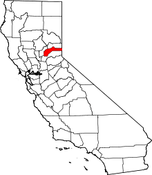
 Union Hill Location in California | |
| Coordinates: 39°12′20″N 121°02′15″W / 39.20556°N 121.03750°WCoordinates: 39°12′20″N 121°02′15″W / 39.20556°N 121.03750°W | |
| Country |
|
| State |
|
| County | Nevada County |
| Elevation[1] | 2,700 ft (823 m) |
| Time zone | Pacific (PST) (UTC-8) |
| • Summer (DST) | PDT (UTC-7) |
Union Hill is a former settlement in Nevada County, California, 1.5 mi (2.4 km) from Grass Valley.[2] Its elevation is 2,700 ft (820 m) above sea level.[1]
The Union Hill School District, established in 1868, continues to operate in Grass Valley.
History
Travelers could reach Union Hill via the Nevada County Narrow Gauge Railroad.[3] Its station was located south of Grass Valley and north of Colfax.[4]
References
- 1 2 U.S. Geological Survey Geographic Names Information System: Union Hill, California
- ↑ Durham, David L. (1998). California's Geographic Names: A Gazetteer of Historic and Modern Names of the State. Quill Driver Books. p. 571. ISBN 1-884995-14-4.
- ↑ Preston, E. M. (1886). Nevada County, the famous Bartlett pear belt of California. Digitized Aug 29, 2008. Nevada County Land and Improvement Association. Brown & Calkins, Printers. p. 51.
- ↑ Shearer, Frederick E. (1882). The Pacific Tourist: J.R. Bowman's Illustrated Transcontinental Guide of Travel, from the Atlantic to the Pacific Ocean (Digitized Jan 30, 2008 ed.). J.R. Bowman. p. 253.
This article is issued from Wikipedia - version of the 10/29/2016. The text is available under the Creative Commons Attribution/Share Alike but additional terms may apply for the media files.