Graniteville, California
| Graniteville | |
|---|---|
| census-designated place & unincorporated community | |
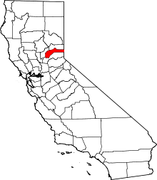
 Graniteville Location of Graniteville in California | |
| Coordinates: 39°26′27″N 120°44′23″W / 39.44083°N 120.73972°WCoordinates: 39°26′27″N 120°44′23″W / 39.44083°N 120.73972°W | |
| Country |
|
| State |
|
| County | Nevada |
| Area[1] | |
| • Total | 1.488 sq mi (3.853 km2) |
| • Land | 1.488 sq mi (3.853 km2) |
| • Water | 0 sq mi (0 km2) 0% |
| Elevation[2] | 4,977 ft (1,517 m) |
| Population (2010) | |
| • Total | 11 |
| • Density | 7.4/sq mi (2.9/km2) |
| Time zone | Pacific (PST) (UTC-8) |
| • Summer (DST) | PDT (UTC-7) |
| ZIP code | 95959 |
| Area code(s) | 530 |
| FIPS code | 06-06057 |
| GNIS feature ID | 1658648[2] |
| [3] | |
Graniteville (previously: Eureka South) is a small, unincorporated community and census-designated place (CDP) located in Nevada County, California, United States. The town is located on a ridge separating the Middle and South Fork of the Yuba River, 23 miles (37.0 km) northeast of Grass Valley.[4] There are no paved roads that lead to Graniteville, and the roads are not snowplowed in the winter.[5]
In 2010, the population was 11.[6] The winter population drops to 5.
History
The town was called "Eureka South" during the California Gold Rush.[4] A post office operated in town from 1867 to 1959.[4]
Geography
Graniteville is located at 39°26′27″N 120°44′23″W / 39.44083°N 120.73972°W (39.440732 -120.739662),[2] about 26 miles (42 km) east of Nevada City.[5] The elevation of Graniteville is 4,977 feet (1,517 m) above sea level.
According to the United States Census Bureau, the CDP covers an area of 1.5 square miles (3.8 km²), all of it land.
Demographics
The 2010 United States Census[7] reported that Graniteville had a population of 11. The population density was 7.4 people per square mile (2.9/km²). The racial makeup of Graniteville was 11 (100.0%) White. Hispanic or Latino of any race were 0 persons (0.0%).
The Census reported that 11 people (100% of the population) lived in households, 0 (0%) lived in non-institutionalized group quarters, and 0 (0%) were institutionalized.
There were 8 households, out of which 0 (0%) had children under the age of 18 living in them, 2 (25.0%) were opposite-sex married couples living together, 0 (0%) had a female householder with no husband present, 0 (0%) had a male householder with no wife present. There were 1 (12.5%) unmarried opposite-sex partnerships, and 0 (0%) same-sex married couples or partnerships. 5 households (62.5%) were made up of individuals and 4 (50.0%) had someone living alone who was 65 years of age or older. The average household size was 1.38. There were 2 families (25.0% of all households); the average family size was 2.00.
The population was spread out with 0 people (0%) under the age of 18, 0 people (0%) aged 18 to 24, 0 people (0%) aged 25 to 44, 3 people (27.3%) aged 45 to 64, and 8 people (72.7%) who were 65 years of age or older. The median age was 78.3 years. For every 100 females there were 266.7 males. For every 100 females age 18 and over, there were 266.7 males.
There were 36 housing units at an average density of 24.2 per square mile (9.3/km²), of which 7 (87.5%) were owner-occupied, and 1 (12.5%) were occupied by renters. The homeowner vacancy rate was 0%; the rental vacancy rate was 0%. 10 people (90.9% of the population) lived in owner-occupied housing units and 1 people (9.1%) lived in rental housing units.
Politics
In the state legislature, Graniteville is in the 1st Senate District, represented by Republican Ted Gaines,[8] and the 1st Assembly District, represented by Republican Brian Dahle.[9]
Federally, Graniteville is in California's 1st congressional district, represented by Republican Doug LaMalfa.[10]
References
- ↑ U.S. Census
- 1 2 3 U.S. Geological Survey Geographic Names Information System: Graniteville, California. Retrieved on 2008-05-29.
- ↑ "ZIP Code Lookup". Retrieved 2008-06-09.
- 1 2 3 Durham, David L. (1998). California's Geographic Names: A Gazetteer of Historic and Modern Names of the State. Clovis, Calif.: Word Dancer Press. p. 493. ISBN 1-884995-14-4.
- 1 2 Laura Brown. "A different way of life, The Union (Grass Valley), January 6, 2008. Retrieved on 2008-05-29.
- ↑ "Census 2010: Table 3A — Total Population by Race (Hispanic exclusive) and Hispanic or Latino: 2010" (Excel). California Department of Finance. Retrieved March 22, 2010.
- ↑ "2010 Census Interactive Population Search: CA - Graniteville CDP". U.S. Census Bureau. Retrieved July 12, 2014.
- ↑ "Senators". State of California. Retrieved March 10, 2013.
- ↑ "Members Assembly". State of California. Retrieved March 2, 2013.
- ↑ "California's 1st Congressional District - Representatives & District Map". Civic Impulse, LLC. Retrieved March 2, 2013.