Zgornje Poljčane
| Zgornje Poljčane | |
|---|---|
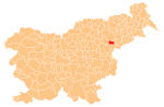
 Zgornje Poljčane Location in Slovenia | |
| Coordinates: 46°18′9.73″N 15°35′0.72″E / 46.3027028°N 15.5835333°ECoordinates: 46°18′9.73″N 15°35′0.72″E / 46.3027028°N 15.5835333°E | |
| Country |
|
| Traditional region | Styria |
| Statistical region | Drava |
| Municipality | Poljčane |
| Area | |
| • Total | 4.14 km2 (1.60 sq mi) |
| Elevation | 276 m (906 ft) |
| Population (2002) | |
| • Total | 815 |
| [1] | |
Zgornje Poljčane (pronounced [ˈzɡoːɾnjɛ pɔlˈtʃaːnɛ]) is a settlement in the Municipality of Poljčane in northeastern Slovenia. It lies at the foothills of Mount Boč on the right bank of the Dravinja River. The area is part of the traditional region of Styria. It is now included with the rest of the municipality in the Drava Statistical Region.[2]
Name
The name of the settlement was changed from Poljčane to Zgornje Poljčane in 1957.[3]
Church
The parish church in the settlement is dedicated to the Holy Cross and belongs to the Roman Catholic Archdiocese of Maribor. It is a Romanesque building dating to the late 12th century. It has a Gothic belfry. In 1895 the church was extended and re-orientated with a complete new nave added. The sanctuary of the original church was converted to a side chapel.[4]
References
- ↑ Statistical Office of the Republic of Slovenia Archived November 18, 2008, at the Wayback Machine.
- ↑ Poljčane municipal site
- ↑ Spremembe naselij 1948–95. 1996. Database. Ljubljana: Geografski inštitut ZRC SAZU, DZS.
- ↑ Slovenian Ministry of Culture register of national heritage Archived July 12, 2010, at the Wayback Machine. reference number ešd 3264
External links
| Settlements | Administrative centre: Poljčane
|  | ||||||
|---|---|---|---|---|---|---|---|---|
| Landmarks |
| |||||||