Lovnik
| Lovnik | |
|---|---|
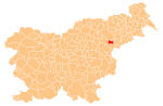
 Lovnik Location in Slovenia | |
| Coordinates: 46°16′40.46″N 15°33′30.08″E / 46.2779056°N 15.5583556°ECoordinates: 46°16′40.46″N 15°33′30.08″E / 46.2779056°N 15.5583556°E | |
| Country |
|
| Traditional region | Styria |
| Statistical region | Drava |
| Municipality | Poljčane |
| Area | |
| • Total | 1.73 km2 (0.67 sq mi) |
| Elevation | 347.8 m (1,141.1 ft) |
| Population (2002) | |
| • Total | 36 |
| [1] | |
Lovnik (pronounced [ˈloːu̯nik]) is a small settlement on the western slopes of Mount Boč in the Municipality of Poljčane in northeastern Slovenia. The area is part of the traditional region of Styria. It is now included with the rest of the municipality in the Drava Statistical Region.[2]
References
External links
| Settlements | Administrative centre: Poljčane
|  | ||||||
|---|---|---|---|---|---|---|---|---|
| Landmarks |
| |||||||
This article is issued from Wikipedia - version of the 6/27/2016. The text is available under the Creative Commons Attribution/Share Alike but additional terms may apply for the media files.