Zapotitlán Tablas (municipality)
| Zapotitlán Tablas | |
|---|---|
| Municipality | |
|
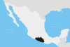
Zapotitlán Tablas Location in Mexico | |
| Coordinates: 16°59′N 98°45′W / 16.983°N 98.750°WCoordinates: 16°59′N 98°45′W / 16.983°N 98.750°W | |
| Country |
|
| State | Guerrero |
| Municipal seat | Zapotitlán Tablas |
| Area | |
| • Total | 820.9 km2 (317.0 sq mi) |
| Population (2005) | |
| • Total | 9,601 |
Zapotitlán Tablas is one of the 81 municipalities of Guerrero, in south-western Mexico. The municipal seat lies at Zapotitlán Tablas. The municipality covers an area of 820.9 km².
In 2005, the municipality had a total population of 9,601.[1]
References
- ↑ "Zapotitlán Tablas". Enciclopedia de los Municipios de México. Instituto Nacional para el Federalismo y el Desarrollo Municipal. Retrieved December 23, 2008.
This article is issued from Wikipedia - version of the 7/28/2015. The text is available under the Creative Commons Attribution/Share Alike but additional terms may apply for the media files.