Zumpango del Río
| Zumpango del Río | |
|---|---|
| Municipal seat and city | |
 | |
| Nickname(s): Xumpango | |
|
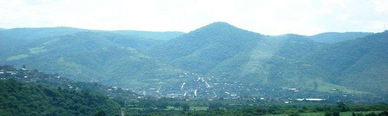
Zumpango del Río Location in Mexico | |
| Coordinates: 17°39′N 99°30′W / 17.650°N 99.500°WCoordinates: 17°39′N 99°30′W / 17.650°N 99.500°W | |
| Country |
|
| State | Guerrero |
| Municipality | Eduardo Neri |
| Region | Sierra Madre del Sur |
| Elevation | 1,912 m (6,273 ft) |
| Population (2010) | |
| • Total | 24,719 |
Zumpango del Río is the capital of Eduardo Neri Municipality, within the state of Guerrero, in central−western Mexico.
The Spanish discovered silver lodes here in 1531, which started commercial silver mining in the area. Francisco de Hoyos and Juan Juan Jaramillo made the discovery when returning from a military expedition to Guerrero. Using Indian slave labor until the ban from doing so was enforced in 1550, the resultant mines produced 1000 pounds of silver by 1539. Prominent mine owners included Juan de Burgos and Hernan Cortes. Most of the mines were abandoned by 1582 however.[1]
Geography
The city is located in the Sierra Madre del Sur, at an altitude of 1,092 meters (3,583 feet).
It is on Mexican Federal Highway 95 (Mexico City-Acapulco Highway), about 8 miles (13 km) northeast of the Guerrero state capital city of Chilpancingo [2]
Climate
| Climate data for Zumpango del Río (1951–2010) | |||||||||||||
|---|---|---|---|---|---|---|---|---|---|---|---|---|---|
| Month | Jan | Feb | Mar | Apr | May | Jun | Jul | Aug | Sep | Oct | Nov | Dec | Year |
| Record high °C (°F) | 34.0 (93.2) |
37.0 (98.6) |
40.0 (104) |
42.0 (107.6) |
44.0 (111.2) |
42.0 (107.6) |
41.0 (105.8) |
41.0 (105.8) |
36.0 (96.8) |
36.0 (96.8) |
39.0 (102.2) |
35.0 (95) |
44.0 (111.2) |
| Average high °C (°F) | 29.1 (84.4) |
30.9 (87.6) |
33.5 (92.3) |
35.2 (95.4) |
34.9 (94.8) |
32.7 (90.9) |
31.6 (88.9) |
31.3 (88.3) |
30.2 (86.4) |
30.3 (86.5) |
29.7 (85.5) |
28.7 (83.7) |
31.5 (88.7) |
| Daily mean °C (°F) | 21.6 (70.9) |
23.1 (73.6) |
25.6 (78.1) |
27.3 (81.1) |
27.5 (81.5) |
26.1 (79) |
25.2 (77.4) |
25.0 (77) |
24.3 (75.7) |
24.0 (75.2) |
22.5 (72.5) |
21.3 (70.3) |
24.5 (76.1) |
| Average low °C (°F) | 14.2 (57.6) |
15.3 (59.5) |
17.7 (63.9) |
19.3 (66.7) |
20.0 (68) |
19.4 (66.9) |
18.7 (65.7) |
18.7 (65.7) |
18.5 (65.3) |
17.7 (63.9) |
15.3 (59.5) |
13.9 (57) |
17.4 (63.3) |
| Record low °C (°F) | 1.0 (33.8) |
8.0 (46.4) |
11.0 (51.8) |
13.0 (55.4) |
14.0 (57.2) |
10.0 (50) |
11.0 (51.8) |
10.0 (50) |
14.0 (57.2) |
12.0 (53.6) |
7.0 (44.6) |
2.0 (35.6) |
1.0 (33.8) |
| Average precipitation mm (inches) | 11.6 (0.457) |
5.7 (0.224) |
3.7 (0.146) |
7.4 (0.291) |
37.4 (1.472) |
126.7 (4.988) |
143.3 (5.642) |
138.4 (5.449) |
137.3 (5.406) |
54.9 (2.161) |
25.2 (0.992) |
14.8 (0.583) |
706.4 (27.811) |
| Average precipitation days (≥ 0.1 mm) | 1.2 | 0.6 | 0.6 | 0.9 | 3.9 | 12.5 | 15.5 | 15.3 | 15.6 | 6.2 | 2.0 | 1.5 | 75.8 |
| Source: Servicio Meteorologico Nacional[3][4] | |||||||||||||
See also
- Populated places in Guerrero
| Wikimedia Commons has media related to Zumpango del Río, Guerrero. |
References
- ↑ West,Robert. Early Silver Mining in New Spain, 1531-1555 (1997). Bakewell, Peter, ed. Mines of Silver and Gold in the Americas. Aldershot: Variorum, Ashgate Publishing Limited. pp. 57,60–61.
- ↑ Instituto Nacional de Estadística y Geografía. Principales resultados por localidad 2005 (ITER). Retrieved on December 23, 2008
- ↑ "Estado de Guerrero-Estacion: Zumpango del Río". Normales Climatologicas 1951–2010 (in Spanish). Servicio Meteorologico Nacional. Retrieved 30 April 2015.
- ↑ "Extreme Temperatures and Precipitation for Zumpango del Río 1961–2010" (in Spanish). Servicio Meteorológico Nacional. Retrieved 30 April 2015.