Yaak, Montana
| Yaak, Montana | |
|---|---|
| Census-designated place & Unincorporated community | |
 Yaak, Montana  Yaak, Montana | |
| Coordinates: 48°49′59″N 115°42′32″W / 48.83306°N 115.70889°WCoordinates: 48°49′59″N 115°42′32″W / 48.83306°N 115.70889°W | |
| Country | United States |
| State | Montana |
| County | Lincoln |
| Area[1] | |
| • Total | 28.122 sq mi (72.84 km2) |
| • Land | 27.846 sq mi (72.12 km2) |
| • Water | 0.276 sq mi (0.71 km2) |
| Elevation | 2,986 ft (910 m) |
| Population (2010)[2] | |
| • Total | 248 |
| • Density | 8.8/sq mi (3.4/km2) |
| Time zone | Mountain (MST) (UTC-7) |
| • Summer (DST) | MDT (UTC-6) |
| Area code(s) | 406 |
| GNIS feature ID | 778715[3] |
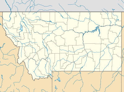
Yaak is an unincorporated community and census-designated place in Lincoln County, Montana,[3] United States. It is located along the Yaak River, within the Kootenai National Forest. As of the 2010 census, its population was 248.[2]
It has frequently been noted on lists of unusual place names.[4]
Climate
This climatic region is typified by large seasonal temperature differences, with warm to hot (and often humid) summers and cold (sometimes severely cold) winters. According to the Köppen Climate Classification system, Yaak has a humid continental climate, abbreviated "Dfb" on climate maps.[5]
References
- ↑ "US Gazetteer files: 2010, 2000, and 1990". United States Census Bureau. 2011-02-12. Retrieved 2011-04-23.
- 1 2 "American FactFinder". United States Census Bureau. Retrieved 2011-05-14.
- 1 2 "Yaak". Geographic Names Information System. United States Geological Survey.
- ↑ Parker, Quentin (2010). Welcome to Horneytown, North Carolina, Population: 15: An insider's guide to 201 of the world's weirdest and wildest places. Adams Media. pp. xii.
- ↑ Climate Summary for Yaak, Montana
External links
Municipalities and communities of Lincoln County, Montana, United States | ||
|---|---|---|
| Cities | 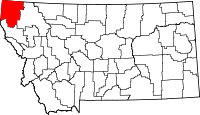 | |
| Towns | ||
| CDPs | ||
| Unincorporated communities | ||
This article is issued from Wikipedia - version of the 10/9/2016. The text is available under the Creative Commons Attribution/Share Alike but additional terms may apply for the media files.