Wyalkatchem, Western Australia
| Wyalkatchem Western Australia | |
|---|---|
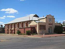 Wyalkatchem Town Hall, 2013 | |
 Wyalkatchem | |
| Coordinates | 31°11′00″S 117°23′00″E / 31.18333°S 117.38333°ECoordinates: 31°11′00″S 117°23′00″E / 31.18333°S 117.38333°E |
| Population | 344 (2006 census)[1] |
| Established | 1910s |
| Postcode(s) | 6485 |
| Location | |
| LGA(s) | Shire of Wyalkatchem |
| State electorate(s) | Central Wheatbelt |
| Federal Division(s) | Durack |
Wyalkatchem townsite is located in the central agricultural region, 192 kilometres (119 mi) east-north-east of Perth and 35 kilometres (22 mi) east of Dowerin. At the 2006 census, Wyalkatchem had a population of 344.[1]
The town won the state tidy town award in 2000 and 2002 and then won the national award in 2003.[2]
History
Wyalkatchem is an Aboriginal name first recorded for a waterhole spelt Walkatching in the 1870s. The spelling Walcatching was used in 1881 when the Toodyay Road Board referred to a tank to be built there, and when the road from Northam to the Yilgarn Goldfield was surveyed in 1892 the spelling Wyalcatchem was used for the tank. The Walkatching spelling is probably the most accurate, as Aboriginal names in this region rarely end in em. The change of spelling from Wyalcatchem to Wyalkatchem in 1911 was done by the Department of Lands & Surveys according to rules the Department had adopted for spelling Aboriginal names. The meaning of the name is not known.[3]
In 1932 the Wheat Pool of Western Australia announced that the town would have two grain elevators, each fitted with an engine, installed at the railway siding.[4]
When the extension of the railway east from Dowerin was planned in 1908 land was set aside for a future townsite in the area of Wyalcatchem Tank. The route of the railway and site for a station was not fixed until 1910, and action followed to then fix the position of the townsite and survey town lots. Following the survey of the lots the townsite was gazetted spelt Wyalkatchem in 1911.
When the railway from Dowerin opened in February 1911, Wyalkatchem was a minor siding only, but its importance grew when it was selected as the turnout point for a branch line leading north and then east to the Mount Marshall district. Thus a small village quickly blossomed on the town site. The branch line to Bencubbin opened on 1 February 1915 and the line from Dowerin was extended to Merredin in August, 1911.[5]
A bioblitz was conducted in 2012 in a bush reserve between Korrelocking and Wyalkatchem. 54 people took part and collected samples of scorpions, pseudoscoprions, isopods, spiders and centipedes, including some new species.[6][7]
Commercial area
The extensive railway barracks in town are leased by the shire council from the Western Australian Governments Railway Commission. The barracks represent one of the few intact examples of its kind in Australia and are currently used as accommodation during Dowerin Field Days and as the headquarters of a hang-gliding club.[8]
Home to a Cooperative Bulk Handling receival point that can hold nearly 120,000 tonnes of grain and crops, the primary industry in the area are wheat and sheep farming. The town also supports a gypsum mine that is situated just outside town at Lake Cowcowing.[9]
In 2013 Wyalkatchem hosted the inaugural Racewars event, organised by The Racewars Group. The event saw 200 competitors and over 3000 spectators witness some of Western Australia's fastest vehicles race head-to-head and against the clock on the 1500m airstrip at the Wyalkatchem airport. After the success of the inaugural event, Wyalkatchem has agreed to host the event for another 5 years.
Climate
| Climate data for Wyalkatchem | |||||||||||||
|---|---|---|---|---|---|---|---|---|---|---|---|---|---|
| Month | Jan | Feb | Mar | Apr | May | Jun | Jul | Aug | Sep | Oct | Nov | Dec | Year |
| Record high °C (°F) | 44.0 (111.2) |
43.8 (110.8) |
41.1 (106) |
38.2 (100.8) |
33.4 (92.1) |
25.4 (77.7) |
24.2 (75.6) |
25.9 (78.6) |
34.4 (93.9) |
39.9 (103.8) |
41.3 (106.3) |
43.6 (110.5) |
44.0 (111.2) |
| Average high °C (°F) | 33.9 (93) |
33.3 (91.9) |
29.6 (85.3) |
24.4 (75.9) |
20.2 (68.4) |
17.0 (62.6) |
16.0 (60.8) |
16.7 (62.1) |
19.7 (67.5) |
24.3 (75.7) |
28.3 (82.9) |
32.4 (90.3) |
24.6 (76.3) |
| Average low °C (°F) | 17.7 (63.9) |
17.9 (64.2) |
15.8 (60.4) |
12.9 (55.2) |
9.5 (49.1) |
8.0 (46.4) |
6.7 (44.1) |
6.1 (43) |
7.1 (44.8) |
9.8 (49.6) |
12.6 (54.7) |
15.9 (60.6) |
11.7 (53.1) |
| Record low °C (°F) | 9.3 (48.7) |
9.0 (48.2) |
5.9 (42.6) |
3.3 (37.9) |
0.9 (33.6) |
0.8 (33.4) |
−1.2 (29.8) |
−1.1 (30) |
0.8 (33.4) |
0.7 (33.3) |
3.6 (38.5) |
7.0 (44.6) |
−1.2 (29.8) |
| Average precipitation mm (inches) | 17.2 (0.677) |
16.8 (0.661) |
18.7 (0.736) |
23.1 (0.909) |
41.5 (1.634) |
54.1 (2.13) |
52.9 (2.083) |
40.1 (1.579) |
23.9 (0.941) |
17.1 (0.673) |
11.3 (0.445) |
10.3 (0.406) |
327.8 (12.906) |
| Average precipitation days | 2.2 | 2.2 | 2.8 | 4.4 | 7.9 | 11.1 | 12.1 | 10.7 | 7.5 | 4.9 | 3.0 | 2.0 | 70.8 |
| Source: [10] | |||||||||||||
References
- 1 2 Australian Bureau of Statistics (25 October 2007). "Wyalkatchem (L) (Urban Centre/Locality)". 2006 Census QuickStats. Retrieved 25 July 2011.
- ↑ "Wyalkatchem is Australia's Tidiest Town". 2003. Retrieved 2011-02-05.
- ↑ Western Australian Land Information Authority. "History of country town names – W". Retrieved 25 March 2007.
- ↑ "Country elevators". The West Australian. Perth: National Library of Australia. 6 July 1932. p. 10. Retrieved 6 April 2013.
- ↑ All Change at Wyalkatchem Milne, Rod Australian Railway Historical Society Bulletin, July 1991 pp 155–162
- ↑ "2012 BioBlitz at Korrelocking". Bennelongia. 26 September 2012. Retrieved 16 September 2016.
- ↑ "Wheatbelt Bioblitz discovers unique species". Australian Broadcasting Corporation. 27 September 2012. Retrieved 16 September 2016.
- ↑ "Wheatbelt – Heritage update" (PDF). 2003. Retrieved 2011-02-05.
- ↑ "Gypsum Industries". 2010. Retrieved 5 February 2011.
- ↑ "Climate statistics for Wyalkatchem". Bureau of Meteorology. Retrieved 12 July 2014.
External links
![]() Media related to Wyalkatchem, Western Australia at Wikimedia Commons
Media related to Wyalkatchem, Western Australia at Wikimedia Commons