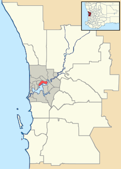
Bailup, Western Australia
Bailup is a Western Australian locality and rural residential estate located 62 kilometres (39 mi) north-east of the state capital, Perth, along Toodyay Road. The area is split between the Shire of Toodyay and Shire of Mundaring, the latter of which contains most of the land area.
History
Bailup was named after a nearby creek and a police station and inn established on Toodyay Road in the 1840s. The name is of Noongar origin but its meaning is unclear.[1] The name was approved in early 1999 by the Department of Land Administration.[2]
Description
Most of the locality is covered in open Jarrah, marri and wandoo woodland, with some areas of dense understorey vegetation. Nearby Morangup Hill (31°39′31″S 116°18′55″E / 31.65861°S 116.31528°E), the main feature of a reserve managed by the Department of Environment and Conservation (DEC) on the edge of the Avon Valley National Park, is a granite peak providing extensive views over the surrounding area and is home to several species of birds including the square-tailed kite.[3] The Red Swamp Brook, which runs through Bailup, feeds a significant wetland area.
Morangup Estate, the main residential area, is located just to the north of Toodyay Road on the east bank of the Red Swamp Brook, and contains about 200 residents and a small commercial centre. Some hobby farms have been established on nearby cleared land. Plans to build a new estate 2 km south within the Mundaring boundary were submitted in 2004, with Mundaring council approving the rezoning at its June meeting.[4]
Transport
The main road route through the area is Toodyay Road (State Route 50). Bailup Road links Bailup to Wooroloo further south.[5] No public transport is available.
References
- ↑ Western Australian Land Information Authority. "History of metropolitan suburb names – B". Retrieved 9 June 2007.
- ↑ Department of Land Administration (January–March 1999). "Geographic name approvals in Western Australia". 15 (1). ISSN 0817-265X.
- ↑ Birds Australia WA (Inc) (November 2005). "Birds Around Northam (Number 17A)" (PDF). Archived (PDF) from the original on 11 October 2006. Retrieved 13 November 2006.
- ↑ Shire of Mundaring (Development Approvals Committee) (8 June 2004). "Item 4.8 - Toodyay Road (No 3650 Lot 7) Bailup - Rezoning" (PDF). Archived from the original (PDF) on 24 August 2006. Retrieved 13 November 2006.
- ↑ Department of Land Information. StreetSmart® Perth Street Directory (54 (2013) ed.). West Australian Newspapers Ltd. pp. Maps S4–S5 (overview). ISBN 978-0-909439-67-5.
Further reading
- Elliot, Ian (1983). Mundaring - A History of the Shire (2nd ed.). Mundaring: Mundaring Shire. ISBN 0-9592776-0-9.
- Spillman, Ken (2003). Life was meant to be here: community and local government in the Shire of Mundaring. Mundaring: Mundaring Shire. ISBN 0-9592776-3-3.
External links
- Mundaring and Hills Historical Society Website
- Photos of Morangup Hill area (CSIRO)
- Gidgegannup Progress Association
- Bailup on Geoscience Australia
