Woodville Township, Greene County, Illinois
| Woodville Township | |
|---|---|
| Township | |
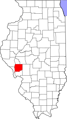
 Location in Greene County | |
 Greene County's location in Illinois | |
| Coordinates: 39°12′26″N 90°31′42″W / 39.20722°N 90.52833°WCoordinates: 39°12′26″N 90°31′42″W / 39.20722°N 90.52833°W | |
| Country | United States |
| State | Illinois |
| County | Greene |
| Established | November 4, 1884 |
| Area | |
| • Total | 48.24 sq mi (124.9 km2) |
| • Land | 47.41 sq mi (122.8 km2) |
| • Water | 0.83 sq mi (2.1 km2) 1.72% |
| Elevation | 459 ft (140 m) |
| Population (2010) | |
| • Total | 239 |
| • Density | 5/sq mi (2/km2) |
| Time zone | CST (UTC-6) |
| • Summer (DST) | CDT (UTC-5) |
| ZIP codes | 62016, 62027 |
| GNIS feature ID | 0429956 |
Woodville Township is one of thirteen townships in Greene County, Illinois, USA. As of the 2010 census, its population was 239 and it contained 128 housing units.[1]
Geography
According to the 2010 census, the township has a total area of 48.24 square miles (124.9 km2), of which 47.41 square miles (122.8 km2) (or 98.28%) is land and 0.83 square miles (2.1 km2) (or 1.72%) is water.[1]
Unincorporated towns
- Clark at 39°15′35″N 90°34′40″W / 39.25977°N 90.577899°W
- East Hardin at 39°09′36″N 90°36′32″W / 39.160048°N 90.609010°W
- King at 39°13′51″N 90°34′44″W / 39.230881°N 90.579010°W
- Titus at 39°11′36″N 90°34′43″W / 39.193381°N 90.578732°W
(This list is based on USGS data and may include former settlements.)
Cemeteries
The township contains these eleven cemeteries: Borlin, Busch, Clark, Cumming, Dayton, Fry, Maberry, Mills, Mount Gilead, Reynolds and Varble.
Major highways
-
 Illinois Route 16
 - Woody Road
Rivers
School districts
- Calhoun Community Unit School District 40
- Carrollton Community Unit School District 1
Political districts
- Illinois' 17th congressional district
- State House District 97
- State Senate District 49
References
- "Woodville Township, Greene County, Illinois". Geographic Names Information System. United States Geological Survey. Retrieved 2010-01-17.
- United States Census Bureau 2007 TIGER/Line Shapefiles
- United States National Atlas
- 1 2 "Population, Housing Units, Area, and Density: 2010 - County -- County Subdivision and Place -- 2010 Census Summary File 1". United States Census. Retrieved 2013-05-28.
External links
 |
Bluffdale Township | Carrollton Township | | |
| |
Kane Township | |||
| ||||
| | ||||
| Richwood Township, Jersey County |
Municipalities and communities of Greene County, Illinois, United States | ||
|---|---|---|
| Cities | ||
| Villages | ||
| Townships | ||
| Unincorporated communities | ||
This article is issued from Wikipedia - version of the 12/1/2013. The text is available under the Creative Commons Attribution/Share Alike but additional terms may apply for the media files.