Wisconsin Highway 108
| ||||
|---|---|---|---|---|
| Route information | ||||
| Maintained by WisDOT | ||||
| Length: | 19.08 mi[1] (30.71 km) | |||
| Major junctions | ||||
| South end: |
| |||
| North end: |
| |||
| Location | ||||
| Counties: | La Crosse, Jackson | |||
| Highway system | ||||
| ||||

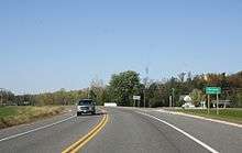
State Trunk Highway 108 (often called Highway 108, STH 108 or WIS 108) is a state highway in the U.S. state of Wisconsin. It runs in west central Wisconsin from Wisconsin Highway 16 north of West Salem to Wisconsin Highway 54 and Wisconsin Highway 71 in Melrose. The highway also serves Mindoro and Burr Oak and passes through the Mindoro Cut south of Mindoro. Highway 108 is maintained by the Wisconsin Department of Transportation.
Route description
Highway 108 begins at a junction with Highway 16 in the Town of Hamilton in La Crosse County, just north of the border of West Salem. The highway heads northeast along a brief concurrency with County Highway C, then runs west for a short distance before heading north. From here, the route passes through a rural area and climbs the Phillips Ridge. This section of the route has been called "ski-jump steep and centerfold curvy, often at the same time" and "a road to be driven – enjoyed, that is – in the classic sense" by Milwaukee Journal Sentinel travel writer Dennis McCann.[2]

Atop the ridge, the highway passes through the Mindoro Cut, a hand-constructed cut in the ridge. The cut was completed in 1908, and is the second-deepest hand-built cut in the Western Hemisphere as well as the oldest such cut still in its original state.[3] It has been placed on both the National Register of Historic Places and the Wisconsin State Register of Historic Places.[4][3] Past the cut, Highway 108 twists down the ridge and continues through the Town of Farmington toward Mindoro.[5][6]
In Mindoro, Highway 108 intersects two county highways and passes the Farmington Town Hall. After crossing the creek, the highway briefly follows County Highway T eastward before curving to the north. It turns northeast to pass through Burr Oak, then crosses another creek before entering Jackson County.[5] In Jackson County, the route passes Melrose-Mindoro High School before heading north through the Town of Melrose. Highway 108 meets Highway 71 in the town, and the two highways continue northward together. The highways cross the Black River and continue north into the village of Melrose. Both highways terminate at a junction with Highway 54 in southern Melrose.[6][7]
Major intersections
| County | Location | mi[6] | km | Destinations | Notes |
|---|---|---|---|---|---|
| La Crosse | Town of Hamilton | 0.0 | 0.0 | Southern terminus | |
| Jackson | Town of Melrose | 17.8 | 28.6 | ||
| Melrose | 19.2 | 30.9 | Northern terminus | ||
1.000 mi = 1.609 km; 1.000 km = 0.621 mi
| |||||
References
| Wikimedia Commons has media related to Wisconsin Highway 108. |
- ↑ Bessert, Chris. "Wisconsin Highways: Highways 100-109 (Highway 108)". Wisconsin Highways. Retrieved 2007-03-20.
- ↑ McCann, Dennis (December 24, 2006). "Gash in rock now a driver's dream". Milwaukee Journal Sentinel. Archived from the original on December 22, 2011. Retrieved December 22, 2011.
- 1 2 Bissen, Adam (December 3, 2006). "This Cut is Second-Deepest - The Gap Cut in Rock on Highway 108 Near Mindoro is Newly Recognized as a Historic Landmark". Wisconsin State Journal.
- ↑ National Park Service (2008-04-15). "National Register Information System". National Register of Historic Places. National Park Service.
- 1 2 La Crosse County (PDF) (Map). Wisconsin Department of Transportation. 2011. Retrieved December 23, 2011.
- 1 2 3 Google (December 23, 2011). "Overview map of Highway 108" (Map). Google Maps. Google. Retrieved December 23, 2011.
- ↑ Jackson County (PDF) (Map). Wisconsin Department of Transportation. 2011. Retrieved December 23, 2011.