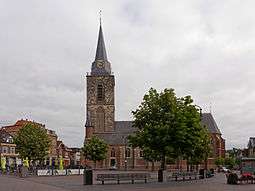
Winterswijk
| Winterswijk | |||
|---|---|---|---|
| Municipality | |||
|
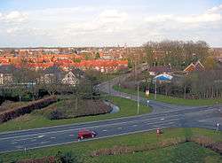
Winterswijk seen from Venemansmolen windmill | |||
| |||
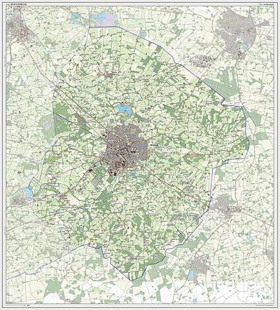
.svg.png) Location in Gelderland | |||
| Coordinates: 51°58′N 6°43′E / 51.967°N 6.717°ECoordinates: 51°58′N 6°43′E / 51.967°N 6.717°E | |||
| Country | Netherlands | ||
| Province | Gelderland | ||
| Government[1] | |||
| • Body | Municipal council | ||
| • Mayor | Thijs van Beem (PvdA) | ||
| Area[2] | |||
| • Total | 138.81 km2 (53.59 sq mi) | ||
| • Land | 138.15 km2 (53.34 sq mi) | ||
| • Water | 0.66 km2 (0.25 sq mi) | ||
| Elevation[3] | 37 m (121 ft) | ||
| Population (May 2014)[4] | |||
| • Total | 28,932 | ||
| • Density | 209/km2 (540/sq mi) | ||
| Demonym(s) | Winterswijker | ||
| Time zone | CET (UTC+1) | ||
| • Summer (DST) | CEST (UTC+2) | ||
| Postcode | 7100–7119 | ||
| Area code | 0543 | ||
| Website |
www | ||


_op_de_achtergrond_foto5_2015-05-14_08.54.jpg)

Winterswijk (![]() pronunciation ) is a municipality and a town in the eastern Netherlands.
pronunciation ) is a municipality and a town in the eastern Netherlands.
Winterswijk (Winterswiek, Wenters) is a town with a population of 28,932 in the Achterhoek which lies in the most eastern part of the province of Gelderland in the Netherlands. It was also known as Winethereswick, Winriswic or Wenterswic. Wic or the Anglo Saxon wich means the living place of a certain person. The person would likely have been called Wenether, Winitar or Winter.
Topography
History
Founded around 1000 AD it remained an isolated farming community until 1830 when the road from Borken to Zutphen via Winterswijk and Groenlo was built. Around 1840 many emigrated to America — Michigan in particular. After 1870 the town became a centre for textiles, such as spinning and weaving and indeed the Tricot fabriek employed a large proportion of the local population in its heyday. In 1878 the railway line to Zutphen was built primarily for the textile industry, which was set up by Jan Willink. Some of the families such as the Willinks have lived there since 1284.
World War II Liberation
31 March 1945 was the liberation day for Winterswijk during World War II. Before the city was liberated, there was a tank battle on 30 March in one of the townships called Woold, with sixty Sherman tanks. The 53rd Welsh Division and the 3rd British Infantry Division, were moving from Bocholt via Aalten to Winterswijk. The tank battle resulted in sixteen German and nine British soldiers losing their lives. On 30 March 1945 (Good Friday), at around nine o'clock in the evening, allied forces had a struggle just over five km south of Winterswijk. On 31 March the first allied troops finally reached the Slingestream near Winterswijk. 31 March is marked as the official day to remember the liberation of Winterswijk, despite of the fact that, in the late afternoon of 30 March parts of Miste and Woold were already liberated. After the liberation of Winterswijk they founded a Rest-Centre for British soldiers in the Sociëteit de Eendracht (Zonnebrink), where the British soldiers, who came from the front, could find some rest. The British front was moving in April 1945, in the northwest of Germany.[5]
Notable residents
- John H. Corscot (1839–1926), mayor of Madison, Wisconsin
- Willem van Otterloo (1907–1978), conductor, cellist, composer
- Johanna Reiss (born 1932), novelist
- Bram Stemerdink (born 1936), politician (Minister of Defence 1976/77)
- Gerrit Komrij (1944-2012) poet, writer
- Martijn Meerdink (born 1976), football player
- Jurgen Wevers (born 1979), football goalkeeper
- Pieter Bas Kwak (born 1983), cyberathlete
- Stef Dusseldorp (born 1989), racing driver
- Piet Mondriaan (1872–1944), painter, lived in Winterswijk from the age of 8 to 20.
Railway stations
References
- ↑ "Samenstelling" [Members] (in Dutch). Gemeente Winterswijk. Retrieved 23 July 2014.
- ↑ "Kerncijfers wijken en buurten" [Key figures for neighbourhoods]. CBS Statline (in Dutch). CBS. 2 July 2013. Retrieved 12 March 2014.
- ↑ "Postcodetool for 7101GH". Actueel Hoogtebestand Nederland (in Dutch). Het Waterschapshuis. Retrieved 23 July 2014.
- ↑ "Bevolkingsontwikkeling; regio per maand" [Population growth; regions per month]. CBS Statline (in Dutch). CBS. 26 June 2014. Retrieved 24 July 2014.
- ↑ Liberation of Winterswijk, during World War II wenters.nu
External links
 Media related to Winterswijk at Wikimedia Commons
- Official website
 |
Vreden (DE-NW) | | ||
| Oost Gelre Aalten |
|
Stadtlohn (DE-NW) Südlohn (DE-NW) | ||
| ||||
| | ||||
| Bocholt (DE-NW) | Rhede (DE-NW) | Borken (DE-NW) |
