Winfred, South Dakota
| Winfred, South Dakota | |
|---|---|
| census-designated place | |
| Coordinates: 43°59′10″N 97°20′21″W / 43.98611°N 97.33917°WCoordinates: 43°59′10″N 97°20′21″W / 43.98611°N 97.33917°W | |
| Country | United States |
| State | South Dakota |
| County | Lake |
| Founded | 1882[1] |
| Area | |
| • Total | 36.5 sq mi (94.4 km2) |
| • Land | 36.4 sq mi (94.3 km2) |
| • Water | 0.0 sq mi (0.1 km2) |
| Elevation | 1,677 ft (511 m) |
| Population (2000) | |
| • Total | 176 |
| • Density | 4.8/sq mi (1.9/km2) |
| Time zone | Central (CST) (UTC-6) |
| • Summer (DST) | CDT (UTC-5) |
| ZIP code | 57076 |
| Area code(s) | 605 |
| FIPS code | 46-72140[2] |
| GNIS feature ID | 1267706[3] |
| Website | Winfred, South Dakota |
Winfred is an unincorporated community and census-designated place in Lake County, South Dakota, United States, about 15 miles west of Madison. Although not tracked by the Census Bureau, Winfred has been assigned the ZIP code of 57076.
History
Winfred was laid out in 1882.[4]
References
- ↑ "SD Towns" (PDF). South Dakota State Historical Society. Retrieved 2010-02-17.
- ↑ "American FactFinder". United States Census Bureau. Retrieved 2008-01-31.
- ↑ "US Board on Geographic Names". United States Geological Survey. 2007-10-25. Retrieved 2008-01-31.
- ↑ Federal Writers' Project (1940). South Dakota place-names, v.1-3. University of South Dakota. p. 69.
Municipalities and communities of Lake County, South Dakota, United States | ||
|---|---|---|
| City | 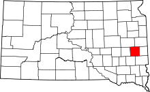 | |
| Towns | ||
| Village | ||
| CDPs | ||
| Other unincorporated communities | ||
This article is issued from Wikipedia - version of the 2/5/2016. The text is available under the Creative Commons Attribution/Share Alike but additional terms may apply for the media files.