Rutland, South Dakota
| Rutland, South Dakota | |
|---|---|
| unincorporated community | |
| Coordinates: 44°4′24″N 96°57′33″W / 44.07333°N 96.95917°WCoordinates: 44°4′24″N 96°57′33″W / 44.07333°N 96.95917°W | |
| Country | United States |
| State | South Dakota |
| County | Lake |
| Area | |
| • Total | 36.0 sq mi (93.1 km2) |
| • Land | 35.8 sq mi (92.8 km2) |
| • Water | 0.1 sq mi (0.3 km2) |
| Elevation | 1,696 ft (517 m) |
| Population (2000) | |
| • Total | 205 |
| • Density | 5.7/sq mi (2.2/km2) |
| Time zone | Central (CST) (UTC-6) |
| • Summer (DST) | CDT (UTC-5) |
| ZIP code | 57057 |
| Area code(s) | 605 |
| FIPS code | 46-57020[1] |
| GNIS feature ID | 1267703[2] |
Rutland is an unincorporated community in Lake County, South Dakota, United States.
Rutland was laid out in 1906, and named after Rutland Township.[3]
Rutland is served by the Rutland School District, which has a single Pre-K through 12 school located in the town.[4]
References
- ↑ "American FactFinder". United States Census Bureau. Retrieved 2008-01-31.
- ↑ "US Board on Geographic Names". United States Geological Survey. 2007-10-25. Retrieved 2008-01-31.
- ↑ Federal Writers' Project (1940). South Dakota place-names, v.1-3. University of South Dakota. p. 59.
- ↑ "Homepage". Rutland ISD. Retrieved 3 February 2016.
External links
Municipalities and communities of Lake County, South Dakota, United States | ||
|---|---|---|
| City | 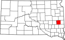 | |
| Towns | ||
| Village | ||
| CDPs | ||
| Other unincorporated communities | ||
This article is issued from Wikipedia - version of the 2/4/2016. The text is available under the Creative Commons Attribution/Share Alike but additional terms may apply for the media files.