Winfield, Alabama
| Winfield, Alabama | ||
|---|---|---|
| City | ||
| ||
 Location in Marion County and the state of Alabama | ||
| Coordinates: 33°55′42″N 87°48′29″W / 33.92833°N 87.80806°W | ||
| Country | United States | |
| State | Alabama | |
| Counties | Marion, Fayette | |
| Area | ||
| • Total | 17.3 sq mi (44.9 km2) | |
| • Land | 17.3 sq mi (44.8 km2) | |
| • Water | 0.04 sq mi (0.1 km2) | |
| Elevation | 476 ft (145 m) | |
| Population (2010) | ||
| • Total | 4,717 | |
| • Density | 273/sq mi (105.4/km2) | |
| Time zone | Central (CST) (UTC-6) | |
| • Summer (DST) | CDT (UTC-5) | |
| ZIP code | 35594 | |
| Area code(s) | 205 | |
| FIPS code | 01-82992 | |
| GNIS feature ID | 0154009 | |
| Website |
www | |

Winfield is a city in Marion and Fayette counties in the U.S. state of Alabama. The population was 4,717[1] at the 2010 census, the second largest city in Marion County.
History
Winfield is a small city situated in Northwest Alabama 26 miles (42 km) east of the Mississippi state line. It lies in the foothills of the Appalachian Mountain range which stretches from the deep South all the way to Maine. Long before the earliest settlers arrived, Indian tribes hunted in the forest and fished in the streams and along and around Winfield. The town was originally called "Needmore", but when it was incorporated in either 1887 or 1891,[2] the name was changed to Winfield in honor of General Winfield Scott. This area was once the Chickasaw Indian domain. Although there were no known Indian settlements within the county, several sites were maintained as hunting camps.
At the end of 2014, a secret meeting by the city council of Winfield, and by unanimous vote, symbolically declared God the owner of the city of Winfield.[3]
Geography and climate
Geography
Winfield is located in southern Marion County at 33°55′42″N 87°48′29″W / 33.92833°N 87.80806°W (33.928258, -87.807990),[4] with a portion extending south into Fayette County. U.S. Route 43 passes through the city, leading northwest 6.5 miles (10.5 km) to Guin and south 18 miles (29 km) to Fayette. Hamilton, the Marion County seat, is 20 miles (32 km) northwest via US 43.
According to the U.S. Census Bureau, the city has a total area of 17.3 square miles (44.9 km2), of which 17.3 square miles (44.8 km2) is land and 0.04 square miles (0.1 km2), or 0.28%, is water.[1]
Climate
Winfield has a subtropical climate characterized by hot, humid summers, mild winters, and abundant rainfall during the late winter and spring. January sees average daily high temperatures of 53.0 °F (11.7 °C) and lows of 31.8 °F (−0.1 °C). In July, the average daily high is 90.6 °F (32.6 °C), and the low is 69.2 °F (20.7 °C). Snowfall is infrequent in the area, with a yearly average of 0.5 inches (12.7 mm). The average yearly rainfall in Winfield is about 52 inches (1,300 mm), with March being the wettest month and October the driest.
The spring and fall months are pleasant but variable, but cold fronts frequently bring strong to severe thunderstorms and occasional tornadoes to the region. The fall season features less rainfall and fewer storms, as well as lower humidity than the spring, but is also a secondary severe weather season.
Demographics
| Historical population | |||
|---|---|---|---|
| Census | Pop. | %± | |
| 1900 | 316 | — | |
| 1910 | 419 | 32.6% | |
| 1920 | 753 | 79.7% | |
| 1930 | 1,254 | 66.5% | |
| 1940 | 1,662 | 32.5% | |
| 1950 | 2,108 | 26.8% | |
| 1960 | 2,907 | 37.9% | |
| 1970 | 3,292 | 13.2% | |
| 1980 | 3,781 | 14.9% | |
| 1990 | 3,689 | −2.4% | |
| 2000 | 4,540 | 23.1% | |
| 2010 | 4,717 | 3.9% | |
| Est. 2015 | 4,570 | [5] | −3.1% |
| U.S. Decennial Census[6] 2013 Estimate[7] | |||
As of the census[8] of 2000, there were 4,540 people. The population density was 279.9 people per square mile (108.1/km²). There were 2,126 housing units at an average density of 131.1 per square mile (50.6/km²). The racial makeup of the city was 94.56% White, 4.21% Black or African American, 0.20% Native American, 0.22% Asian, 0.20% from other races, and 0.62% from two or more races. 1.19% of the population were Hispanic or Latino of any race.
There were 1,849 households out of which 30.7% had children under the age of 18 living with them, 57.4% were married couples living together, 10.7% had a female householder with no husband present, and 29.1% were non-families. 27.7% of all households were made up of individuals and 15.0% had someone living alone who was 65 years of age or older. The average household size was 2.38 and the average family size was 2.89.
In the city the population was spread out with 23.3% under the age of 18, 7.4% from 18 to 24, 26.7% from 25 to 44, 22.6% from 45 to 64, and 20.0% who were 65 years of age or older. The median age was 40 years. For every 100 females there were 87.5 males. For every 100 females age 18 and over, there were 82.0 males.
The median income for a household in the city was $31,317, and the median income for a family was $38,545. Males had a median income of $32,734 versus $21,184 for females. The per capita income for the city was $15,814. About 11.1% of families and 14.1% of the population were below the poverty line, including 17.6% of those under age 18 and 11.5% of those age 65 or over.
2010 census
As of the census[9] of 2010, there were 4,717 people. The population density was 291.2 people per square mile (112.3/km²). There were 2,289 housing units at an average density of 141.3 per square mile (54.5/km²). The racial makeup of the city was 92.9% White, 4.5% Black or African American, 0.3% Native American, 0.3% Asian, 0.9% from other races, and 1.0% from two or more races. 2.0% of the population were Hispanic or Latino of any race.
There were 1,984 households out of which 26.1% had children under the age of 18 living with them, 49.0% were married couples living together, 13.5% had a female householder with no husband present, and 33.8% were non-families. 30.6% of all households were made up of individuals and 15.1% had someone living alone who was 65 years of age or older. The average household size was 2.31 and the average family size was 2.86.
In the city the population was spread out with 21.3% under the age of 18, 7.8% from 18 to 24, 23.2% from 25 to 44, 27.5% from 45 to 64, and 20.2% who were 65 years of age or older. The median age was 43.2 years. For every 100 females there were 91.1 males. For every 100 females age 18 and over, there were 90.5 males.
The median income for a household in the city was $34,617, and the median income for a family was $43,692. Males had a median income of $38,250 versus $32,250 for females. The per capita income for the city was $19,386. About 16.4% of families and 18.6% of the population were below the poverty line, including 21.1% of those under age 18 and 24.4% of those age 65 or over.
Culture
Festivals
Mule Day is hosted on the fourth Saturday in September each year, and has been termed "One of the top 20 events in the Southeast" by Travel and Tourism magazine. The keynote event is a horse parade through the downtown of the city, but there is also live entertainment, car shows and a diverse venue of homemade baked goods sold in a farmers market setting. One of the most popular events amongst most elementary and middle schoolers is the Mule Day carnival.[10] The small carnival area is usually located along Kirkwood St. between U.S. Route 43 and Midway Dr., a distance of about 460 ft.).[11] Others are small shops and games where food is sold (Vendor booths and food stands are set up throughout the town and are not part of the "carnival"). Celebrated since 1975,[12] Mule Day has grown into a major event not only for the City of Winfield but also for the State of Alabama.
The Pastime Theater
The Pastime Theater is a historical theater built in 1937 and recently renovated for use as a performing arts center. This facility offers cultural events which benefit Winfield and outlying communities.
Notable people
- W. Eugene Davis, judge of the United States Court of Appeals for the Fifth Circuit
- Jimmy Miles, award winning country musician
- Johnny Micheal Spann, an operative of the Central Intelligence Agency (CIA) and the first American killed in combat after the U.S. invasion of Afghanistan
- The Dirty Clergy,[13] a national garage rock/pop band
References
- 1 2 "Geographic Identifiers: 2010 Census Summary File 1 (G001): Winfield city, Alabama". American Factfinder. U.S. Census Bureau. Retrieved April 11, 2016.
- ↑ http://www.encyclopediaofalabama.org/article/h-3071
- ↑ "City council declares God 'owns' City of Winfield; mayor says response mostly positive". AL.com.
- ↑ "US Gazetteer files: 2010, 2000, and 1990". United States Census Bureau. 2011-02-12. Retrieved 2011-04-23.
- ↑ "Annual Estimates of the Resident Population for Incorporated Places: April 1, 2010 to July 1, 2015". Retrieved July 2, 2016.
- ↑ "U.S. Decennial Census". Census.gov. Retrieved June 6, 2013.
- ↑ "Annual Estimates of the Resident Population: April 1, 2010 to July 1, 2013". Retrieved June 3, 2014.
- ↑ "American FactFinder". United States Census Bureau. Retrieved 2008-01-31.
- ↑ "American FactFinder". United States Census Bureau. Retrieved 2015-08-02.
- ↑ "Winfield's Mule Day".
- ↑ https://www.google.com/maps/dir/33.9272649,-87.8159033/33.9267589,-87.8172883/@33.9271009,-87.8165958,19z/am=t/data=!3m1!4b1!4m4!4m3!1m0!1m0!3e0
- ↑ http://www.encyclopediaofalabama.org/face/Article.jsp?id=h-3071
- ↑ "The Dirty Clergy Prep 'Rattlesnake' And Debut 'All I Need' #VIDEO". Australia's Music News Authority. 2016-06-26. Retrieved 2016-08-11.
External links
Coordinates: 33°55′42″N 87°48′29″W / 33.928258°N 87.80799°W
Municipalities and communities of Fayette County, Alabama, United States | ||
|---|---|---|
| Cities | 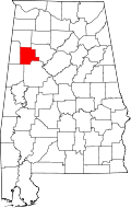 | |
| Towns | ||
| Unincorporated communities | ||
| Footnotes | ‡This populated place also has portions in an adjacent county or counties | |
Municipalities and communities of Marion County, Alabama, United States | ||
|---|---|---|
| Cities | 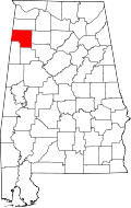 | |
| Towns | ||
| Unincorporated communities | ||
| Ghost town | ||
| Footnotes | ‡This populated place also has portions in an adjacent county or counties | |