Wheatland Township, Fayette County, Illinois
| Wheatland Township | |
|---|---|
| Township | |
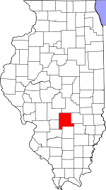
 Location in Fayette County | |
 Fayette County's location in Illinois | |
| Coordinates: 38°57′21″N 88°51′34″W / 38.95583°N 88.85944°WCoordinates: 38°57′21″N 88°51′34″W / 38.95583°N 88.85944°W | |
| Country | United States |
| State | Illinois |
| County | Fayette |
| Established | November 9, 1859 |
| Area | |
| • Total | 36.73 sq mi (95.1 km2) |
| • Land | 36.69 sq mi (95.0 km2) |
| • Water | 0.04 sq mi (0.1 km2) 0.11% |
| Elevation | 584 ft (178 m) |
| Population (2010) | |
| • Total | 467 |
| • Density | 12.7/sq mi (4.9/km2) |
| Time zone | CST (UTC-6) |
| • Summer (DST) | CDT (UTC-5) |
| ZIP codes | 62418, 62458, 62838, 62857, 62880 |
| GNIS feature ID | 0429925 |
Wheatland Township is one of twenty townships in Fayette County, Illinois, USA. As of the 2010 census, its population was 467 and it contained 246 housing units.[1]
Geography
According to the 2010 census, the township has a total area of 36.73 square miles (95.1 km2), of which 36.69 square miles (95.0 km2) (or 99.89%) is land and 0.04 square miles (0.10 km2) (or 0.11%) is water.[1]
Unincorporated towns
Cemeteries
The township contains these five cemeteries: German Reformed, Lovett, Old Loogootee, Sidener and Stein.
Major highways
School districts
- Brownstown Community Unit School District 201
- Saint Elmo Community Unit School District 202
Political districts
- Illinois' 19th congressional district
- State House District 102
- State Senate District 51
References
- "Wheatland Township, Fayette County, Illinois". Geographic Names Information System. United States Geological Survey. Retrieved 2010-01-16.
- United States Census Bureau 2007 TIGER/Line Shapefiles
- United States National Atlas
- 1 2 "Population, Housing Units, Area, and Density: 2010 - County -- County Subdivision and Place -- 2010 Census Summary File 1". United States Census. Retrieved 2013-05-28.
External links
 |
Sefton Township | Avena Township | Mound Township, Effingham County | |
| Otego Township | |
West Township, Effingham County | ||
| ||||
| | ||||
| Wilberton Township | Lone Grove Township | LaClede Township |
Municipalities and communities of Fayette County, Illinois, United States | ||
|---|---|---|
| Cities | ||
| Villages | ||
| Townships | ||
| Unincorporated communities | ||
This article is issued from Wikipedia - version of the 2/18/2015. The text is available under the Creative Commons Attribution/Share Alike but additional terms may apply for the media files.