Kaskaskia Township, Fayette County, Illinois
| Kaskaskia Township | |
|---|---|
| Township | |
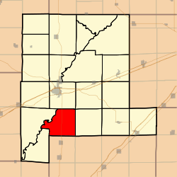 Location in Fayette County | |
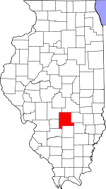 Fayette County's location in Illinois | |
| Coordinates: 38°51′57″N 89°05′13″W / 38.86583°N 89.08694°WCoordinates: 38°51′57″N 89°05′13″W / 38.86583°N 89.08694°W | |
| Country | United States |
| State | Illinois |
| County | Fayette |
| Established | November 9, 1859 |
| Area | |
| • Total | 34.34 sq mi (88.9 km2) |
| • Land | 34.3 sq mi (89 km2) |
| • Water | 0.04 sq mi (0.1 km2) 0.12% |
| Elevation | 515 ft (157 m) |
| Population (2010) | |
| • Total | 650 |
| • Density | 19/sq mi (7/km2) |
| Time zone | CST (UTC-6) |
| • Summer (DST) | CDT (UTC-5) |
| ZIP codes | 62471, 62885, 62892 |
| GNIS feature ID | 0429197 |
Kaskaskia Township is one of twenty townships in Fayette County, Illinois, USA. As of the 2010 census, its population was 650 and it contained 289 housing units.[1]
Geography
According to the 2010 census, the township has a total area of 34.34 square miles (88.9 km2), of which 34.3 square miles (89 km2) (or 99.88%) is land and 0.04 square miles (0.10 km2) (or 0.12%) is water.[1]
Unincorporated towns
Cemeteries
The township contains these five cemeteries: Britton, Farmer, Heckethorn, Lee and McConnell.
Major highways
School districts
- Patoka Community Unit School District 100
- Vandalia Community Unit School District 203
Political districts
- Illinois' 19th congressional district
- State House District 102
- State Senate District 51
References
- "Kaskaskia Township, Fayette County, Illinois". Geographic Names Information System. United States Geological Survey. Retrieved 2010-01-16.
- United States Census Bureau 2007 TIGER/Line Shapefiles
- United States National Atlas
- 1 2 "Population, Housing Units, Area, and Density: 2010 - County -- County Subdivision and Place -- 2010 Census Summary File 1". United States Census. Retrieved 2013-05-28.
External links
 |
Vandalia Township | Otego Township | | |
| Seminary Township | |
Wilberton Township | ||
| ||||
| | ||||
| Pope Township | Patoka Township, Marion County | Foster Township, Marion County |
Municipalities and communities of Fayette County, Illinois, United States | ||
|---|---|---|
| Cities | ||
| Villages | ||
| Townships | ||
| Unincorporated communities | ||
This article is issued from Wikipedia - version of the 2/18/2015. The text is available under the Creative Commons Attribution/Share Alike but additional terms may apply for the media files.