West Valley, New York
| West Valley, New York | |
|---|---|
| Hamlet & CDP | |
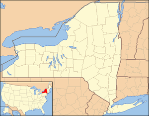 West Valley Location within the state of New York | |
| Coordinates: 42°24′10″N 078°36′36″W / 42.40278°N 78.61000°WCoordinates: 42°24′10″N 078°36′36″W / 42.40278°N 78.61000°W[1] | |
| Country | United States |
| State | New York |
| County | Cattaraugus County |
| Town | Ashford |
| Area (2010 Census)[2] | |
| • Total | 1.535 sq mi (3.98 km2) |
| • Land | 1.532 sq mi (3.97 km2) |
| • Water | 0.003 sq mi (0.008 km2) |
| Elevation[1] | 1,522 ft (464 m) |
| Population (2010)[3] | |
| • Total | 518 |
| • Density | 337/sq mi (130/km2) |
| Time zone | Eastern (EST) (UTC-5) |
| • Summer (DST) | EDT (UTC-4) |
| ZIP code[4] | 14171 |
| Area code | 716 |
| FIPS code[2][5] | 36-81138 |
| GNIS feature ID[5] | 970885 |
| Website |
www |
West Valley is a hamlet in the Town of Ashford in Cattaraugus County, New York, United States. The population was 518 at the 2010 census, which lists the community as a census-designated place.[3]
Located at the intersection of Cattaraugus County Route 53 and State Route 240/County Route 32, the hamlet is home to West Valley Central School and the West Valley Demonstration Project, a nuclear cleanup facility. Because of the presence of a school district, a telephone exchange (716-942), and a post office located in (and named after) the hamlet, many people mistake West Valley to be the name of an actual town or village. However, it does not have any autonomous government separate from the town of Ashford.
Geography
West Valley is located at 42°24′10″N 078°36′36″W / 42.40278°N 78.61000°W (42.4028410, -78.6100253) and its elevation is 1,522 feet (464 m).[1]
According to the 2010 United States Census, the CDP has a total area of 1.535 square miles (3.98 km2), of which 1.532 square miles (3.97 km2) is land and 0.003 square miles (0.01 km2) is water.[2]
References
- 1 2 3 "West Valley". Geographic Names Information System. United States Geological Survey. Retrieved January 14, 2013.
- 1 2 3 "Places: New York". 2010 Census Gazetteer Files. United States Census Bureau. Retrieved January 14, 2013. External link in
|work=(help) - 1 2 "West Valley CDP, New York". Profile of General Population and Housing Characteristics: 2010 Demographic Profile Data. United States Census Bureau. Retrieved January 14, 2013.
- ↑ "Post Offices By County: Cattaraugus County, New York". United States Postal Service. Retrieved January 14, 2013.
- 1 2 "FIPS55 Data: New York". FIPS55 Data. United States Geological Survey. February 23, 2006. Archived from the original on October 19, 2006. External link in
|work=(help)
External links
This webliography covers web sites that will inform individuals about the history of the town and businesses and community organizations within. In addition, because of the interrelatedness and the geographical closeness of the communities in this area the webliography contains information about places around the area that would be of interest to people who want to find out more.
Business
- Department of Energy West Valley Demonstration Project. 42°27′04″N 78°39′18″W / 42.451°N 78.655°W
- This is the cleanup effort for a former spent fuel reprocessing plant.
Community group
Cultural locations
Education and library
Emergency
Ethnic
Government
History
- Concord Historical Society. Concord NY Historical Society - History Timeline.
- University at Buffalo Special Collections. Reform, Religion and the Underground Railroad in Western New York.
- USGenWeb-an Ancestry.com Community. Town of Ashford- 1824.
- USGenWeb-an Ancestry.com Community. Welcome to Cattaraugus Towns and County Page.
- USGenWeb-an Ancestry.com Community. “The History of Cattaraugus County, New York.”
Media
Recreation
- The Ashford Hollow Foundation Griffis Sculpture Park. Griffis Sculpture Park: History
- Enchanted Mountains of Cattaraugus County
- Holiday Valley
- Holimont
Regional information
- Discover Southwest, NY-Southern Tier West Regional Planning and Development Board.
- Ellicottville Chamber of Commerce. Ellicottville, NY.
- New York State Office of Parks, Recreation, and Historic Preservation. Welcome to the Allegany Region.
Religion
- St. Paul’s United Methodist Church. St. Paul’s United Methodist Church West Valley, NY.
- The Catholic Directory. St. John the Baptist Parish.
Municipalities and communities of Cattaraugus County, New York, United States | ||
|---|---|---|
| Cities | 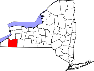 | |
| Towns |
| |
| Villages | ||
| CDPs | ||
| Other hamlets | ||
| Indian reservations | ||
| Footnotes |
| |