West Goshen Historic District
|
West Goshen Historic District | |
|
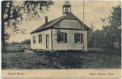
Postcard depicting a schoolhouse in West Goshen (1911 postmark) | |
  | |
| Location | Roughly bounded by CT 4, Beach, Mill and Milton Sts., and Thompson Rd., Goshen, Connecticut |
|---|---|
| Coordinates | 41°49′32″N 73°15′16″W / 41.82556°N 73.25444°WCoordinates: 41°49′32″N 73°15′16″W / 41.82556°N 73.25444°W |
| Area | 29 acres (12 ha) |
| Built | 1790 |
| Architectural style | Greek Revival, Federal, Vernacular Federal |
| NRHP Reference # | 87000982[1] |
| Added to NRHP | October 23, 1987 |
The West Goshen Historic District is a historic district in the village of West Goshen in the town of Goshen, Connecticut. It encompasses twenty historically significant properties in the village, most of which lie on Connecticut Route 4 between Bean Street and Thompson Road. Most of this area's buildings are residential and were built in the early decades of the 19th century, although there are some buildings that are older and some that date to the 1880s. Non-residential buildings include the former West Goshen Store (330 Rt. 4) and a former carding mill at 331 Rt. 4, built in 1818. The district also includes archaeological remnants of other industrial structures.[2]
The district was listed on the National Register of Historic Places in 1987.[1]
See also
- Goshen Historic District
- National Register of Historic Places listings in Litchfield County, Connecticut
References
- 1 2 National Park Service (2009-03-13). "National Register Information System". National Register of Historic Places. National Park Service.
- ↑ "NRHP nomination for West Goshen Historic District" (PDF). National Park Service. Retrieved 2014-12-28.
| Topics | |
|---|---|
| Lists by states |
|
| Lists by insular areas | |
| Lists by associated states | |
| Other areas | |
| |