Weishan Yi and Hui Autonomous County
| Weishan Yi and Hui Autonomous County 巍山彝族回族自治县 وِشًا یِذُو خُوِذُو ذِجِشِیًا | |
|---|---|
| County | |
|
[[File:Gong Chen Men in Weishan, Yunnan, China.jpg|280px|Gongchen Tower, atop the Gongchen Gate, is a symbol of Weishan]] Gongchen Tower, atop the Gongchen Gate, is a symbol of Weishan | |
.png) Weishan County (pink) in Dali Bai Autonomous Prefecture (yellow), Yunnan (light grey) | |
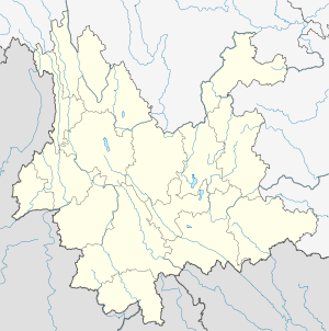 Weishan Yi and Hui Autonomous County Location in [[Yunnan, China]] | |
| Coordinates: 25°15′25.62″N 100°09′56.83″E / 25.2571167°N 100.1657861°E | |
| Country | China |
| Province | Yunnan |
| Prefecture | Dali |
| Area | |
| • Total | 2,200 km2 (800 sq mi) |
| Population (2010) | |
| • Total | 304,400 |
| • Density | 140/km2 (360/sq mi) |
| Postal code | 672400 |
| Area code(s) | 0872 |
| Climate | Cwb |
| Website |
www |
Weishan Yi and Hui Autonomous County (Chinese: 巍山彝族回族自治县; pinyin: Wēishān Yízú Huízú Zìzhìxiàn; Xiao'erjing: وِشًا یِذُو خُوِذُو ذِجِشِیًا) is an autonomous county in the Dali Bai Autonomous Prefecture of Yunnan Province, China. It was known as Menghua (蒙化) until the 1950s.
Geography
It is situated in the upper section of the Ailao Mountains and the Wuliang Mountains.
External links
| Wikimedia Commons has media related to Weishan, Yunnan. |
Coordinates: 25°15′25.62″N 100°09′56.83″E / 25.2571167°N 100.1657861°E
This article is issued from Wikipedia - version of the 10/28/2016. The text is available under the Creative Commons Attribution/Share Alike but additional terms may apply for the media files.