Mojiang Hani Autonomous County
| Mojiang County | |
|---|---|
| Autonomous county | |
| Chinese transcription(s) | |
| • Characters | 墨江哈尼族自治县 |
| • Pinyin | Mòjiāng hānízú Zìzhìxiàn |
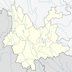
.png) Location of Mojiang County (pink) and Pu'er Prefecture (yellow) within Yunnan province of China | |
 Mojiang County Location within Yunnan, China | |
| Coordinates: 23°25′N 101°44′E / 23.417°N 101.733°E | |
| Country | China |
| Province | Yunnan |
| Prefecture | Pu'er |
| GB/T 2260 CODE[1] | 530822 |
| Area | |
| • Total | 5,312 km2 (2,051 sq mi) |
| Population | |
| • Total | 350,991 |
| • Density | 66/km2 (170/sq mi) |
| Time zone | China Standard Time (UTC+8) |
| Postal code | 654800[2] |
| Area code(s) | 0879[2] |
| Website | mojiang.gov.cn |
|
1Yunnan Statistics Bureau 2Puer Gov. 3Yunnan Portal | |
Mojiang Hani Autonomous County (墨江哈尼族自治县; pinyin: Mòjiāng hānízú Zìzhìxiàn) is an autonomous county under the jurisdiction of Pu'er Prefecture, Yunnan Province, China.
Demographics
There was a total of 210,628 ethnic Hani in Mojiang County as of 2006. Hani subgroups in Mojiang County include the following, with 2006 population estimates (Jiang, et al. 2009:3).
- Kaduo 卡多 (62,696 people)
- Biyue 碧约 (63,359 people)
- Haoni 豪尼 (29,915 people)
- Baihong 白宏 (27,052 people)
- Ximoluo 西摩洛 (14,711 people)
- Amu 阿木 (7,050 people)
- Lami 腊米 (3,105 people)
- Qiedi 切弟 (1,497 people)
- Kabie 卡别 (1,243 people)
The Budu and Bukong are also found in Mojiang County.[3]
- Budu 布都 (17,498 people)
- Bukong 布孔 (14,106 people), including in Niangpuzhai 娘浦寨,[4] Mengli Village 勐里村, Longba Township 龙坝乡
According to the Mojiang County Almanac (2002:640), ethnic Bulang, who numbered 2,968 individuals as of 1993, are found in the townships of Jingxing 景星, Xinwu 新抚, and Tongguan 通关. The Bulang of Mojiang County speak Va, an Angkuic language.
In Mojiang County, ethnic Yao are found in Yaojia 瑶家[5] and Guangshan 光山[6] of Manxing Village 曼兴村, Wenwu Township 文武乡.[7]
Transport
References
- ↑ http://www.stats.gov.cn/tjbz/xzqhdm/index.htm
- 1 2 Area Code and Postal Code in Yunnan Province
- ↑ 中国少数民族社会历史调查资料丛刊》修订编辑委员会. 2009. 哈尼族社会历史调查, p.94, 99. Beijing: Minzu Chubanshe.
- ↑ http://www.ynszxc.gov.cn/villagePage/vIndex.aspx?departmentid=204985
- ↑ http://www.ynszxc.gov.cn/villagePage/vIndex.aspx?departmentid=175910
- ↑ http://www.ynszxc.gov.cn/villagePage/vIndex.aspx?departmentid=175909
- ↑ http://www.cqvip.com/QK/96982A/198504/1002289522.html
- Jiang Ying [蒋颖], Cui Xia [崔霞], Qiao Xiang [乔翔]. 2009. A study of Ximoluo [西摩洛语研究]. Beijing: Ethnic Publishing House [民族出版社].
External links
Coordinates: 23°25′00″N 101°44′00″E / 23.41667°N 101.7333°E