Webb, Alabama
| Webb, Alabama | |
|---|---|
| Town | |
 Location in Houston County and the state of Alabama | |
| Coordinates: 31°15′37″N 85°17′1″W / 31.26028°N 85.28361°W | |
| Country | United States |
| State | Alabama |
| County | Houston |
| Area | |
| • Total | 11.7 sq mi (30.4 km2) |
| • Land | 11.7 sq mi (30.4 km2) |
| • Water | 0 sq mi (0 km2) |
| Elevation | 305 ft (93 m) |
| Population (2000) | |
| • Total | 1,298 |
| • Density | 110.9/sq mi (42.7/km2) |
| Time zone | Central (CST) (UTC-6) |
| • Summer (DST) | CDT (UTC-5) |
| ZIP code | 36376 |
| Area code(s) | 334 |
| FIPS code | 01-80376 |
| GNIS feature ID | 0128676 |
Webb is a town in Houston County, Alabama, United States. Named for plantation owner B. F. Webb, who settled in the area around 1890. The town was incorporated in 1903.[1] It is part of the Dothan, Alabama Metropolitan Statistical Area. As of the 2010 census, the population was 1,430, up from 1,298 in 2000. The estimate as of 2014 was 1,421, a slight decline.
Geography
Webb is located at 31°15′37″N 85°17′1″W / 31.26028°N 85.28361°W (31.260358, -85.283533).[2]
According to the U.S. Census Bureau, the town has a total area of 11.7 square miles (30 km2), all land.
Demographics
| Historical population | |||
|---|---|---|---|
| Census | Pop. | %± | |
| 1910 | 256 | — | |
| 1920 | 415 | 62.1% | |
| 1930 | 400 | −3.6% | |
| 1940 | 379 | −5.2% | |
| 1950 | 344 | −9.2% | |
| 1960 | 331 | −3.8% | |
| 1970 | 354 | 6.9% | |
| 1980 | 448 | 26.6% | |
| 1990 | 1,039 | 131.9% | |
| 2000 | 1,298 | 24.9% | |
| 2010 | 1,430 | 10.2% | |
| Est. 2015 | 1,413 | [3] | −1.2% |
| U.S. Decennial Census[4] 2013 Estimate[5] | |||
As of the census[6] of 2000, there were 1,298 people, 491 households, and 375 families residing in the town. The population density was 110.6 people per square mile (42.7/km²). There were 523 housing units at an average density of 44.6 per square mile (17.2/km²). The racial makeup of the town was 79.20% White, 19.65% Black or African American, 0.31% Native American, and 0.85% from two or more races. 1.00% of the population were Hispanic or Latino of any race.
There were 491 households out of which 38.1% had children under the age of 18 living with them, 61.9% were married couples living together, 11.4% had a female householder with no husband present, and 23.6% were non-families. 22.6% of all households were made up of individuals and 8.6% had someone living alone who was 65 years of age or older. The average household size was 2.63 and the average family size was 3.06.
In the town the population was spread out with 28.1% under the age of 18, 8.1% from 18 to 24, 29.7% from 25 to 44, 23.7% from 45 to 64, and 10.5% who were 65 years of age or older. The median age was 35 years. For every 100 females there were 92.3 males. For every 100 females age 18 and over, there were 88.9 males.
The median income for a household in the town was $31,364, and the median income for a family was $36,667. Males had a median income of $32,656 versus $19,479 for females. The per capita income for the town was $15,150. About 13.7% of families and 17.0% of the population were below the poverty line, including 22.4% of those under age 18 and 16.9% of those age 65 or over.
2010 census
As of the census[7] of 2010, there were 1,430 people, 544 households, and 391 families residing in the town. The population density was 122.2 people per square mile (47.0/km²). There were 616 housing units at an average density of 52.6 per square mile (20.3/km²). The racial makeup of the town was 74.8% White, 18.7% Black or African American, 0.7% Native American, and 1.5% from two or more races. 6.2% of the population were Hispanic or Latino of any race.
There were 544 households out of which 28.5% had children under the age of 18 living with them, 52.0% were married couples living together, 14.5% had a female householder with no husband present, and 28.1% were non-families. 22.1% of all households were made up of individuals and 7.9% had someone living alone who was 65 years of age or older. The average household size was 2.60 and the average family size was 3.05.
In the town the population was spread out with 24.0% under the age of 18, 8.0% from 18 to 24, 27.6% from 25 to 44, 26.9% from 45 to 64, and 13.6% who were 65 years of age or older. The median age was 39.1 years. For every 100 females there were 98.6 males. For every 100 females age 18 and over, there were 98.4 males.
The median income for a household in the town was $34,650, and the median income for a family was $38,352. Males had a median income of $32,847 versus $18,938 for females. The per capita income for the town was $15,124. About 13.2% of families and 15.4% of the population were below the poverty line, including 20.2% of those under age 18 and 13.7% of those age 65 or over.
References
- ↑ http://www.encyclopediaofalabama.org/article/h-3350
- ↑ "US Gazetteer files: 2010, 2000, and 1990". United States Census Bureau. 2011-02-12. Retrieved 2011-04-23.
- ↑ "Annual Estimates of the Resident Population for Incorporated Places: April 1, 2010 to July 1, 2015". Retrieved July 2, 2016.
- ↑ "U.S. Decennial Census". Census.gov. Retrieved June 6, 2013.
- ↑ "Annual Estimates of the Resident Population: April 1, 2010 to July 1, 2013". Retrieved June 3, 2014.
- ↑ "American FactFinder". United States Census Bureau. Retrieved 2008-01-31.
- ↑ "American FactFinder". United States Census Bureau. Retrieved 2015-07-25.
External links
Coordinates: 31°15′37″N 85°17′01″W / 31.260358°N 85.283533°W
Municipalities and communities of Houston County, Alabama, United States | ||
|---|---|---|
| City | 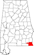 | |
| Towns | ||
| Unincorporated communities | ||
| Footnotes | ‡This populated place also has portions in an adjacent county or counties | |