Houston County, Alabama
| Houston County, Alabama | |
|---|---|
 Houston County courthouse in Dothan | |
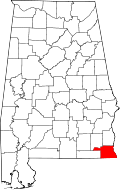 Location in the U.S. state of Alabama | |
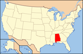 Alabama's location in the U.S. | |
| Founded | February 9, 1903 |
| Named for | George S. Houston |
| Seat | Dothan |
| Largest city | Dothan |
| Area | |
| • Total | 582 sq mi (1,507 km2) |
| • Land | 580 sq mi (1,502 km2) |
| • Water | 1.8 sq mi (5 km2), 0.3% |
| Population (est.) | |
| • (2015) | 104,173 |
| • Density | 175/sq mi (68/km²) |
| Congressional district | 2nd |
| Time zone | Central: UTC-6/-5 |
| Website |
www |
|
Footnotes:
| |
Houston County is a county located in the southeastern corner of the U.S. state of Alabama. As of the 2010 census the population was 101,547.[1] Its county seat is Dothan.[2]
Houston County is part of the Dothan, Alabama metropolitan area.
History
Houston County was established on February 9, 1903, from parts of Dale County, Geneva County and Henry County. It was named after George Smith Houston, the 24th Governor of Alabama.
Geography
According to the U.S. Census Bureau, the county has a total area of 582 square miles (1,510 km2), of which 580 square miles (1,500 km2) is land and 1.8 square miles (4.7 km2) (0.3%) is water.[3]
Major highways
 U.S. Highway 84
 U.S. Highway 231
 U.S. Highway 431
 State Route 52
 State Route 53
 State Route 92
 State Route 95
 State Route 103
 State Route 123
 State Route 134
 State Route 210
 State Route 605
Adjacent counties
- Henry County (north)
- Early County, Georgia (east)
- Seminole County, Georgia (southeast)
- Jackson County, Florida (south)
- Geneva County (west)
- Dale County (northwest)
Demographics
| Historical population | |||
|---|---|---|---|
| Census | Pop. | %± | |
| 1910 | 32,414 | — | |
| 1920 | 37,334 | 15.2% | |
| 1930 | 45,935 | 23.0% | |
| 1940 | 45,665 | −0.6% | |
| 1950 | 46,522 | 1.9% | |
| 1960 | 50,718 | 9.0% | |
| 1970 | 56,574 | 11.5% | |
| 1980 | 74,632 | 31.9% | |
| 1990 | 81,331 | 9.0% | |
| 2000 | 88,787 | 9.2% | |
| 2010 | 101,547 | 14.4% | |
| Est. 2015 | 104,173 | [4] | 2.6% |
| U.S. Decennial Census[5] 1790–1960[6] 1900–1990[7] 1990–2000[8] 2010–2015[1] | |||
As of the census[9] of 2000, there were 88,787 people, 35,834 households, and 25,119 families residing in the county. The population density was 153 people per square mile (59/km2). There were 39,571 housing units at an average density of 68 per square mile (26/km2). The racial makeup of the county was 73.08% White, 24.60% Black or African American, 0.37% Native American, 0.62% Asian, 0.02% Pacific Islander, 0.39% from other races, and 0.92% from two or more races. 1.26% of the population were Hispanic or Latino of any race.
There were 35,834 households out of which 33.00% had children under the age of 18 living with them, 52.50% were married couples living together, 14.10% had a female householder with no husband present, and 29.90% were non-families. 26.40% of all households were made up of individuals and 10.10% had someone living alone who was 65 years of age or older. The average household size was 2.45 and the average family size was 2.95.
In the county the population was spread out with 25.90% under the age of 18, 8.20% from 18 to 24, 28.70% from 25 to 44, 23.50% from 45 to 64, and 13.70% who were 65 years of age or older. The median age was 37 years. For every 100 females there were 95.0 males. For every 100 females age 18 and over, there were 86.20 males.
The median income for a household in the county was $34,431, and the median income for a family was $42,437. Males had a median income of $32,092 versus $21,409 for females. The per capita income for the county was $18,759. About 11.80% of families and 15.00% of the population were below the poverty line, including 21.10% of those under age 18 and 16.30% of those age 65 or over.
2010 census
As of the census[10] of 2010, there were 101,547 people, 40,969 households, and 28,041 families residing in the county. The population density was 175 people per square mile (67.5/km2). There were 45,319 housing units at an average density of 77.9 per square mile (30.1/km2). The racial makeup of the county was 70.0% White, 25.8% Black or African American, 0.4% Native American, 0.8% Asian, 0.0% Pacific Islander, 1.2% from other races, and 1.7% from two or more races. 2.9% of the population were Hispanic or Latino of any race.
There were 40,969 households out of which 29.2% had children under the age of 18 living with them, 47.9% were married couples living together, 16.2% had a female householder with no husband present, and 31.6% were non-families. 27.2% of all households were made up of individuals and 9.7% had someone living alone who was 65 years of age or older. The average household size was 2.44 and the average family size was 2.96.
In the county the population was spread out with 24.5% under the age of 18, 8.3% from 18 to 24, 25.7% from 25 to 44, 27.0% from 45 to 64, and 14.5% who were 65 years of age or older. The median age was 38.5 years. For every 100 females there were 92.3 males. For every 100 females age 18 and over, there were 92.5 males.
The median income for a household in the county was $41,022, and the median income for a family was $51,741. Males had a median income of $41,021 versus $28,240 for females. The per capita income for the county was $22,725. About 12.7% of families and 16.8% of the population were below the poverty line, including 25.8% of those under age 18 and 11.5% of those age 65 or over.
Government
As of 2016, the County Chairman is held by Mark Culver, while William Dempsey is the Chief Administrative Officer. The County Commission is District 1, Curtis Harvey; District 2, Doug Sinquefield; District 3, Jackie Battles; and District 4, Brandon Shoupe. Donald Valenza serves as Sheriff, Probate Judge is Patrick Davenport, Revenue Commissioner is Starla Moss, Coroner is Robert Byrd. The county engineer is Barkley Kirkland. Houston County is located in Alabama's Second Congressional District; its current Representative (as of 2016) is Martha Roby (R).
| Year | GOP | DNC | Others |
|---|---|---|---|
| 2016 | 72.2% 30,567 | 24.9% 10,547 | 2.9% 1,238 |
| 2012 | 69.8% 29,214 | 29.5% 12,348 | 0.7% 281 |
| 2008 | 70.1% 29,254 | 29.3% 12,225 | 0.6% 256 |
| 2004 | 74.2% 26,874 | 25.3% 9,144 | 0.5% 183 |
| 2000 | 69.1% 22,150 | 29.4% 9,412 | 1.5% 495 |
Communities
City
- Dothan (county seat; partly in Dale County and Henry County)
Towns
Unincorporated communities
See also
- National Register of Historic Places listings in Houston County, Alabama
- Properties on the Alabama Register of Landmarks and Heritage in Houston County, Alabama
References
- 1 2 "State & County QuickFacts". United States Census Bureau. Retrieved May 16, 2014.
- ↑ "Find a County". National Association of Counties. Retrieved 2011-06-07.
- ↑ "2010 Census Gazetteer Files". United States Census Bureau. August 22, 2012. Retrieved August 22, 2015.
- ↑ "County Totals Dataset: Population, Population Change and Estimated Components of Population Change: April 1, 2010 to July 1, 2015". Retrieved July 2, 2016.
- ↑ "U.S. Decennial Census". United States Census Bureau. Retrieved August 22, 2015.
- ↑ "Historical Census Browser". University of Virginia Library. Retrieved August 22, 2015.
- ↑ Forstall, Richard L., ed. (March 24, 1995). "Population of Counties by Decennial Census: 1900 to 1990". United States Census Bureau. Retrieved August 22, 2015.
- ↑ "Census 2000 PHC-T-4. Ranking Tables for Counties: 1990 and 2000" (PDF). United States Census Bureau. April 2, 2001. Retrieved August 22, 2015.
- ↑ "American FactFinder". United States Census Bureau. Retrieved 2011-05-14.
- ↑ "American FactFinder". United States Census Bureau. Retrieved 2015-07-25.
- ↑ "Dave Leip's Atlas of U.S. Presidential Elections". Retrieved November 16, 2016.
External links
 |
Dale County | Henry County | | |
| Geneva County | |
Early County, Georgia | ||
| ||||
| | ||||
| Jackson County, Florida | Seminole County, Georgia |
Municipalities and communities of Houston County, Alabama, United States | ||
|---|---|---|
| City | | |
| Towns | ||
| Unincorporated communities | ||
| Footnotes | ‡This populated place also has portions in an adjacent county or counties | |
Coordinates: 31°09′08″N 85°17′36″W / 31.15222°N 85.29333°W