Wau, South Sudan
| Wau واو | |
|---|---|
|
Huts outside Wau, 2008 | |
| Motto: Arabic: واو نار English: Wau is Fire | |
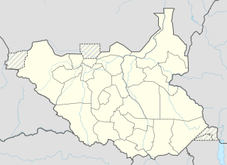 Wau Location in South Sudan | |
| Coordinates: SS 07°42′00″N 28°00′00″E / 7.70000°N 28.00000°ECoordinates: SS 07°42′00″N 28°00′00″E / 7.70000°N 28.00000°E | |
| Country | South Sudan |
| Region | Bahr el Ghazal |
| State | Wau State |
| County | Wau County |
| Elevation | 433 m (1,420 ft) |
| Population (2014 est.) | |
| • Total | 232,910 |
| Time zone | GMT+3 |


Wau (Arabic: واو Wāw; also Wow or Waw) is a city in northwestern South Sudan, on the western bank of the Jur River, in Wau County, Wau State.[1] It lies approximately 650 kilometres (400 mi) northwest of Juba, the capital and largest city in that country.[2]
History
Wau was initially established as a zariba (fortified base) by slave-traders in the 19th century. During the time of condominium rule, the city became an administrative center.
Burr and Collins in 1994 described Wau:[3] as follows:
No one has ever been “at home” in Wau. It is surrounded by a host of disorganized and diverse peoples . . . It was and remains a town belonging to no single ethnic group, deriving its importance only from its position as a commercial and administrative center . . . Located in the midst of the vast Nilotic plain hundreds of miles from nowhere, it was miserable under the best of circumstances . . .
During the Second Sudanese Civil War, it was a garrison town of the Khartoum-based Sudanese Armed Forces, and was the scene of extensive fighting in the spring of 1998. Battles erupted again in the town in the spring of 2007, killing several hundred people.
In 2010 the Ministry of Housing, Physical Planning and Environment (South Sudan) proposed to reshape the city as a giraffe.[4]
In 2016, Wau experienced heavy clashes that displaced much of its Fertit population and led to widespread destruction.[5]
Overview
The city of Wau is the headquarters of Wau State, in which it lies. It also served as the capital of the erstwhile Western Bahr el Ghazal State, one of the original ten (10) states which constitute the Republic of South Sudan. The city is a culturally, ethnically, and linguistically diverse urban center. Its residents include peoples of Fertit, Dinka, Luo, and Arab ethnicity.
Population and demographics
In 2008, Wau was the third-largest city in South Sudan, by population, behind Juba the capital and Malakal, in Upper Nile State. At that time, the estimated population of the city of Wau was about 128,100.[6] In 2011, the city's population was estimated at about 151,320.[7]
| Year | Population[8] |
|---|---|
| 1973 | 52,800 |
| 1983 | 58,000 |
| 1993 | 84,000 |
| 2010 | 128,100 |
| 2011 | 151,320 |
Transport and infrastructure

- Wau is the terminus of a narrow gauge branch line of the Sudan Railways. A plan exists, as of 2008, to open a standard gauge line north from Gulu in Uganda to Wau. Through trains from Khartoum to Mombasa would be possible only if one of the lines was regauged.
- Wau Airport - The airport, (IATA: WUU, ICAO: HSWW) has a single paved runway which measures 2,500 metres (8,200 ft) in length.
- The city hosts University of Bahr El-Ghazal and many secondary and primary schools.
- The Catholic University of South Sudan maintains a campus in the city.[9]
- Wau Stadium - A soccer stadium in the middle of town
- The Cathedral in Wau is known as the Largest of former Sudan
- There are five (5) main roads out of town:
- B38-North leads directly north to Gogrial, South Sudan
- B43-South leads southeast to Tonj, South Sudan
- A44-South leads directly south to Tumbura, South Sudan
- B41-West leads west to Raga, South Sudan
- B43-North leads northwest to Aweil, South Sudan
- Southern National Park - Located about 100 kilometres (62 mi), by road, south of Wau along A44-South
Economy
Wau is a vibrant economic center in the newly established Republic of South Sudan. The major contributors to the local economy include:
- Buffalo Commercial Bank branch
- Equity Bank (South Sudan)[10] branch
- Ivory Bank branch
- Kenya Commercial Bank (South Sudan) branch[11]
- Catholic University of South Sudan, Wau campus
- University of Bahr El-Ghazal
- Wau Airport
- Wau County Government
- Western Bahr el Ghazal State Government
- RCS - Radio & Satellite Communication
- Commercial Bank of Ethiopia (South Sudan Subsidiary Comp.) expected shortly
Geography and climate
Wau has two seasons: a dry season from November to March, and a rainy season the rest of the year, as depicted in the referenced box below:
| Climate data for Wau, South Sudan | |||||||||||||
|---|---|---|---|---|---|---|---|---|---|---|---|---|---|
| Month | Jan | Feb | Mar | Apr | May | Jun | Jul | Aug | Sep | Oct | Nov | Dec | Year |
| Record high °C (°F) | 41.1 (106) |
42.2 (108) |
43.5 (110.3) |
42.0 (107.6) |
41.5 (106.7) |
38.5 (101.3) |
36.5 (97.7) |
36.7 (98.1) |
40.0 (104) |
39.2 (102.6) |
38.5 (101.3) |
39.5 (103.1) |
43.5 (110.3) |
| Average high °C (°F) | 35.5 (95.9) |
37.1 (98.8) |
38.1 (100.6) |
37.4 (99.3) |
35.3 (95.5) |
32.9 (91.2) |
31.4 (88.5) |
31.4 (88.5) |
32.6 (90.7) |
33.8 (92.8) |
35.2 (95.4) |
35.2 (95.4) |
34.7 (94.5) |
| Daily mean °C (°F) | 26.8 (80.2) |
28.5 (83.3) |
30.4 (86.7) |
30.6 (87.1) |
29.3 (84.7) |
27.5 (81.5) |
26.3 (79.3) |
26.2 (79.2) |
26.8 (80.2) |
27.4 (81.3) |
27.4 (81.3) |
26.5 (79.7) |
27.8 (82) |
| Average low °C (°F) | 19.1 (66.4) |
19.9 (67.8) |
22.7 (72.9) |
23.8 (74.8) |
23.2 (73.8) |
22.0 (71.6) |
21.2 (70.2) |
21.0 (69.8) |
21.0 (69.8) |
21.0 (69.8) |
19.6 (67.3) |
17.9 (64.2) |
20.9 (69.6) |
| Record low °C (°F) | 9.3 (48.7) |
12.5 (54.5) |
14.9 (58.8) |
16.5 (61.7) |
19.5 (67.1) |
17.7 (63.9) |
18.0 (64.4) |
18.6 (65.5) |
17.0 (62.6) |
16.4 (61.5) |
11.4 (52.5) |
10.3 (50.5) |
9.3 (48.7) |
| Average precipitation mm (inches) | 1.3 (0.051) |
3.6 (0.142) |
18.6 (0.732) |
68.3 (2.689) |
118.8 (4.677) |
177.4 (6.984) |
176.0 (6.929) |
192.3 (7.571) |
179.4 (7.063) |
123.8 (4.874) |
14.9 (0.587) |
0.1 (0.004) |
1,074.5 (42.303) |
| Average precipitation days (≥ 0.1 mm) | 0.2 | 0.3 | 3.4 | 6.3 | 11.4 | 12.7 | 15.9 | 15.5 | 23.7 | 11.2 | 1.7 | 0.1 | 102.4 |
| Average relative humidity (%) | 29 | 26 | 35 | 48 | 62 | 71 | 76 | 77 | 74 | 69 | 48 | 35 | 54 |
| Mean monthly sunshine hours | 288.3 | 246.4 | 229.4 | 228.0 | 220.1 | 204.0 | 182.9 | 192.2 | 204.0 | 223.2 | 264.0 | 294.5 | 2,777 |
| Mean daily sunshine hours | 9.3 | 8.8 | 7.4 | 7.6 | 7.1 | 6.8 | 5.9 | 6.2 | 6.8 | 7.2 | 8.8 | 9.5 | 7.6 |
| Percent possible sunshine | 79 | 74 | 62 | 61 | 60 | 54 | 47 | 50 | 56 | 60 | 75 | 82 | 63 |
| Source: NOAA[12] | |||||||||||||
Notable people
Some of the notable people from Wau include
- Prof Barri Arkanjelo Wanji veteran Anya Anya /SPLM/A soldier and long serving politician
- Clement Mboro veteran politician
- Luol Deng - NBA basketball player
- Alek Wek - World model
- Khamis Leyano - South Sudanese footballer and captain
- Longar Longar - former University of Oklahoma basketball player and NBA D-League player
- Longar Yak Jiel- National basketball player
- Gabriel Cardinal Zubeir Wako - Retired archbishop of Khartoum arch dioceses (Sudan)
- Thon Maker – NBA basketball player
See also
References
- ↑ Fighting in Wau; Red cross calls for civilians to be spared Radio Tamazuj
- ↑ calculate travel time. "Estimated Road Distance Between Juba And Wau". Travelmath.com. Retrieved 2013-04-11.
- ↑
- Burr, J.M. and Collins, R.O. (1994) Requiem for the Sudan: War, Drought and Disaster Relief on the Nile. Westview Press, Boulder, CO, USA, p. 74
- ↑ A city shaped like a giraffe? Toronto Star, Wed Aug 18 2010, by Maggie Fick, Associated Pres
- ↑ "President Kiir fires Wau state governor". Sudan Tribune. 24 June 2016. Retrieved 12 July 2016.
- ↑ "Estimated Population of Sudanese Cities & Towns In 2010". World-gazetteer.com. Retrieved 2013-04-11.
- ↑ "Estimated Population of Waw In 2011". Wolframalpha.com. Retrieved 2013-04-11.
- ↑ "Estimated Population of Wau (1973 - 2010)". World-gazetteer.com. Retrieved 2013-04-11.
- ↑ Sean, Michael (2010-11-11). "Catholic University Maintains A Campus In Wau". Ncronline.org. Retrieved 2013-04-11.
- ↑ Equity Bank Expands In South Sudan
- ↑ KCB Expands Branch Network In South Sudan
- ↑ "Wau Climate Normals 1961–1990". National Oceanic and Atmospheric Administration. Retrieved January 16, 2015.
External links
| Wikivoyage has a travel guide for Wau. |
| Wikimedia Commons has media related to Wau. |
- Location of Wau At Google Maps
- Human Rights Watch (1999) Famine in Sudan, 1998: The Human Rights Causes.
- Detailed Map of The City of Wau
- Photos of Wau River Lodge, A Private Establishment