Watab Township, Benton County, Minnesota
| Watab Township, Minnesota | |
|---|---|
| Township | |
 Watab Township Location within the state of Minnesota | |
| Coordinates: 45°41′42″N 94°10′46″W / 45.69500°N 94.17944°WCoordinates: 45°41′42″N 94°10′46″W / 45.69500°N 94.17944°W | |
| Country | United States |
| State | Minnesota |
| County | Benton |
| Area | |
| • Total | 22.4 sq mi (58.0 km2) |
| • Land | 20.3 sq mi (52.6 km2) |
| • Water | 2.1 sq mi (5.5 km2) |
| Elevation | 1,027 ft (313 m) |
| Population (2010) | |
| • Total | 3,093 |
| • Density | 152/sq mi (58.8/km2) |
| Time zone | Central (CST) (UTC-6) |
| • Summer (DST) | CDT (UTC-5) |
| FIPS code | 27-68476[1] |
| GNIS feature ID | 0665927[2] |
| Website |
www |
Watab Township is a township in Benton County, Minnesota, United States, located north of the mouth of Watab Creek on the opposite side of the Mississippi River in Sartell. The population was 3,093 as of the 2010 census.[3]
History
Watab Township was organized in 1858.[4] It took its name from the Watab River.[4]
Geography
According to the United States Census Bureau, the township has a total area of 22.4 square miles (58.0 km2), of which 20.3 square miles (52.6 km2) is land and 2.1 square miles (5.5 km2), or 9.39%, is water.[3]
It is slightly larger than half of a normal (36-section) township, being bounded on the west by the Mississippi River.
Unincorporated communities
Major highways
Lakes
- Little Rock Lake (south half)
- Unnamed Lake
Adjacent townships
- Graham Township (northeast)
- Mayhew Lake Township (east)
- Minden Township (southeast)
- Sauk Rapids Township (south)
- Le Sauk Township, Stearns County (southwest)
- Brockway Township, Stearns County (west)
- Langola Township (northwest)
Demographics
As of the census[1] of 2000, there were 2,920 people, 1,036 households, and 812 families residing in the township. The population density was 143.8 people per square mile (55.5/km²). There were 1,088 housing units at an average density of 53.6/sq mi (20.7/km²). The racial makeup of the township was 98.70% White, 0.14% African American, 0.14% Native American, 0.34% Asian, 0.17% from other races, and 0.51% from two or more races. Hispanic or Latino of any race were 0.72% of the population.
There were 1,036 households out of which 42.2% had children under the age of 18 living with them, 66.6% were married couples living together, 7.5% had a female householder with no husband present, and 21.6% were non-families. 15.7% of all households were made up of individuals and 4.2% had someone living alone who was 65 years of age or older. The average household size was 2.82 and the average family size was 3.17.
In the township the population was spread out with 29.6% under the age of 18, 7.3% from 18 to 24, 31.7% from 25 to 44, 23.4% from 45 to 64, and 8.0% who were 65 years of age or older. The median age was 36 years. For every 100 females there were 105.3 males. For every 100 females age 18 and over, there were 103.3 males.
The median income for a household in the township was $50,604, and the median income for a family was $53,542. Males had a median income of $35,750 versus $22,017 for females. The per capita income for the township was $20,554. About 4.8% of families and 6.1% of the population were below the poverty line, including 10.5% of those under age 18 and 3.1% of those age 65 or over.
References
- United States National Atlas
- United States Census Bureau 2007 TIGER/Line Shapefiles
- United States Board on Geographic Names (GNIS)
- 1 2 "American FactFinder". United States Census Bureau. Retrieved 2008-01-31.
- ↑ "US Board on Geographic Names". United States Geological Survey. 2007-10-25. Retrieved 2008-01-31.
- 1 2 "Geographic Identifiers: 2010 Demographic Profile Data (G001): Watab township, Benton County, Minnesota". U.S. Census Bureau, American Factfinder. Retrieved January 17, 2014.
- 1 2 Upham, Warren (1920). Minnesota Geographic Names: Their Origin and Historic Significance. Minnesota Historical Society. p. 51.
External links
Municipalities and communities of Benton County, Minnesota, United States | ||
|---|---|---|
| Cities | 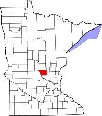 | |
| Townships | ||
| CDP | ||
| Unincorporated communities | ||
| Ghost town | ||
| Footnotes | ‡This populated place also has portions in an adjacent county or counties | |