Washington Township, Carroll County, Illinois
| Washington Township | |
|---|---|
| Township | |
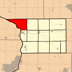 Location in Carroll County | |
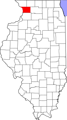 Carroll County's location in Illinois | |
| Coordinates: 42°09′50″N 90°10′11″W / 42.16389°N 90.16972°WCoordinates: 42°09′50″N 90°10′11″W / 42.16389°N 90.16972°W | |
| Country | United States |
| State | Illinois |
| County | Carroll |
| Government | |
| • Supervisor | Jesse L. Bundy |
| Area | |
| • Total | 39.74 sq mi (102.9 km2) |
| • Land | 35.39 sq mi (91.7 km2) |
| • Water | 4.35 sq mi (11.3 km2) 10.95% |
| Elevation | 656 ft (200 m) |
| Population (2010) | |
| • Total | 356 |
| • Density | 10.1/sq mi (3.9/km2) |
| Time zone | CST (UTC-6) |
| • Summer (DST) | CDT (UTC-5) |
| ZIP codes | 61028, 61074 |
| GNIS feature ID | 0429897 |
Washington Township is one of twelve townships in Carroll County, Illinois, USA. As of the 2010 census, its population was 356 and it contained 198 housing units.[1]
Geography
According to the 2010 census, the township has a total area of 39.74 square miles (102.9 km2), of which 35.39 square miles (91.7 km2) (or 89.05%) is land and 4.35 square miles (11.3 km2) (or 10.95%) is water.[1]
Cities, towns, villages
- Savanna (north edge)
Unincorporated towns
(This list is based on USGS data and may include former settlements.)
Cemeteries
The township contains Mosquito Hill Cemetery which is also known as St. Peter's Evangelical Lutheran Cemetery. The cemetery is the site of the former St. Matthew's Evangelical Lutheran Church.
Major highways
Rivers
Lakes
- Buffalo Lake
- Horseshoe Lake
- Lundy Lake
Landmarks
- Mississippi Palisades State Park (vast majority)
- Savanna Army Depot
School districts
- West Carroll Community Unit School District 314
Political districts
- Illinois' 16th congressional district
- State House District 71
- State Senate District 36
References
- "Washington Township, Carroll County, Illinois". Geographic Names Information System. United States Geological Survey. Retrieved 2010-01-04.
- United States Census Bureau 2007 TIGER/Line Shapefiles
- United States National Atlas
- 1 2 "Population, Housing Units, Area, and Density: 2010 - County -- County Subdivision and Place -- 2010 Census Summary File 1". United States Census. Retrieved 2013-05-28.
External links
 |
Hanover Township, Jo Daviess County | Derinda Township, Jo Daviess County | Pleasant Valley Township, Jo Daviess County | |
| |
Woodland Township | |||
| ||||
| | ||||
| Savanna Township | Mount Carroll Township |
Municipalities and communities of Carroll County, Illinois, United States | ||
|---|---|---|
| Cities | ||
| Villages | ||
| Townships | ||
| Unincorporated communities | ||
| Ghost town | ||
| Footnotes | ‡This populated place also has portions in an adjacent county or counties | |
This article is issued from Wikipedia - version of the 3/27/2014. The text is available under the Creative Commons Attribution/Share Alike but additional terms may apply for the media files.