Carroll County, Illinois
| Carroll County, Illinois | |
|---|---|
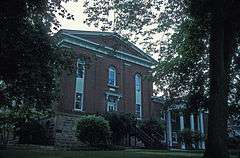 Carroll County Courthouse | |
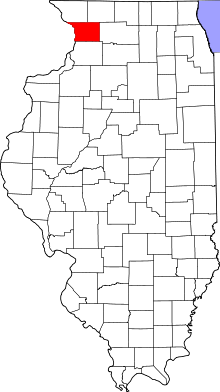 Location in the U.S. state of Illinois | |
 Illinois's location in the U.S. | |
| Founded | 1839 |
| Named for | Charles Carroll |
| Seat | Mount Carroll |
| Largest city | Savanna |
| Area | |
| • Total | 466 sq mi (1,207 km2) |
| • Land | 445 sq mi (1,153 km2) |
| • Water | 22 sq mi (57 km2), 4.6% |
| Population | |
| • (2010) | 15,387 |
| • Density | 35/sq mi (14/km²) |
| Congressional district | 17th |
| Time zone | Central: UTC-6/-5 |
| Website |
www |
Carroll County is a county located in the U.S. state of Illinois. As of the 2010 census, the population was 15,387.[1] Its county seat is Mount Carroll.[2]
History
Carroll County was formed in 1839 out of Jo Daviess County. The county is named for Charles Carroll who signed the Declaration of Independence.[3] Carroll, who died in 1832, was the last signer to die.
-

Carroll County at the time of its creation in 1839
Geography
According to the U.S. Census Bureau, the county has a total area of 466 square miles (1,210 km2), of which 445 square miles (1,150 km2) is land and 22 square miles (57 km2) (4.6%) is water.[4] The Mississippi Palisades State Park is in this county, just north of the city of Savanna. The Savanna Army Depot is located partly in this county.
Adjacent counties
- Stephenson County - northeast
- Ogle County - east
- Whiteside County - south
- Clinton County, Iowa - southwest
- Jackson County, Iowa - west
- Jo Daviess County - northwest
National protected area
Major highways
-
 US Route 52
 -
 Illinois Route 40
 -
 Illinois Route 64
 -
 Illinois Route 72
 -
 Illinois Route 73
 -
 Illinois Route 78
 -
 Illinois Route 84
Climate and weather
| Mount Carroll, Illinois | ||||||||||||||||||||||||||||||||||||||||||||||||||||||||||||
|---|---|---|---|---|---|---|---|---|---|---|---|---|---|---|---|---|---|---|---|---|---|---|---|---|---|---|---|---|---|---|---|---|---|---|---|---|---|---|---|---|---|---|---|---|---|---|---|---|---|---|---|---|---|---|---|---|---|---|---|---|
| Climate chart (explanation) | ||||||||||||||||||||||||||||||||||||||||||||||||||||||||||||
| ||||||||||||||||||||||||||||||||||||||||||||||||||||||||||||
| ||||||||||||||||||||||||||||||||||||||||||||||||||||||||||||
In recent years, average temperatures in the county seat of Mount Carroll have ranged from a low of 7 °F (−14 °C) in January to a high of 85 °F (29 °C) in July, although a record low of −31 °F (−35 °C) was recorded in January 1910 and a record high of 108 °F (42 °C) was recorded in July 1936. Average monthly precipitation ranged from 1.43 inches (36 mm) in January to 4.77 inches (121 mm) in June.[5]
Demographics

| Historical population | |||
|---|---|---|---|
| Census | Pop. | %± | |
| 1840 | 1,023 | — | |
| 1850 | 4,586 | 348.3% | |
| 1860 | 11,733 | 155.8% | |
| 1870 | 16,705 | 42.4% | |
| 1880 | 16,976 | 1.6% | |
| 1890 | 18,320 | 7.9% | |
| 1900 | 18,963 | 3.5% | |
| 1910 | 18,035 | −4.9% | |
| 1920 | 19,345 | 7.3% | |
| 1930 | 18,433 | −4.7% | |
| 1940 | 17,987 | −2.4% | |
| 1950 | 18,976 | 5.5% | |
| 1960 | 19,507 | 2.8% | |
| 1970 | 19,276 | −1.2% | |
| 1980 | 18,779 | −2.6% | |
| 1990 | 16,805 | −10.5% | |
| 2000 | 16,674 | −0.8% | |
| 2010 | 15,387 | −7.7% | |
| Est. 2015 | 14,616 | [6] | −5.0% |
| U.S. Decennial Census[7] 1790-1960[8] 1900-1990[9] 1990-2000[10] 2010-2013[1] | |||
As of the 2010 United States Census, there were 15,387 people, 6,622 households, and 4,343 families residing in the county.[11] The population density was 34.6 inhabitants per square mile (13.4/km2). There were 8,437 housing units at an average density of 19.0 per square mile (7.3/km2).[4] The racial makeup of the county was 96.9% white, 0.8% black or African American, 0.3% Asian, 0.3% American Indian, 0.6% from other races, and 1.1% from two or more races. Those of Hispanic or Latino origin made up 2.8% of the population.[11] In terms of ancestry, 40.4% were German, 14.0% were Irish, 11.2% were English, and 10.6% were American.[12]
Of the 6,622 households, 26.3% had children under the age of 18 living with them, 53.1% were married couples living together, 8.2% had a female householder with no husband present, 34.4% were non-families, and 29.8% of all households were made up of individuals. The average household size was 2.29 and the average family size was 2.80. The median age was 46.5 years.[11]
The median income for a household in the county was $44,805 and the median income for a family was $55,341. Males had a median income of $42,421 versus $27,552 for females. The per capita income for the county was $25,914. About 7.8% of families and 11.7% of the population were below the poverty line, including 18.4% of those under age 18 and 5.8% of those age 65 or over.[13]
Education
- Chadwick-Milledgeville Community Unit School District 399
- Eastland Community Unit School District 308
- West Carroll Community Unit School District 314
Communities
Cities
Villages
Townships
Carroll County is divided into these twelve townships:
Notable people
- Willis J. Bailey, United States Representative from Kansas and the 16th Governor of Kansas[14]
- David J. Summerville, Wisconsin State Assemblyman[15]
See also
References
- 1 2 "State & County QuickFacts". United States Census Bureau. Retrieved July 4, 2014.
- ↑ "Find a County". National Association of Counties. Archived from the original on 2011-05-31. Retrieved 2011-06-07.
- ↑ Gannett, Henry (1905). The Origin of Certain Place Names in the United States. Govt. Print. Off. p. 70.
- 1 2 "Population, Housing Units, Area, and Density: 2010 - County". United States Census Bureau. Retrieved 2015-07-11.
- 1 2 "Monthly Averages for Mount Carroll, Illinois". The Weather Channel. Retrieved 2011-01-27.
- ↑ "County Totals Dataset: Population, Population Change and Estimated Components of Population Change: April 1, 2010 to July 1, 2015". Retrieved July 2, 2016.
- ↑ "U.S. Decennial Census". United States Census Bureau. Archived from the original on May 11, 2015. Retrieved July 4, 2014.
- ↑ "Historical Census Browser". University of Virginia Library. Retrieved July 4, 2014.
- ↑ "Population of Counties by Decennial Census: 1900 to 1990". United States Census Bureau. Retrieved July 4, 2014.
- ↑ "Census 2000 PHC-T-4. Ranking Tables for Counties: 1990 and 2000" (PDF). United States Census Bureau. Retrieved July 4, 2014.
- 1 2 3 "DP-1 Profile of General Population and Housing Characteristics: 2010 Demographic Profile Data". United States Census Bureau. Retrieved 2015-07-11.
- ↑ "DP02 SELECTED SOCIAL CHARACTERISTICS IN THE UNITED STATES – 2006-2010 American Community Survey 5-Year Estimates". United States Census Bureau. Retrieved 2015-07-11.
- ↑ "DP03 SELECTED ECONOMIC CHARACTERISTICS – 2006-2010 American Community Survey 5-Year Estimates". United States Census Bureau. Retrieved 2015-07-11.
- ↑ "Kansas Governor Willis Joshua Bailey". National Governors Association. Retrieved September 29, 2012.
- ↑ 'Wisconsin Blue Book 1923,' Biographical Sketch of David J. Summerville, pg. 636
External links
- Carroll County Government
- Visit Carroll County
- Village of Chadwick
- City of Lanark
- Village of Milledgeville
- City of Mt. Carroll
- City of Savanna
- Visit Savanna
- Village of Shannon
- Village of Thomson
- Visit Thomson
- United States Census Bureau 2007 TIGER/Line Shapefiles
- United States Board on Geographic Names (GNIS)
- United States National Atlas
 |
Jo Daviess County | Stephenson County | | |
| Jackson County, Iowa | |
Ogle County | ||
| ||||
| | ||||
| Clinton County, Iowa | Whiteside County |
Municipalities and communities of Carroll County, Illinois, United States | ||
|---|---|---|
| Cities | ||
| Villages | ||
| Townships | ||
| Unincorporated communities | ||
| Ghost town | ||
| Footnotes | ‡This populated place also has portions in an adjacent county or counties | |

Coordinates: 42°04′N 89°55′W / 42.06°N 89.92°W