Washington State Route 112
| ||||
|---|---|---|---|---|
| Strait of Juan de Fuca Highway | ||||
|
SR 112 is highlighted in red. | ||||
| Route information | ||||
| Defined by RCW 47.17.215 | ||||
| Maintained by WSDOT | ||||
| Length: | 61.29 mi[1] (98.64 km) | |||
| Existed: | 1964[2] – present | |||
| Tourist routes: |
| |||
| Major junctions | ||||
| West end: | Makah Indian Reservation boundary near Neah Bay | |||
|
| ||||
| East end: |
| |||
| Highway system | ||||
| ||||

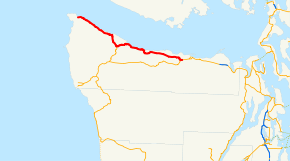
State Route 112 (SR 112, named the Strait of Juan de Fuca Highway) is a state highway extending 61.29 miles (98.64 km) within Clallam County in the U.S. state of Washington.
Route description
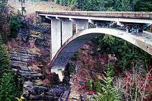
State Route 112 (SR 112) begins at the Makah Indian Reservation boundary east of Neah Bay and the delta of the Sail River. The Strait of Juan de Fuca Highway, a National Scenic Byway, also starts at the boundary and is concurrent with the whole highway.[3] Traveling southeast along the Strait of Juan de Fuca and a cliff to Hoko, the roadway crosses the Hoko River before the river empties into the strait. After the bridge, the road starts to turn southeast away from the coast to Sekiu, where SR 112 passes the Sekiu Airport and travel on a cliff near Clallam Bay and passes the community of the same name. At Clallam Bay, the roadway turns south along the Clallam River inland to intersect the northern terminus of SR 113, which travels south to Sappho. The road curves northeast from the intersection along the Pysht River to Pysht, where another turn places the highway stays southeastward along the strait. Approaching Port Angeles, SR 112 travels through plains past Joyce and the Lower Elwha Indian Reservation, the highway crosses the Elwha River on a deck arch bridge. After the bridge, the roadway had an estimated daily average of 5,400 motorists in 2007.[4][5] The road and scenic byway end at an intersection with U.S. Route 101 (US 101) west of Port Angeles.[6][7][8]
History
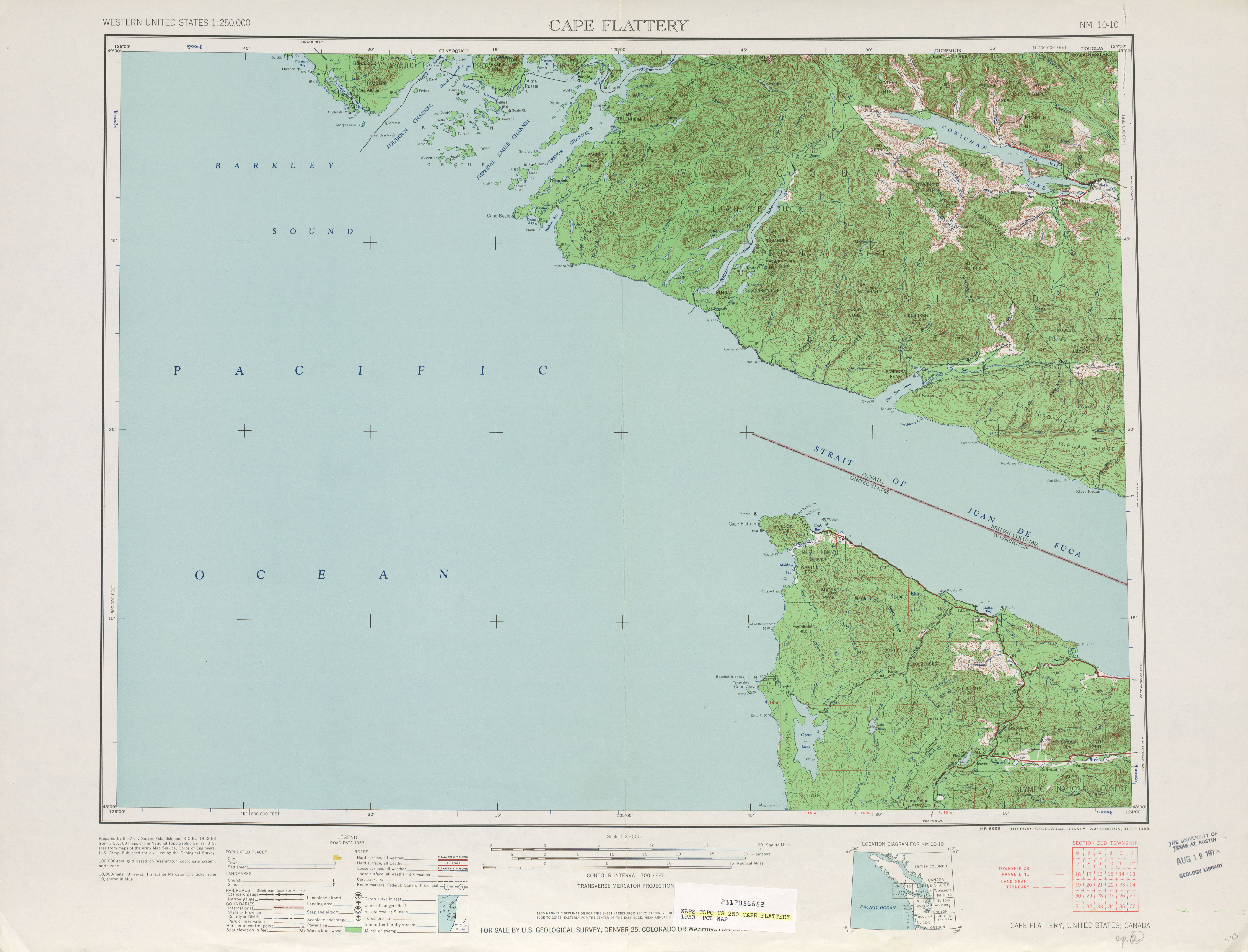
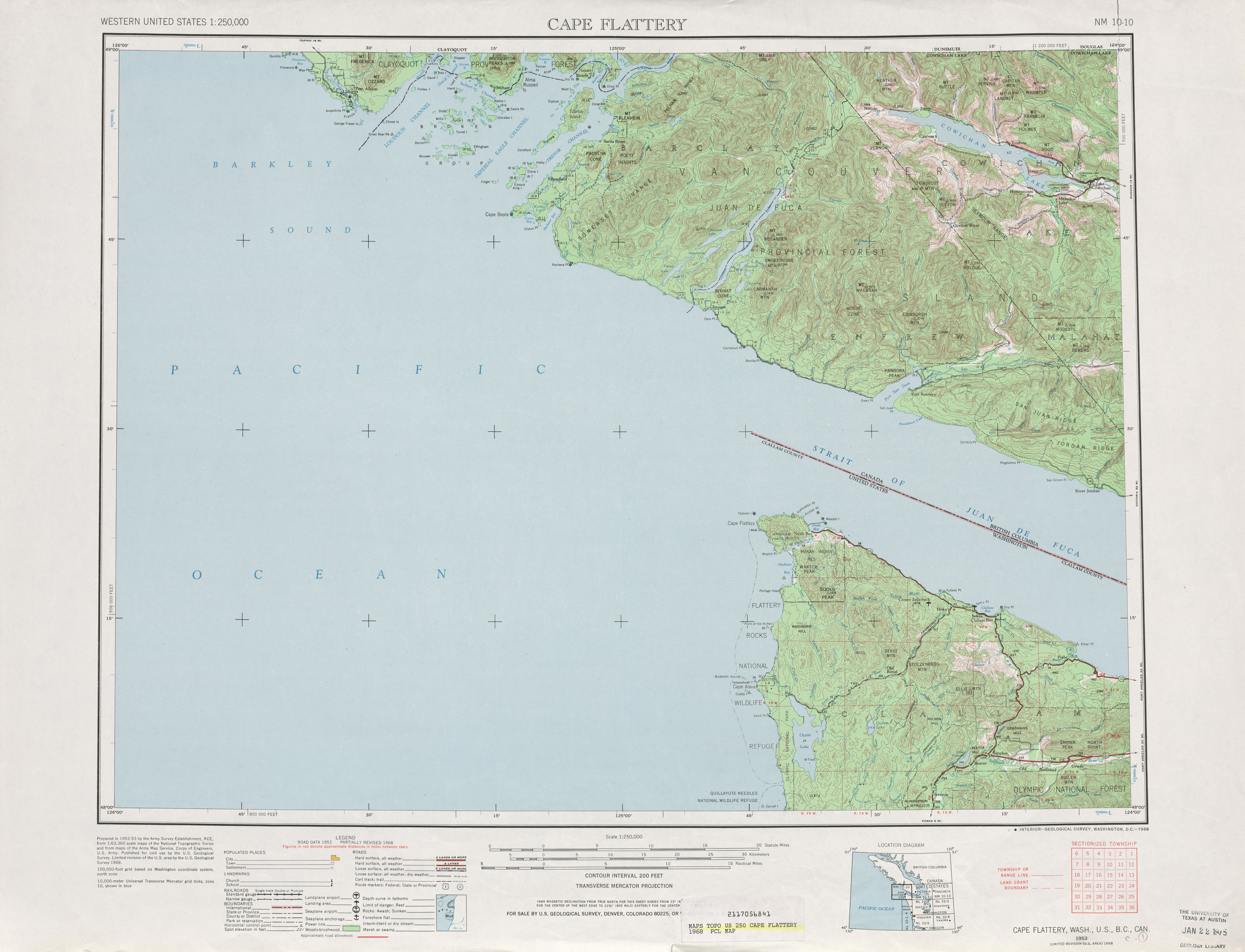
When the primary and secondary highways were created in 1937, a branch of Primary State Highway 9 (PSH 9), named Secondary State Highway 9A (SSH 9A) was established and extended from PSH 9 in Sappho north and east to PSH 9 in Port Angeles.[9] By 1953, a road extending from Neah Bay to SSH 9A was completed and in 1955, the roadway was added to SSH 9A, while the Sappho segment was deleted.[10][11] During the 1964 highway renumbering, SSH 9A became SR 112;[12][13][14] the highway became a state scenic byway in 1967.[15] The Sappho segment of SSH 9A later was readded to the state highway system in 1991 as SR 113.[16] On June 15, 2000, SR 112 became a National Scenic Byway named the Strait of Juan de Fuca Highway.[17] A late December winter storm in 2008 resulted in floods that triggered a landslide that closed the highway near Joyce on January 8, 2009.[18] Temporary repairs began on March 2 and only one-way traffic was allowed until the roadway reopened on March 12.[19][20]
Major intersections
The entire highway is in Clallam County.
| Location | mi[1] | km | Destinations | Notes | |
|---|---|---|---|---|---|
| | 0.00 | 0.00 | Makah Indian Reservation boundary | Western terminus; continues west as Bayview Avenue | |
| | 23.12 | 37.21 | |||
| | 59.33 | 95.48 | Old SR 112 alignment | ||
| | 61.29 | 98.64 | Eastern terminus | ||
| 1.000 mi = 1.609 km; 1.000 km = 0.621 mi | |||||
References
- 1 2 Washington State Department of Transportation (2008). "State Highway Log: Planning Report, SR 2 to SR 971" (PDF). Retrieved August 2, 2009.
- ↑ Washington State Legislature (1970). "RCW 47.17.215: State route No. 112". Retrieved August 2, 2009.
- ↑ Washington State Tourism (2009). "Scenic Byways: Strait of Juan de Fuca Hwy". Retrieved August 2, 2009.
- ↑ Washington State Department of Transportation (2007). "2007 Annual Traffic Report" (PDF). Retrieved August 2, 2009.
- ↑ National Scenic Byways Online (2009). "Strait of Juan de Fuca Highway Overview". Retrieved August 2, 2009.
- ↑ Google (August 2, 2009). "State Route 112" (Map). Google Maps. Google. Retrieved August 2, 2009.
- ↑ Washington State Highways, 2008–2009 (PDF) (Map) (2008–09 ed.). 1:842,000. Cartography by United States Geological Survey. Washington State Department of Transportation. 2008. § C1, C2. Retrieved August 2, 2009.
- ↑ Strait of Juan de Fuca Highway – SR 112 (Map). National Scenic Byways Online. 2009. Retrieved August 2, 2009.
- ↑ Washington State Legislature (March 18, 1937). "Chapter 207: Classification of Public Highways". Session Laws of the State of Washington. Session Laws of the State of Washington (1937 ed.). Olympia, Washington: Washington State Legislature. p. 1006. Retrieved August 2, 2009.
(a) Secondary State Highway No. 9A; beginning at Port Angeles on Primary State Highway No. 9, thence in a westerly direction by the most feasible route by way of the Pysht river to a junction with Primary State Highway No. 9 in the vicinity of Sappho.
- ↑ Cape Flattery, 1953 (Map). 1:125,000. Cartography by United States Geological Survey. University of Texas at Austin. 1953. Retrieved August 2, 2009.
- ↑ Washington State Legislature (1955). "Chapter 383". Session Laws of the State of Washington. Session Laws of the State of Washington (1955 ed.). Olympia, Washington: Washington State Legislature.
- ↑ C. G. Prahl (December 1, 1965). "Identification of State Highways" (PDF). Washington State Highway Commission, Department of Highways. Retrieved August 2, 2009.
- ↑ Victoria, 1966 (Map). 1:125,000. Cartography by United States Geological Survey. University of Texas at Austin. 1966. Retrieved August 2, 2009.
- ↑ Cape Flattery, 1968 (Map). 1:125,000. Cartography by United States Geological Survey. University of Texas at Austin. 1968. Retrieved August 2, 2009.
- ↑ National Scenic Byways Online. "Strait of Juan de Fuca Highway – SR 112 Official Designations". Retrieved August 2, 2009.
- ↑ Washington House of Representatives (1991). "Chapter 342, Laws of 1991: State Highway Routes – Revisons To (House Bill 5801)". Washington State Legislature. Retrieved August 2, 2009.
NEW SECTION. Sec. 7. A state highway to be known as state route number 113 is established as follows: Beginning at a junction with state route number 101 in the vicinity of Sappho, thence northerly to a junction with state route number 112 in the vicinity of the Pysht River.
- ↑ "U.S. Transportation Deputy Secretary Downey Announces New All-American Roads, National Scenic Byways in 20 States" (Press release). United States Department of Transportation. June 15, 2000. Retrieved August 2, 2009.
- ↑ "Landslide closes SR 112 for several weeks" (Press release). Port Angeles, Washington: Washington State Department of Transportation. January 13, 2009. Retrieved August 2, 2009.
- ↑ "Slide-damaged SR 112 gets a temporary fix, one-way traffic" (Press release). Port Angeles, Washington: Washington State Department of Transportation. March 2, 2009. Retrieved August 2, 2009.
- ↑ "One-way traffic moving again on slide-damaged SR 112" (Press release). Port Angeles, Washington: Washington State Department of Transportation. March 11, 2009. Retrieved August 2, 2009.
External links
- Highways of Washington State
- Strait of Juan de Fuca Highway — SR 112
- WSDOT Projects
- Completed WSDOT Projects
Former or proposed State Routes: SR 111 | ||