Wade, North Carolina
| Wade, North Carolina | |
|---|---|
| Town | |
|
Water tower on Highway 301 | |
| Motto: "Home of Southern Hospitality" | |
 Location in Cumberland County and the state of North Carolina. | |
| Coordinates: 35°9′42″N 78°43′59″W / 35.16167°N 78.73306°WCoordinates: 35°9′42″N 78°43′59″W / 35.16167°N 78.73306°W | |
| Country | United States |
| State | North Carolina |
| County | Cumberland |
| Government | |
| • Mayor | Joseph Dixon |
| Area | |
| • Total | 1.80 sq mi (4.65 km2) |
| • Land | 1.78 sq mi (4.62 km2) |
| • Water | 0.008 sq mi (0.02 km2) |
| Elevation | 138 ft (42 m) |
| Population (2010) | |
| • Total | 556 |
| • Density | 311/sq mi (120.2/km2) |
| Time zone | Eastern (EST) (UTC-5) |
| • Summer (DST) | EDT (UTC-4) |
| ZIP code | 28395 |
| Area code(s) | 910 |
| FIPS code | 37-70340[1] |
| GNIS feature ID | 0996656[2] |
| Website |
wadenc |

Wade is a town in Cumberland County, North Carolina, United States. The population was 556 at the 2010 census.[3]
History
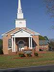
The Old Bluff Presbyterian Church was listed on the National Register of Historic Places in 1974.[4]
Geography
Wade is located in northeastern Cumberland County at 35°9′42″N 78°43′59″W / 35.16167°N 78.73306°W (35.161774, -78.732977).[5] U.S. Route 301 passes through the town, leading southwest 12 miles (19 km) to Fayetteville, the county seat, and northeast 12 miles (19 km) to Dunn. Interstate 95 passes to the southeast of the town, with access from Exit 61.
According to the United States Census Bureau, the town has a total area of 1.8 square miles (4.7 km2), of which 0.01 square miles (0.02 km2), or 0.54%, is water.[3] The Cape Fear River runs just north of the town limits.
Demographics
| Historical population | |||
|---|---|---|---|
| Census | Pop. | %± | |
| 1920 | 190 | — | |
| 1930 | 362 | 90.5% | |
| 1970 | 315 | — | |
| 1980 | 474 | 50.5% | |
| 1990 | 238 | −49.8% | |
| 2000 | 480 | 101.7% | |
| 2010 | 556 | 15.8% | |
| Est. 2015 | 560 | [6] | 0.7% |
As of the census[1] of 2000, there were 480 people, 196 households, and 131 families residing in the town. The population density was 367.6 people per square mile (141.5/km²). There were 220 housing units at an average density of 168.5 per square mile (64.8/km²). The racial makeup of the town was 72.29% White, 22.71% African American, 1.46% Native American, 0.42% Asian, 0.62% Pacific Islander, 2.50% from other races. Hispanic or Latino of any race were 2.71% of the population.
There were 196 households out of which 34.7% had children under the age of 18 living with them, 48.5% were married couples living together, 13.8% had a female householder with no husband present, and 32.7% were non-families. 30.1% of all households were made up of individuals and 13.8% had someone living alone who was 65 years of age or older. The average household size was 2.45 and the average family size was 3.05.
In the town the population was spread out with 27.1% under the age of 18, 7.5% from 18 to 24, 27.1% from 25 to 44, 22.7% from 45 to 64, and 15.6% who were 65 years of age or older. The median age was 37 years. For every 100 females there were 83.9 males. For every 100 females age 18 and over, there were 90.2 males.
The median income for a household in the town was $25,000, and the median income for a family was $33,750. Males had a median income of $25,972 versus $17,344 for females. The per capita income for the town was $13,933. About 12.7% of families and 20.7% of the population were below the poverty line, including 16.1% of those under age 18 and 39.0% of those age 65 or over.
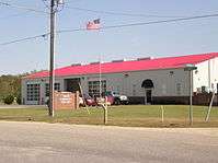
Gallery
|


References
- 1 2 "American FactFinder". United States Census Bureau. Retrieved 2008-01-31.
- ↑ "US Board on Geographic Names". United States Geological Survey. 2007-10-25. Retrieved 2008-01-31.
- 1 2 "Geographic Identifiers: 2010 Demographic Profile Data (G001): Wade town, North Carolina". U.S. Census Bureau, American Factfinder. Retrieved January 6, 2015.
- ↑ National Park Service (2010-07-09). "National Register Information System". National Register of Historic Places. National Park Service.
- ↑ "US Gazetteer files: 2010, 2000, and 1990". United States Census Bureau. 2011-02-12. Retrieved 2011-04-23.
- ↑ "Annual Estimates of the Resident Population for Incorporated Places: April 1, 2010 to July 1, 2015". Retrieved July 2, 2016.
- ↑ "Census of Population and Housing". Census.gov. Retrieved June 4, 2015.
External links
Municipalities and communities of Cumberland County, North Carolina, United States | ||
|---|---|---|
| City |  | |
| Towns | ||
| CDP | ||
| Unincorporated communities | ||
| Military bases | ||
| Footnotes | ‡This populated place also has portions in an adjacent county or counties | |