Linden, North Carolina
| Linden, North Carolina | |
|---|---|
| Town | |
|
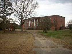
The long-since closed Linden School | |
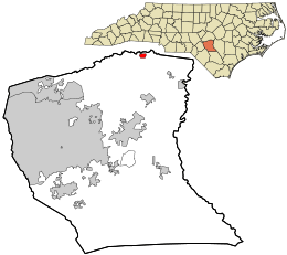 Location in Cumberland County and the state of North Carolina. | |
| Coordinates: 35°15′20″N 78°44′48″W / 35.25556°N 78.74667°WCoordinates: 35°15′20″N 78°44′48″W / 35.25556°N 78.74667°W | |
| Country | United States |
| State | North Carolina |
| County | Cumberland |
| Government | |
| • Mayor | Marie Butler |
| Area | |
| • Total | 0.5 sq mi (1.3 km2) |
| • Land | 0.5 sq mi (1.3 km2) |
| • Water | 0.0 sq mi (0.0 km2) |
| Elevation | 112 ft (34 m) |
| Population (2010) | |
| • Total | 130 |
| • Density | 257/sq mi (99.3/km2) |
| Time zone | Eastern (EST) (UTC-5) |
| • Summer (DST) | EDT (UTC-4) |
| ZIP code | 28356 |
| Area code(s) | 910 |
| FIPS code | 37-38360[1] |
| GNIS feature ID | 1021155[2] |
Linden is a town in Cumberland County, North Carolina, United States. The population was 130 at the 2010 census, the mayor is Haley Chavis.[3]
History
Ellerslie, Ivy Burne, and the Dr. Wayman C. Melvin House are listed on the National Register of Historic Places.[4]
Geography
Linden is located in northeastern Cumberland County at 35°15′20″N 78°44′48″W / 35.25556°N 78.74667°W (35.255483, -78.746744).[5] Its northern border comes close to the Harnett County line, here formed by the Little River, a tributary of the Cape Fear River.
North Carolina Highway 217 passes through the town as Linden Road and Mill Road, leading northeast 7 miles (11 km) to Erwin and west 2 miles (3 km) to U.S. Route 401. Via US 401 it is 18 miles (29 km) southwest from Linden to Fayetteville, the Cumberland County seat.
According to the United States Census Bureau, Linden has a total area of 0.50 square miles (1.3 km2), all of it land.[3]
Demographics
| Historical population | |||
|---|---|---|---|
| Census | Pop. | %± | |
| 1920 | 191 | — | |
| 1930 | 174 | −8.9% | |
| 1940 | 224 | 28.7% | |
| 1950 | 194 | −13.4% | |
| 1960 | 157 | −19.1% | |
| 1970 | 205 | 30.6% | |
| 1980 | 365 | 78.0% | |
| 1990 | 180 | −50.7% | |
| 2000 | 127 | −29.4% | |
| 2010 | 130 | 2.4% | |
| Est. 2015 | 134 | [6] | 3.1% |
As of the census[1] of 2000, there were 127 people, 51 households, and 39 families residing in the town. The population density was 263.8 people per square mile (102.2/km²). There were 58 housing units at an average density of 120.5 per square mile (46.7/km²). The racial makeup of the town was 94.49% White, 3.15% African American, 0.79% Native American, 0.79% from other races, and 0.79% from two or more races. Hispanic or Latino of any race were 2.36% of the population.
There were 51 households out of which 21.6% had children under the age of 18 living with them, 54.9% were married couples living together, 11.8% had a female householder with no husband present, and 21.6% were non-families. 17.6% of all households were made up of individuals and 9.8% had someone living alone who was 65 years of age or older. The average household size was 2.49 and the average family size was 2.80.
In the town the population was spread out with 20.5% under the age of 18, 9.4% from 18 to 24, 21.3% from 25 to 44, 30.7% from 45 to 64, and 18.1% who were 65 years of age or older. The median age was 44 years. For every 100 females there were 101.6 males. For every 100 females age 18 and over, there were 102.0 males.
The median income for a household in the town was $41,250, and the median income for a family was $48,750. Males had a median income of $30,625 versus $25,781 for females. The per capita income for the town was $17,617. There were 7.9% of families and 7.9% of the population living below the poverty line, including no under eighteens and 26.7% of those over 64.
References
- 1 2 "American FactFinder". United States Census Bureau. Retrieved 2008-01-31.
- ↑ "US Board on Geographic Names". United States Geological Survey. 2007-10-25. Retrieved 2008-01-31.
- 1 2 "Geographic Identifiers: 2010 Demographic Profile Data (G001): Linden town, North Carolina". U.S. Census Bureau, American Factfinder. Retrieved January 6, 2015.
- ↑ National Park Service (2010-07-09). "National Register Information System". National Register of Historic Places. National Park Service.
- ↑ "US Gazetteer files: 2010, 2000, and 1990". United States Census Bureau. 2011-02-12. Retrieved 2011-04-23.
- ↑ "Annual Estimates of the Resident Population for Incorporated Places: April 1, 2010 to July 1, 2015". Retrieved July 2, 2016.
- ↑ "Census of Population and Housing". Census.gov. Retrieved June 4, 2015.
Municipalities and communities of Cumberland County, North Carolina, United States | ||
|---|---|---|
| City |  | |
| Towns | ||
| CDP | ||
| Unincorporated communities | ||
| Military bases | ||
| Footnotes | ‡This populated place also has portions in an adjacent county or counties | |