Villa Ridge, Missouri
| Villa Ridge, Missouri | |
|---|---|
| Census-designated place | |
 Location of Villa Ridge, Missouri | |
| Coordinates: 38°28′19″N 90°53′12″W / 38.47194°N 90.88667°WCoordinates: 38°28′19″N 90°53′12″W / 38.47194°N 90.88667°W | |
| Country | United States |
| State | Missouri |
| County | Franklin |
| Area | |
| • Total | 4.89 sq mi (12.67 km2) |
| • Land | 4.86 sq mi (12.58 km2) |
| • Water | 0.03 sq mi (0.08 km2) |
| Elevation | 659 ft (201 m) |
| Population (2010) | |
| • Total | 2,636 |
| • Density | 776/sq mi (299.5/km2) |
| Time zone | Central (CST) (UTC-6) |
| • Summer (DST) | CDT (UTC-5) |
| ZIP code | 63089 |
| Area code(s) | 636 |
| FIPS code | 29-76192[1] |
| GNIS feature ID | 0731662[2] |
Villa Ridge is an unincorporated community and census-designated place (CDP) in Franklin County, Missouri, United States. The population was 2,636 at the 2010 census,[3] up from 2,417 at the 2000 census.
History
A post office called Villa Ridge has been in operation since 1889.[4] The community was named for a ridge near the town site, with villa meaning "town".[5]
Geography
Villa Ridge is located in northeastern Franklin County at 38°28′19″N 90°53′12″W / 38.47194°N 90.88667°W (38.471979, -90.886672).[6] It is bordered on the southeast by Interstate 44 and on the northeast by Missouri Route 100. St. Louis is 43 miles (69 km) to the northeast.
According to the United States Census Bureau, the CDP has a total area of 4.9 square miles (12.7 km2), of which 0.031 square miles (0.08 km2), or 0.65%, is water.[3]
The town is in an area of rolling valleys and ridges.
Demographics
As of the census[1] of 2000, there were 2.417 people, 869 households, and 678 families residing in the CDP. The population density was 489.9 people per square mile (189.3/km²). There were 928 housing units at an average density of 188.1/sq mi (72.7/km²). The racial makeup of the CDP was 95.66% White, 2.48% African American, 0.41% Native American, 0.33% Asian, 0.29% from other races, and 0.83% from two or more races. Hispanic or Latino of any race were 0.91% of the population.
There were 869 households out of which 37.9% had children under the age of 18 living with them, 66.5% were married couples living together, 8.4% had a female householder with no husband present, and 21.9% were non-families. 17.3% of all households were made up of individuals and 6.1% had someone living alone who was 65 years of age or older. The average household size was 2.78 and the average family size was 3.14.
In the CDP the population was spread out with 28.5% under the age of 18, 7.2% from 18 to 24, 31.4% from 25 to 44, 22.1% from 45 to 64, and 10.8% who were 65 years of age or older. The median age was 35 years. For every 100 females there were 97.6 males. For every 100 females age 18 and over, there were 98.1 males.
The median income for a household in the CDP was $45,045, and the median income for a family was $46,762. Males had a median income of $41,875 versus $20,441 for females. The per capita income for the CDP was $18,378. About 1.8% of families and 4.7% of the population were below the poverty line, including .46% of those under age 18 and 99% of those age 65 or over.
References
- 1 2 "American FactFinder". United States Census Bureau. Archived from the original on September 11, 2013. Retrieved 2008-01-31.
- ↑ "US Board on Geographic Names". United States Geological Survey. 2007-10-25. Retrieved 2008-01-31.
- 1 2 "Geographic Identifiers: 2010 Census Summary File 1 (G001), Villa Ridge CDP, Missouri". American FactFinder. U.S. Census Bureau. Retrieved June 5, 2016.
- ↑ "Post Offices". Jim Forte Postal History. Retrieved 1 October 2016.
- ↑ "Franklin County Place Names, 1928–1945 (archived)". The State Historical Society of Missouri. Retrieved 1 October 2016.
- ↑ "US Gazetteer files: 2010, 2000, and 1990". United States Census Bureau. 2011-02-12. Retrieved 2011-04-23.
Municipalities and communities of Franklin County, Missouri, United States | ||
|---|---|---|
| Cities | 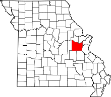 | |
| Villages | ||
| Townships | ||
| CDPs | ||
| Other unincorporated communities |
| |
| Ghost towns | ||
| Footnotes | ‡This populated place also has portions in an adjacent county or counties | |