Venango, Pennsylvania
| Venango, Pennsylvania | |
|---|---|
| Borough | |
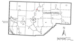 Location of Venango in Crawford County | |
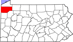
 Venango Location of Venango in Pennsylvania | |
| Coordinates: 41°46′22″N 80°6′39″W / 41.77278°N 80.11083°WCoordinates: 41°46′22″N 80°6′39″W / 41.77278°N 80.11083°W | |
| Country | United States |
| State | Pennsylvania |
| County | Crawford County |
| Founded | 1838 |
| Area | |
| • Total | 0.27 sq mi (0.71 km2) |
| • Land | 0.27 sq mi (0.71 km2) |
| • Water | 0.0 sq mi (0.0 km2) |
| Elevation | 1,145 ft (349 m) |
| Population (2010) | |
| • Total | 239 |
| • Density | 870/sq mi (336.0/km2) |
| Time zone | EST (UTC-4) |
| • Summer (DST) | EDT (UTC-5) |
| Area code(s) | 814 |
Venango is a borough in Crawford County, Pennsylvania, United States. The population was 239 at the 2010 census, [1] down from 288 at the 2000 census.
Geography
Venango is located in north-central Crawford County at 41°46′22″N 80°6′39″W / 41.77278°N 80.11083°W (41.772815, -80.110813).[2] It is bordered by Venango Township to the north, west, and south, and by Cambridge Township to the east, across French Creek.
According to the United States Census Bureau, the borough has a total area of 0.27 square miles (0.71 km2), all of it land.[1]
Venango is located on conjoined U.S. Route 6 and U.S. Route 19, with Cambridge Springs 4 miles (6 km) to the northeast and Meadville, the county seat, 10 miles (16 km) to the south. Interstate 79 passes 2 miles (3 km) to the west of Venango but without any nearby exits.
Demographics
| Historical population | |||
|---|---|---|---|
| Census | Pop. | %± | |
| 1870 | 318 | — | |
| 1880 | 347 | 9.1% | |
| 1890 | 278 | −19.9% | |
| 1900 | 233 | −16.2% | |
| 1910 | 251 | 7.7% | |
| 1920 | 237 | −5.6% | |
| 1930 | 235 | −0.8% | |
| 1940 | 300 | 27.7% | |
| 1950 | 359 | 19.7% | |
| 1960 | 318 | −11.4% | |
| 1970 | 274 | −13.8% | |
| 1980 | 298 | 8.8% | |
| 1990 | 289 | −3.0% | |
| 2000 | 288 | −0.3% | |
| 2010 | 239 | −17.0% | |
| Est. 2015 | 241 | [3] | 0.8% |
| Sources:[4][5][6] | |||
As of the census[5] of 2000, there were 288 people, 104 households, and 79 families residing in the borough. The population density was 1,089.7 people per square mile (427.7/km²). There were 112 housing units at an average density of 423.8 per square mile (166.3/km²). The racial makeup of the borough was 96.53% White, 2.43% African American, and 1.04% from two or more races. Hispanic or Latino of any race were 1.04% of the population.
There were 104 households, out of which 36.5% had children under the age of 18 living with them, 60.6% were married couples living together, 12.5% had a female householder with no husband present, and 24.0% were non-families. 17.3% of all households were made up of individuals, and 6.7% had someone living alone who was 65 years of age or older. The average household size was 2.77 and the average family size was 3.11.
In the borough the population was spread out, with 25.3% under the age of 18, 11.5% from 18 to 24, 28.8% from 25 to 44, 21.2% from 45 to 64, and 13.2% who were 65 years of age or older. The median age was 34 years. For every 100 females there were 110.2 males. For every 100 females age 18 and over, there were 106.7 males.
The median income for a household in the borough was $35,250, and the median income for a family was $38,125. Males had a median income of $27,250 versus $21,563 for females. The per capita income for the borough was $15,978. About 3.5% of families and 7.6% of the population were below the poverty line, including 4.8% of those under the age of eighteen and 7.7% of those sixty five or over.
References
- 1 2 "Geographic Identifiers: 2010 Census Summary File 1 (G001): Springboro borough, Pennsylvania". U.S. Census Bureau, American Factfinder. Retrieved June 5, 2015.
- ↑ "US Gazetteer files: 2010, 2000, and 1990". United States Census Bureau. 2011-02-12. Retrieved 2011-04-23.
- ↑ "Annual Estimates of the Resident Population for Incorporated Places: April 1, 2010 to July 1, 2015". Retrieved July 2, 2016.
- ↑ "Census of Population and Housing". U.S. Census Bureau. Retrieved 11 December 2013.
- 1 2 "American FactFinder". United States Census Bureau. Retrieved 2008-01-31.
- ↑ "Incorporated Places and Minor Civil Divisions Datasets: Subcounty Resident Population Estimates: April 1, 2010 to July 1, 2012". Population Estimates. U.S. Census Bureau. Retrieved 11 December 2013.