Cochranton, Pennsylvania
| Cochranton, Pennsylvania | |
|---|---|
| Borough | |
|
Adams Street Bridge over French Creek. This bridge was replaced in late 2015. | |
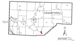 Location of Cochranton in Crawford County | |
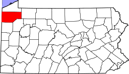
 Cochranton Location of Cochranton in Pennsylvania | |
| Coordinates: 41°31′10″N 80°2′56″W / 41.51944°N 80.04889°WCoordinates: 41°31′10″N 80°2′56″W / 41.51944°N 80.04889°W | |
| Country | United States |
| State | Pennsylvania |
| County | Crawford County |
| Founded | 1800 |
| Government | |
| • Mayor | Mark Roche |
| Area | |
| • Total | 1.2 sq mi (3.1 km2) |
| • Land | 1.2 sq mi (3.1 km2) |
| • Water | 0.0 sq mi (0.0 km2) |
| Elevation | 1,065 ft (325 m) |
| Population (2010) | |
| • Total | 1,136 |
| • Density | 950/sq mi (370/km2) |
| Time zone | EST (UTC-4) |
| • Summer (DST) | EDT (UTC-5) |
| Area code(s) | 814 |
| Website |
cochrantonboro |

Cochranton is a borough in Crawford County, Pennsylvania, United States. The population was 1,136 as of the 2010 census.[1]
Geography
Cochranton is located in southern boundary Crawford County at 41°31′10″N 80°2′56″W / 41.51944°N 80.04889°W (41.519497, -80.048906).[2] It is bordered by East Fairfield Township to the north, Wayne Township to the east, and Fairfield Township to the southwest.
According to the United States Census Bureau, the borough has a total area of 1.2 square miles (3.1 km2), all of it land. French Creek, a southeast-flowing tributary of the Allegheny River, forms the southwest border of the borough. Little Sugar Creek enters the borough from the east, passes north of the center of town, and joins French Creek just north of the Adams Street bridge.
U.S. Route 322 passes through the northern part of the borough, bypassing the downtown. US 322 leads 10 miles (16 km) northwest to Meadville, the county seat, and southeast 16 miles (26 km) to Franklin on the Allegheny River. Pennsylvania Route 173 passes through the borough center as Adams Street, leading northeast 8 miles (13 km) to Mount Hope and south 10 miles (16 km) to New Lebanon. Pennsylvania Route 285 departs PA 173 just west of the borough limits, leading west 8 miles (13 km) to Interstate 79 near Custards.
Demographics
| Historical population | |||
|---|---|---|---|
| Census | Pop. | %± | |
| 1860 | 250 | — | |
| 1870 | 459 | 83.6% | |
| 1880 | 645 | 40.5% | |
| 1890 | 655 | 1.6% | |
| 1900 | 640 | −2.3% | |
| 1910 | 695 | 8.6% | |
| 1920 | 647 | −6.9% | |
| 1930 | 727 | 12.4% | |
| 1940 | 793 | 9.1% | |
| 1950 | 1,092 | 37.7% | |
| 1960 | 1,139 | 4.3% | |
| 1970 | 1,229 | 7.9% | |
| 1980 | 1,240 | 0.9% | |
| 1990 | 1,174 | −5.3% | |
| 2000 | 1,148 | −2.2% | |
| 2010 | 1,136 | −1.0% | |
| Est. 2015 | 1,109 | [3] | −2.4% |
| Sources:[4][5][6] | |||
As of the census[5] of 2000, there were 1,148 people, 478 households, and 335 families residing in the borough. The population density was 953.8 people per square mile (369.4/km²). There were 506 housing units at an average density of 420.4 per square mile (162.8/km²). The racial makeup of the borough was 98.78% White, 0.44% African American, 0.09% Native American, 0.26% Asian, and 0.44% from two or more races. Hispanic or Latino of any race were 0.09% of the population.
There were 478 households, of which 28.2% had children under the age of 18 living with them, 55.9% were married couples living together, 10.7% had a female householder with no husband present, and 29.9% were non-families. 26.4% of all households were made up of individuals and 14.4% comprised someone living alone who was 65 years of age or older. The average household size was 2.40 and the average family size was 2.84.
The age distribution of the borough was: 23.3% under the age of 18; 7.4% from 18 to 24; 26.4% from 25 to 44; 26.2% from 45 to 64; and 16.7% 65 years of age or older. The median age was 41 years. For every 100 females there were 90.4 males. For every 100 females age 18 and over, there were 90.7 males.
The median income for a household in the borough was $36,625, and the median income for a family was $45,463. Males had a median income of $33,333 versus $21,792 for females. The per capita income for the borough was $18,960. About 6.7% of families and 11.3% of the population were below the poverty line, including 23.2% of those under age 18 and 11.8% of those age 65 or over.
References
- ↑ "Geographic Identifiers: 2010 Census Summary File 1 (G001): Cochranton borough, Pennsylvania". U.S. Census Bureau, American Factfinder. Retrieved June 3, 2015.
- ↑ "US Gazetteer files: 2010, 2000, and 1990". United States Census Bureau. 2011-02-12. Retrieved 2011-04-23.
- ↑ "Annual Estimates of the Resident Population for Incorporated Places: April 1, 2010 to July 1, 2015". Retrieved July 2, 2016.
- ↑ "Census of Population and Housing". U.S. Census Bureau. Archived from the original on 11 May 2015. Retrieved 11 December 2013.
- 1 2 "American FactFinder". United States Census Bureau. Archived from the original on 2013-09-11. Retrieved 2008-01-31.
- ↑ "Incorporated Places and Minor Civil Divisions Datasets: Subcounty Resident Population Estimates: April 1, 2010 to July 1, 2012". Population Estimates. U.S. Census Bureau. Archived from the original on 17 June 2013. Retrieved 11 December 2013.